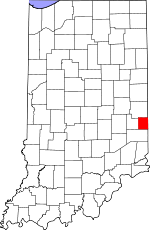
Union County, Indiana Basics:


Union County Indiana - Government Site

Population: 7,349
Area: 161 square miles
County seat: Liberty
Area code(s) in use: 765 317
Time zone: EST
High school graduate or higher: 85.4%
Bachelor's degree or higher: 18.2%
Median household income: $44,263
Persons in poverty: 12.9%
Home ownership rate: 78.0%
Mean travel time to work: 26.1 minutes


Adjacent counties:
Butler (OH)  Fayette  Franklin  Preble (OH)  Wayne  

Find in Indiana

Map of the Union County area


Our detail map of Union County shows the Union County, Indiana boundary lines and other interesting items.

Places in Union County, Indiana

  Airports     show all on map

E-Z Acres Airport, Norris Field Airport

  Buildings     show all on map

College Corner Fire Department, Fayette Regional Emergency Medical Services, Liberty Volunteer Fire Department

  Cemeteries     show all on map

Calvary Cemetery, College Corner Cemetery, Crawfords Cemetery, Drook Cemetery, Keiffer Cemetery, New Hope Cemetery, Nutter Cemetery, Old Bath Springs Cemetery, Patterson Cemetery, Pentecost Cemetery, Railsback Cemetery, Richland Cemetery, Sering Cemetery, Silver Creek Cemetery, West Point Cemetery, Woods Chapel Cemetery

  Churches     show all on map

Fourmile Church, Hanna Creek Church, Mount Pleasant Church, Philomath Church, Salem Church, Sugar Grove Church

  Dams     show all on map

Whitewater State Park Lake Dam

  Locales     show all on map

Dunlapsville Causeway, Quakertown

  Parks     show all on map

Whitewater State Park

  Populated Places     show all on map

Billingsville, Brownsville, Charlottesville, Clifton, Cottage Grove, Dunlapsville, Five Points, Goodwins Corner, Hopeville, Kitchel, Liberty, Lotus, Philomath, Roseburg, Salem, West College Corner, Witts Station, Yankee Town

  Post Offices     show all on map

Beechy Mire Post Office (historical)

  Reservoirs     show all on map

Whitewater Lake

  Schools     show all on map

Liberty Junior High School, Union County High School, Union Township School

  Streams     show all on map

Bear Branch, Brandywine Creek, Charlottesville Creek, Church Creek, City Brook, Clay Creek, Clifton Creek, Corner Run, Cottage Grove Creek, Deer Branch, Dubois Creek, Ellys Creek, Fleisch Run, Goodwins Creek, Hanna Creek, Harold Creek, Kitchel Creek, Nut Run, Nutter Creek, Radar Creek, Railsback Creek, Richland Creek, Salem Branch, Sand Run, Silver Creek, Simpson Creek, Templeton Creek, Toney Run, Turkey Creek, Union Creek, Village Creek, West Fork Four Mile Run, Witts Run, Woods Creek

  Valleys     show all on map

Lopp Hollow,

Union County, Indiana Population By Race (2012 estimate)

RacePopulation
WhiteUnion County White population 7,1737,172  
MixedUnion County Mixed population 8888
BlackUnion County Black population 4444
American IndianUnion County American Indian population 2222
Hawaiian & Pacific IslanderUnion County Hawaiian & Pacific Islander population 00

Additional population tables :
State population table
Indiana population by county