Fayette County, Indiana Basics:


Fayette County Indiana - Government Site

Population: 23,988
Area: 215 square miles
County seat: Connersville
Area code(s) in use: 765
Time zone: EST
High school graduate or higher: 77.8%
Bachelor's degree or higher: 8.4%
Median household income: $36,602
Persons in poverty: 23.6%
Home ownership rate: 71.9%
Mean travel time to work: 24.3 minutes

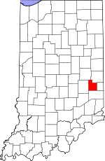
Adjacent counties:
Franklin  Henry  Rush  Union  Wayne  

Find in Indiana

Map of the Fayette County area


Our detail map of Fayette County shows the Fayette County, Indiana boundary lines and other interesting items.

Places in Fayette County, Indiana

  Airports     show all on map

Mettel Field Airport

  Buildings     show all on map

Bentonville Volunteer Fire Department, Clark's Greenhouses, Connersville Fire Department Station 1 Headquarters, Connersville Fire Department Station 3, Connersville Fire Department Station 4, Everton Volunteer Fire Department, Fayette County Emergency Medical Services, Fayette County Highway Department, Heartsavers Emergency Medical Services

  Cemeteries     show all on map

Aldridge Cemetery, Bentonville Church Cemetery, Bever Cemetery, Brittanham Cemetery, Brownlee Cemetery, Brumfiel Cemetery, Burke Cemetery, Caldwell Cemetery, Campbell Cemetery, Columbia Cemetery, Conner Cemetery, Connersville City Cemetery, Dale Cemetery, Everton Cemetery, Gillam Cemetery (historical), Green Cemetery, Halstead Cemetery, Hanson-Crandel Cemetery, Hilltop Cemetery, Kirkwood Cemetery, Klum Cemetery, Little Creek Cemetery, Martin Cemetery, Methodist Farm Cemetery, Mount Garrison Cemetery, Mount Zion Cemetery, Murray Cemetery, Nulltown Cemetery, O Waters Cemetery, Old Friends Church Cemetery, Old Orange Cemetery, Old Parrot Cemetery, Orange-North Cemetery, Parker Cemetery, Poplar Ridge Cemetery, Robinson Chapel Cemetery, Shanee Bluff Cemetery, Shrine of Memories Mausoleum, Simpson Cemetery, Smith Cemetery, Springersville Cemetery, Stevens Cemetery, Tate Cemetery, Thomas Cemetery, Tullis Chapel Cemetery, Union Cemetery, Union Cemetery, Village Creek Church Cemetery, Wadams Cemetery, Waterloo Green Cemetery, Webb Cemetery, Wiley Chapel Cemetery

  Churches     show all on map

Bentonville Church, Columbia Methodist Church, Garrison Creek Church, Gorton Memorial Church, Greater Vision Church, Oak Grove Church, Sanes Creek Church, Taylors Creek Church, Union Church, Village Creek Church

  Dams     show all on map

Manlove Park Dam

  Hospitals     show all on map

Fayette Regional Health System

  Mines     show all on map

Connersville Pit, Park Road Gravel Pit

  Parks     show all on map

Bear Creek Camp, Boys Club Camp, Delaware Camp, Manlove Park, Roberts Park

  Populated Places     show all on map

Alpine, Alquina, Bentonville, Bunker Hill, Columbia, Connersville, Everton, Harrisburg, Huber, Longwood Crossing, Lyonsville, Nulltown, Orange, Springersville, Tyner Crossing, Waterloo

  Reservoirs     show all on map

Manlove Lake

  Schools     show all on map

Alquina Elementary School, Connersville Area Vocational School, Connersville Junior High North, Connersville Senior High School, East View School, Eastview Elementary School, Fayette Central Elementary School, Frazee Elementary School, Grandview Elementary School, Junior High School North, Junior High School South, Maplewood Elementary School

  Streams     show all on map

Bear Creek, Brushy Fork, Dry Branch, Fall Creek, Fishers Creek, Lick Creek, Little Williams Creek, North Branch Garrison Creek, Owl Creek, Pot Creek, Simple Branch, South Branch Garrison Creek, Symons Creek, Williams Creek, Wilson Creek

  Towers     show all on map

WCNB-AM (Connersville), WCNB-FM,

Fayette County, Indiana Population By Race (2012 estimate)

RacePopulation
WhiteFayette County White population 23,26823,268  
BlackFayette County Black population 360359
MixedFayette County Mixed population 240239
AsianFayette County Asian population 9695
American IndianFayette County American Indian population 4847
Hawaiian & Pacific IslanderFayette County Hawaiian & Pacific Islander population 00

Additional population tables :
State population table
Indiana population by county