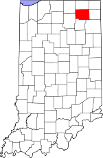
Noble County, Indiana Basics:


Noble County Indiana - Government Site

Population: 47,462
Area: 411 square miles
County seat: Albion
Area code(s) in use: 260 574
Time zone: EST
High school graduate or higher: 82.5%
Bachelor's degree or higher: 12.6%
Median household income: $46,360
Persons in poverty: 13.0%
Home ownership rate: 77.0%
Mean travel time to work: 23.5 minutes


Adjacent counties:
Allen  De Kalb  Elkhart  Kosciusko  Lagrange  Steuben  Whitley  

Find in Indiana

Map of the Noble County area


Our detail map of Noble County shows the Noble County, Indiana boundary lines and other interesting items.

Places in Noble County, Indiana

  Airports     show all on map

Hull Airport, Kendallville Municipal Airport, Ligonier Airport, Miller Field Airport, Pippenger Airport, Ries Airport, Shaffer Airport, Stangland Airport, Winebrenner Airport

  Bridges     show all on map

Dukes Bridge

  Buildings     show all on map

Albion Fire Department, Avilla Fire Department, Kendallville Fire Department Station 1, Kendallville Fire Department Station 2 Headquarters, Kneipp Springs Sanitarium (historical), Laotto Fire Department, Ligonier Fire Department, Noble County Emergency Medical Services - Albion Quarters, Noble County Emergency Medical Services - Cromwell Quarters, Noble Township Fire Department, Orange Township Fire Department, Sacred Heart Home, Sparta Township Fire Department, Wolf Lake Fire Department

  Canals     show all on map

Akers Ditch, Bilger Ditch, Bixler Lake Ditch, Black Ditch, Boughey Ditch, Boyd Ditch, Brown Ditch, Croft Ditch, Cromwell Ditch, Crothers Ditch, Gandy Ditch, Gretzinger Ditch, Heltzel Ditch, Henderson Lake Ditch, Hinkley Ditch, Hosler Ditch, Huston Ditch, Hutchins Ditch, Jacobs Ditch, Long Ditch, McNutt Ditch, Oviatt Ditch, Parker Ditch, Phillips Ditch, Rousch Ditch, Schwab Ditch, Smalley Ditch, Sparta Lake Ditch, Steffy Ditch, Summers Ditch, Thumma Ditch, Thumma Ditch, Uhl Ditch, Waterhouse Ditch, Whan Ditch, Yarde Ditch, Yarian Ditch

  Cemeteries     show all on map

Broadway Cemetery, Fulk Cemetery, Grays Cemetery, Hooper Cemetery, Lakeview Cemetery, Lower Cemetery, Merriam Cemetery, Metz Cemetery, Northport Cemetery, Oak Park Cemetery, Old Cemetery, Orange Cemetery, Perseverance Cemetery, Rose Hill Cemetery, Saint Gaspars Catholic Cemetery, Saint Marys Cemetery, Shobe Cemetery, South Milford Cemetery, Stanford Cemetery, Swan Cemetery, Thorn Cemetery, Valley Cemetery, Weston Chapel Cemetery, Wolflake Cemetery, Wright Cemetery

  Census     show all on map

Kimmell Census Designated Place

  Churches     show all on map

Allen Chapel, Bear Lake Chapel, Bethlehem Church, Broadway Church, Burr Oak Church, Center Chapel, Charter Oak Church, Church of God, Elmwood Church, Hopewell Church, Merriam Chapel, Mount Pleasant Church, North Side Church, Oak Grove Church, Pilgrim Church, Rehoboth Church, Saint Gaspars Church, Salem Church, Salem Church, Sugar Grove Church, Sweet Church, Trinity Church

  Dams     show all on map

Niezer Dam, Rider Lake Dam

  Hospitals     show all on map

Parkview Noble Hospital

  Islands     show all on map

Big Island, Bishop Island, Chicken Coop Island, Cook Island, Eagle Island, Gem Island, Hathaway Island, Kerr Island, Round Island, Twin Island

  Lakes     show all on map

Axel Lake, Barr Lake, Bartley Lake, Bass Lake, Baugher Lake, Bear Lake, Beck Lake, Beers Lake, Big Lake, Bixler Lake, Bowen Lake, Bowman Lake, Brackney Lake, Bristol Lake, Buckles Lake, Bushong Lake, Clouse Lake, Crane Lake, Cree Lake, Cub Lake, Davis Lake, Deep Lake, Deer Lake, Diamond Lake, Dock Lake, Dollar Lake, Duck Lake, Duely Lake, Eagle Lake, Engle Lake, Finster Lakes, Gilbert Lake, Gordy Lake, Grannis Lake, Green Lake, Hall Lake, Harper Lake, Hawk Lake, Henderson Lake, Hickman Lake, High Lake, Hindman Lake, Horseshoe Lake, Indian Lake, Indian Lake, Jessie-Ca Lake, Johnson Lake, Jones Lake, Keister Lake, King Lake, Knapp Lake, Krieger Lake, Kuhns Lake, Latta Lake, Lindsey Lake, Little Bause Lake, Little Knapp Lake, Little Lake, Little Long Lake, Little Metz Lake, Little Whitford Lake, Long Lake, Lower Long Lake, Marl Lake, McHenry Lake, Metz Lake, Miller Lake, Millers Lake, Mirror Lake, Moore Lake, Moss Lake, Mud Lake, Mud Lake, Mud Lake, Muncie Lake, Munk Lake, Needham Lake, Newman Lake, Norman Lake, Petty Lake, Pleasant Lake, Port Mitchell Lake, Poyser Lake, Rider Lake, Rivir Lake, Roudy Lake, Round Lake, Russell Lake, Sacarider Lake, Sand Lake, Sanford Lake, Schauweker Lake, Schockopee Lake, Silver Lake, Skinner Lake, Smalley Lake, Sparta Lake, Spring Lake, Steinbarger Lake, Stump Lake, Sucker Lake, Summit Lake, Sweet Lake, Sylvan Lake, Tamarack Lake, Tamarack Lake, Upper Long Lake, Village Lake, Waldron Lake, Weber Lake, West Lakes, Whirledge Lake, Wible Lake, Williams Lake, Wolf Lake

  Locales     show all on map

Perlich Stock Farms, Rich Haven Farms, Riddle Farms

  Mines     show all on map

Ligonier Pit, Varner Sand and Gravel Pit

  Parks     show all on map

Chain O'Lakes State Park, Gene Stratton Porter State Memorial, Longwood Rest Park, Pioneer Trails Camp (historical), Wawasee Public Fishing Area

  Populated Places     show all on map

Albion, Ari, Avilla, Bakertown, Brimfield, Burr Oak, Cosperville, Cromwell, Egans Point, Ege, Green Center, Grismore, Indian Village, Kendallville, Kimmell, Laotto, Ligonier, Lisbon, Merriam, Port Mitchell, Rome City, Swan, Wakeville Village, Washington Center, Wawaka, Wayne Center, Wilmot, Wolcottville, Wolflake

  Reservoirs     show all on map

Harroff Lake, Lake Maxler, Little Cub Lake, Little Smalley Lake, Wilmot Pond

  Schools     show all on map

Albion Elementary School, Avilla Elementary and Middle School, Central Elementary School, Central Noble High School, Central Noble Middle School, Cromwell Elementary School, East Noble High School, Indiana University Biological Station, Kendallville Middle School, Laotto Elementary School, North Side Elementary School, Perry Elementary School, Rome City Elementary and Middle School, The Way College of Biblical Research (historical), Wawaka Elementary School, Wayne Center Elementary School, West Noble High School, West Noble High School, West Noble Middle School, Wolf Lake Elementary School, York Center School

  Springs     show all on map

Kneipp Springs

  Streams     show all on map

Beal Branch, Black Creek, Carrol Creek, Clock Creek, Correll Creek, Dillon Creek, Dry Run, Dry Run, Elkhart River, Forker Creek, Iden Branch, Little Cedar Creek, Little Elkhart Creek, Middle Branch Elkhart River, North Branch Elkhart River, Piper Branch, Rimmell Branch, Solomon Creek, South Branch Elkhart River, Stony Creek, Sycamore Creek, Turkey Creek, Willow Creek, Winebrenner Branch

  Summits     show all on map

Baby Mountain, Diamond Hill, Sand Hill, The Knobs

  Swamps     show all on map

Red Marsh, The Spread

  Towers     show all on map

WAWF-FM (Kendallville), WAWK-AM (Kendallville),

Noble County, Indiana Population By Race (2012 estimate)

RacePopulation
WhiteNoble County White population 46,32346,322  
MixedNoble County Mixed population 475474
BlackNoble County Black population 285284
AsianNoble County Asian population 237237
American IndianNoble County American Indian population 142142
Hawaiian & Pacific IslanderNoble County Hawaiian & Pacific Islander population 00

Additional population tables :
State population table
Indiana population by county