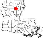
Caldwell Parish, Louisiana Basics:
Caldwell Parish Louisiana - Government Site
Population: 10,029
Area: 529 square miles
Parish seat: Columbia
Area code(s) in use: 318
Time zone: CST
High school graduate or higher: 74.3%
Bachelor's degree or higher: 11.1%
Median household income: $40,181
Persons in poverty: 22.2%
Home ownership rate: 74.0%
Mean travel time to work: 36.1 minutes
Adjacent counties:
Catahoula Franklin Jackson La Salle Ouachita Richland Winn
Places in Caldwell Parish, Louisiana
Caldwell Parish Airport,
Kenneys Airstrip Copenhagen Prairie Ox Bow Bend Caldwell Parish District 1,
Clarks Volunteer Fire Department,
Columbia Heights Volunteer Fire Department,
Columbia Volunteer Fire Department,
East Columbia Volunteer Fire Department,
Grayson Volunteer Fire Department Station 1,
Grayson Volunteer Fire Department Station 2,
Hebert Volunteer Fire Department Barr Point Adams Cemetery,
Benson Cemetery,
Bethany Cemetery,
Brown Cemetery,
Columbia Cemetery,
Cross Roads Cemetery,
Davis Cemetery,
Duchene Cemetery,
Fellowship Cemetery,
Fife Cemetery,
Furlow Cemetery,
Girod Cemetery,
Good Hope Cemetery,
Hargrove Cemetery,
Hebert Cemetery,
Kelly Cemetery,
Landerneau Cemetery,
Little Star Cemetery,
Lively Cemetery,
Long Lake Cemetery,
Lowe Cemetery,
McDaniel Cemetery,
McSween Cemetery,
Mount Pleasant Cemetery,
Mount Zion Cemetery,
New Bethel Cemetery,
Newsom Cemetery,
Old Bethel Cemetery,
Old New Church Cemetery,
Old Union Cemetery,
Palestine Cemetery,
Powers Cemetery,
Roberts Cemetery,
Saint Joseph Cemetery,
Saint Peter Cemetery,
Tidwell Cemetery,
Tingle Cemetery,
Welcome Home Cemetery,
Wyant Cemetery,
Yarborough Cemetery Banks Springs Census Designated Place Crew Bayou Cutoff Bellevue Baptist Church,
Bethany Baptist Church,
Burrough Church,
Caldwell Church,
Columbia Heights Baptist Church,
Cross Roads Baptist Church,
Fellowship Baptist Church,
First Baptist Church of Columbia,
First United Methodist Church,
Good Hope Baptist Church (historical),
Grayson Baptist Church,
Grayson Methodist Church,
Hebert Church of God,
Hebert Methodist Church,
Holum Baptist Church,
Kelly Baptist Church,
Little Star Baptist Church,
Locust Grove Church,
Mount Pleasant Church,
Mount Pleasant Church,
Mount Zion Church,
New Church (historical),
New Testament Church,
Old Bethel Baptist Church,
Old Union Baptist Church,
Palestine Baptist Church,
Pine Grove Church,
Saint Pauls Baptist Church,
Sandy Bayou Baptist Church,
Sardis Church,
Shiloh Methodist Church,
Spring Hill Church,
Ward 5 Church,
Zion Hill Baptist Church Grandview Bluff,
Lone Grave Bluff Douciere Ferry (historical),
Duchene Ferry (historical),
Eitere Ferry (historical),
Grassy Bend Ford,
Hudson Ferry (historical),
Roberts Ferry (historical) Boeuf River Dam Mile 51,
Brushy Lake Dam,
Columbia Closure Dam,
Columbia Lock and Dam,
Lock and Dam Number Three (historical),
S B Harrelson Pond Dam Ash Slough,
Bayou Lafourche,
Bayou Morengo,
Bell Bayou,
Crew Bayou,
Cross Bayou,
Indian Slough,
Old Channel Bayou Lafourche,
Sawyer Pond Bayou,
Sillars Bayou,
Wheeler Bayou Caldwell Memorial Hospital,
Citizens Medical Center Hearn Island,
Perrins Island Brandon Lake,
Broad Lake,
Brown Lake,
Brushy Lake,
Clarks Coupe,
Crew Lake,
Davis Lake,
Dixon Lake,
Dry Lake,
Eagle Lake (historical),
Ferrand Lake,
Ford Lake,
Hilliards Coupe,
Hinze Lake,
Horseshoe Lake,
Horseshoe Lake,
Humble Lake,
Little Long Lake,
Lively Lake,
Locust Thicket Lake,
Long Lake,
Long Lake,
McEnery Lake,
Morengo Lake,
Open Lake,
Riverton Lake,
Sandy Bayou,
Sawyer Pond,
Short Lake,
Stove Lake,
Swim Lake,
Thompson Brake,
Twin Lakes,
Vantley Lake,
Volman Lake,
Wild Boar Lake Barr Point Landing,
Bellevue Landing,
Bunker Hill Landing,
Call Landing,
Castor Landing,
Copenhagen Landing,
Cottingham Landing,
Cottonwood Landing,
Doctor Cole Landing,
Fig Tree Landing,
Forest Home Landing,
Fredericksburg Landing,
Gibson Landing,
Gin Rake Landing,
Gum Point Landing,
Hebert Landing,
Heison Landing,
Hogan Landing,
Home Landing,
Jacks Landing,
Joe Powell Landing,
John Higgins Landing,
John Hough Landing,
John Sillars Landing,
Landerneau Landing,
Linden Landing,
Locust Landing,
Long Lake Landing,
Lower Coles Landing,
Marsh Landing,
Marshall Landing,
McSween Landing,
Mindenhall Landing,
Montgomery Landing,
Myatt Landing,
Neathery Woodyard (historical),
Oak Bluff Landing,
Old Ferry Landing,
Pierce Landing,
Pinder Landing,
Pine Bluff Landing,
Saint Alban Landing,
Seven Runs Crossing,
Sinope Landing,
Smithland Landing,
Sphinx Landing,
Squires Landing,
Stock Landing,
T J Brown Landing,
Upper Danville Landing,
Wade Landing,
Waverly Landing,
Wood Landing Banks Springs Gas Field,
Bethel Church Gas Field,
Cane Hill Gas Field,
Copenhagen Gas Field,
Cotton Plant Gas Field,
Humble Lake Gas Field,
Kelly School Gas Field,
Long Lake Gas Field,
Lost Creek Gas Field,
McBroom Gas Field,
Newport Oil and Gas Field,
North Clarks Gas Field,
North Rabbit Branch Gas Field,
North Standard Gas Fields,
Piney Creek Gas Field,
Pistol Thicket Gas Field,
Sardis Church of Gas Field,
South Grayson Gas Field,
Spaulding Gas Field,
Vixen Gas Field,
Welcome Home Gas Field,
West Clarks Gas Field Boeuf State Wildlife Management Area,
Fort Necessity Recreation Area Banks Springs,
Bellevue,
Blankston,
Clarks,
Columbia,
Columbia Heights,
Cooper (historical),
Copenhagen,
Corey,
Cotton Plant,
Fredericksburg (historical),
Grayson,
Hebert,
Holum,
Kelly,
Mount Pleasant,
Old Mount Pleasant (historical),
Pulpwood Spur,
Riverton,
Spaulding,
Vixen Alpha Post Office (historical), Andalusia Post Office (historical), Bay Post Office (historical), Blankston Post Office (historical), Boeuf River Post Office (historical), Chic Post Office (historical),
Clarks Post Office,
Columbia Post Office, Concord Post Office (historical), Copenhagen Post Office (historical), Cotton Plant Post Office (historical), Fredericksburg Post Office (historical), Glen Ella Post Office (historical), Grayson Post Office, Hardie Post Office (historical),
Hebert Post Office, Hogan Post Office (historical), Holum Post Office (historical), Janus Post Office (historical),
Kelly Post Office, Landerneau Post Office (historical), Lively Post Office (historical), Marshall Post Office (historical), Mount Pleasant Post Office (historical), Riverton Post Office (historical), Rodolph Post Office (historical), Sinope Post Office (historical), Spaulding Post Office (historical), Vixen Post Office (historical)
Lower Long Lake,
Peers Lake Booker T Washington School,
Brushy School (historical),
Caldwell Parish High School,
Caldwell Parish Junior High School,
Caldwell Parish Preschool,
Central Elementary School,
Columbia Developmental Center,
Columbia Elementary School,
Good Hope School (historical),
Grayson Elementary School,
Hebert School (historical),
Kelly Elementary School,
Kelly School,
Oak Grove School (historical),
Old Bethel Christian Academy School, Pine Grove Academy (historical),
Ward 5 School Ballard Bayou,
Banister Creek,
Baygent Branch,
Bayou Calamus,
Bayou Dan,
Bayou deChene,
Bayou Lafourche,
Bayou Wade,
Bayou Wade,
Bentle Creek,
Big Grassy Bayou,
Bills Creek,
Bird Creek,
Black Bayou,
Boggy Bayou,
Bridge Creek,
Bridger Bayou,
Brushy Creek,
Brushy Creek,
Buck Branch,
Bull Creek,
Bushy Creek,
Cypress Creek,
Fox Branch,
Frith Branch,
Garden Creek,
Grassy Bayou,
Hart Creek,
Humble Creek,
Hurricane Creek,
Hurricane Creek,
Indian Branch,
Lindsey Branch,
Lost Creek,
McClellen Branch,
Messer Creek,
Moody Creek,
Morgan Creek,
Muddy Bayou,
Pinder Branch,
Piney Creek,
Richland Creek,
Sweetwater Creek,
Thompson Bayou,
Upper Lone Grave Bayou,
White Oak Creek,
Winn Branch Bayou Dan Hills,
Cane Hill Alligator Hole,
Bucks Brake,
Bushy Lagoon,
Dizzy Brake,
Jones Brake,
McIntyre Brake,
Thompson Brake Holum Lookout Tower,
KARD-TV (West Monroe),
KCTO-AM (Columbia),
KCTO-FM (Columbia),
KLTM-TV (Monroe),
KNOE-FM (Monroe),
KNOE-TV (Monroe),
Mount Pleasant Lookout Tower,

