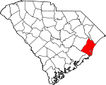
Georgetown County, South Carolina Basics:


Georgetown County South Carolina - Government Site

Population: 60,240
Area: 814 square miles
County seat: Georgetown
Area code(s) in use: 843
Time zone: EST
High school graduate or higher: 84.7%
Bachelor's degree or higher: 22.9%
Median household income: $42,472
Persons in poverty: 20.1%
Home ownership rate: 78.0%
Mean travel time to work: 24.6 minutes


Adjacent counties:
Berkeley  Charleston  Florence  Horry  Marion  Williamsburg  

Find in South Carolina

Map of the Georgetown County area


Our detail map of Georgetown County shows the Georgetown County, South Carolina boundary lines and other interesting items.

Places in Georgetown County, South Carolina

  Airports     show all on map

Georgetown County Airport, Robert F Swinnie Airport

  Bars     show all on map

East Bank, Fishing Bank, Litchfield Spit, Mother Norton Shoal, North Breakers, South Breakers

  Basins     show all on map

Cane Bay, Sand Creek Basin, Squirrel Run Bay, Waterhole Bay, Wheeler Basin

  Bays     show all on map

Bass Hole Bay, Midway Inlet, Mud Bay, Murrells Inlet, North Inlet, North Santee Bay, Oyster Bay, Pawleys Inlet, Sea Creek Bay, Winyah Bay

  Beaches     show all on map

Debidue Beach, Litchfield Beach, Magnolia Beach

  Bends     show all on map

Halfway Bend

  Bridges     show all on map

Browns Ferry Bridge, John T Stevens Memorial Bridge, L H Siau Bridge, Pennyroyal Bridge, Sampit River Bridge

  Buildings     show all on map

Andrews Branch Library, Andrews City Fire Department Station 15, Andrews Old Town Hall Museum, Andrews Police Department, Andrews Senior Center, Andrews Town Hall, Atalaya Mansion, Baruchs Arts Center, Bobby Alford Recreation Center, City of Georgetown Town Hall, Dreamkeepers Community Arts Center, Georgetown City Fire Department Station 1, Georgetown City Hall, Georgetown County Courthouse, Georgetown County Emergency Management Division, Georgetown County Fire Department Station 10, Georgetown County Rural Fire Department Station 10, Georgetown County Rural Fire Department Station 11, Georgetown County Rural Fire Department Station 12, Georgetown County Rural Fire Department Station 13, Georgetown County Rural Fire Department Station 14, Georgetown County Rural Fire Department Station 2, Georgetown County Rural Fire Department Station 3, Georgetown County Rural Fire Department Station 4, Georgetown County Rural Fire Department Station 5, Georgetown County Rural Fire Department Station 6, Georgetown County Rural Fire Department Station 7, Georgetown County Rural Fire Department Station 8, Georgetown County Rural Fire Department Station 9, Georgetown County Sheriff's Office, Georgetown County Sheriff's Office, Georgetown County Sheriff's Office - Detention Center, Georgetown Fire Department Station 2, Georgetown Lighthouse, Georgetown Memorial Library, Georgetown Police Department, Georgetown Police Department - Storage, Georgetown Senior Center, Harold Haminski House Museum, Hobcaw Barony Nature Center, Midway Fire Department Debordieu, Midway Fire Department Pawleys Island, Midway Fire Department Willbrook Plantation, Morningside of Georgetown, Murrells Inlet - Garden City Fire District Station 76, Murrells Inlet - Garden City Fire District Station 78, Murrells Inlet Community Center, ParaBasic Medical Transport, Pawley's Island Police Department, Plantersville Senior Center, Ragtops and Roadsters Auto Museum, RIce Museum, Saint Luke Senior Center, South Carolina Highway Patrol Troop 5 Post C, The Lakes at Litchfield, Tom Yawkey Wildlife Center, US Coast Guard, Winyah Indigo Society Hall

  Canals     show all on map

Estherville Minim Creek Canal, Fourmile Creek Canal, Mosquito Creek Canal, Rockfish Canal

  Capes     show all on map

Belleflower Point, Britton Neck, Cape San Roman, Cedar Island Point, Doar Point, Drunken Jack Island, Frazier Point, Hell Gate, Inlet Point, Rocky Point, Sampit Point, Santee Point, Silver Island, Waccamaw Neck, Waccamaw Point

  Cemeteries     show all on map

All Saints Cemetery, Baptist Cemetery, Bethel Cemetery, Hucks Field Cemetery, Jerusalem Cemetery, Jewish Cemetery, Mount Zion Cemetery, Pennyroyal Cemetery, Pine Bluff Cemetery, Prince George Winyah Cemetery, Union Cemetery, Wallace Cemetery, Wilson Cemetery, Yauhannah Cemetery

  Census     show all on map

Murrells Inlet Census Designated Place

  Channels     show all on map

Bottle Channel, Hell Gate, Middleton Cut, North Santee Inlet, Slue Channel (historical), South Santee Inlet, Western Channel, Winyah Bay Entrance, Yahany Inlet (historical)

  Churches     show all on map

All Saints Church, Andrews Pentecostal Holiness Church, Andrews Presbyterian Church, Annie Village Church, Antioch Church, Arnett African Methodist Episcopal Church, Belin Memorial Methodist Church, Belin United Methodist Church, Beth Elohim Synagogue, Bethel African Methodist Episcopal Church, Bethel Church, Bethel Church, Bethel Church (historical), Bethel Church (historical), Bethseda Missionary Baptist Church, Browns Church, Calvary Baptist Church, Carters Church, Cat Island Church (historical), Center Church, Church of Christ, Church of God, Cumberland Church, Cumberland Church, Dans Creek Church, Dickerson African Methodist Episcopal Church, Duncan Memorial United Methodist Church, Eastside Free Will Baptist Church of Pentecost, Ebenezer Church (historical), First Assembly of God Church, First Baptist Church, First Baptist Church of Andrews, First Church of God, Friendship Church, Friendship Church, Friendship Presbyterian Church, Galilee Church, Georgetown Freewill Baptist Church, Georgetown Presbyterian Church, Good Hope Church, Gordons Church, Gravel Gully Church, Graves Southern Baptist Church, Green Bay Church, Gridiron Chapel, Hines Chapel Holiness Church, Holy Cross Church (historical), Hopewell Church, Hopewell Church, Hopewell Church, Jerusalem Church, Jerusalem Church, Johnson Chapel, Johnson Chapel, Lakewood Baptist Church, Laurel Hill Church (historical), Marysville Church, Millgrove Meeting House (historical), Mount Carmel Church, Mount Carmel Church, Mount Olive Baptist Church, Mount Olive Church, Mount Pisgah Church, Mount Sinai Church, Mount Tabor Church, Mount Zion Baptist Church, Mount Zion Church, Mount Zion Church, Mount Zion Church, Mount Zion Church, Murrells Inlet Church of God, New Bethel Baptist Church, New Hope Church, New Zion Church, Newlight Church, Nurse Chapel, Oak Grove Church, Outland Church of God, Pawleys Island Presbyterian Church, Pee Dee Church, Pennyroyal Church, Pentecostal Church, Pine Bluff Church (historical), Pine Crest Baptist Church, Piney Grove Baptist Church, Pleasant Hill Church, Prince Frederick Chapel, Prince Frederick Church, Prince George Winyah Episcopal Church, Red Hill Church, Rice Hope Church, Rockingham Church, Rose Hill Church, Saint Andrews African Methodist Episcopal Church, Saint Augustine Reformed Episcopal Church, Saint Cyprian Roman Catholic Church, Saint James Church, Saint James Church, Saint Joseph Church, Saint Lukes Church, Saint Marys Church, Saint Marys Church, Saint Marys Roman Catholic Church, Saint Michael Church, Saint Paul Church, Saint Paul Church, Saint Pauls Waccamau United Methodist Church, Saint Peter Lutheran Church, Saint Peters Lutheran Church, Saint Stephens African Methodist Episcopal Church, Saints Delight Church, Sampit Church, Sanctified Church of God, Shiloh Church, Singleton African Methodist Episcopal Church, Trinity Church, Trinity Lutheran Church, Trinity United Methodist Church, Union Church, Victory Christian Fellowship Full Gospel Church, Victory Freewill Baptist Church, Walkers Church, Wesley Methodist Episcopal Church (historical), Williams Hill Church, Yauhannah Church

  Crossings     show all on map

Bradley and Britton Ferry (historical), Browns Ferry (historical), Caring Cross Ferry (historical), Lynches Ferry (historical), Mazycks Ferry (historical), Potato Ferry (historical), Sampit Ferry (historical), South Island Ferry, Yahany Ferry (historical)

  Dams     show all on map

Andrews Sewage Pond Dam D-3594, Black River House One Pond Dam D-3591, Black River House Two Pond Dam D-3590, Bridge Pond Dam D-3513, Georgetown Sewage One Pond Dam D-3588, Georgetown Sewage Two Pond Dam D-3589, Ip Two Waste Pond Dam D-3587, Ip Waste Pond Dam Number One D-3586, Nightingale Pond Dam D-3592, South Carolina Noname 22016 D-3585 Dam

  Guts     show all on map

Atchison Creek, Bass Hole Creek, Bobs Garden Creek, Boor Creek, Cane Creek, Clambank Creek, Clubhouse Creek, Cooks Creek, Cutoff Creek, Dividing Creek, Double Prong Creek, Duck Creek, Foot Log Slough, Haulover Creek, Jericho Creek, Jones Creek, Lagoon Creek, Little Jones Creek, Main Creek, Minim Creek, Mud Creek, Nancy Creek, No Mans Friend Creek, Noble Slough, Oaks Creek, Old Man Creek, Parsonage Creek, Pawleys Island Creek, Perry Creek, Push and Go Creek, Sawmill Creek, Sign Creek, Sixty Bass Creek, Town Creek, Wood Creek, Woodland Creek

  Hospitals     show all on map

Atlantic Surgery Center, Bay Microsurgical Unit, Georgetown Memorial Hospital, Waccamaw Community Hospital, Waccamaw Endoscopy Center

  Islands     show all on map

Big Island, Big Marsh Island, Brookgreen Island, Brown Island, Bull Island, Bull Tongue Island, Butler Island, Cane Island, Cat Island, Cedar Island, Collins Island, Crow Island, Daniels Island, Debidue Island, Flagg Island, Goat Island, Goat Island, Goat Island, Grace Island, Hare Island, Holly Hill, Horse Island, Kilsock Island, Kinloch Island, Laurel Hill Island, Little Crow Island, Malady Bush Island, Marsh Island, Marsh Islands, Middle Ground, Minim Island, North Island, Oaks Island, Pawleys Island, Pumpkinseed Islands, Rabbit Island, Rabbit Island, Richmond Island, Sand Island, Sandy Island, South Island, Springfield Island, Sturgeon Island, Vaux Island, Wadmacon Island, Woodville Island

  Lakes     show all on map

Bread and Butter Creek, Dawhoo Lake, Flagg Pond, Horseshoe Lake, Indian Lake, Jessamine Pond, Kellys Pond, Mosquito Creek, New Ham Lake, Pine Ridge Pond, Silver Lake, Yauhannah Lake

  Locales     show all on map

Airport Industrial Park, Alliston Estate, Andrews Industrial Park, Annandale Plantation, Arcadia Plantation, Arundel Plantation, Bates Hill Plantation, Belle Isle Plantation (historical), Belle Reve Plantation, Bellefield Plantation, Beneventum Plantation, Benvenue Plantation, Black Out Plantation, Brookgreen Plantation (historical), Browns Ferry, Calais Plantation (historical), Caledonia Plantation, Camp Baskerville, Carvers Bay, Cat Island Plantation, Cat Island Plantation, Cherry Hill Golf and Country Club, Chicora Wood Plantation, City of Georgetown Sewage Treatment Facility, Clark Estate (historical), Clifton Plantation, Darlngton Plantation, Doar Plantation, Dorien Station, Dover Plantation, Easterlin Plantation, Eastern Channel Light 24, Eastern Channel Light 25 Upper Range Front, Estherville Plantation, Exchange Plantation, Friend Field Plantation, Friendship Plantation, Georgetown County Business Center, Georgetown Golf and Country Club, Georgetown Landing Marina, Georgetown Square Shopping Center, Georgetown Waterworks, Glenmore Plantation, Greenfield Plantation, Hagley Landing, Hagley Plantation, Harborwalk Marina, Hasty Point Plantation, Heritage Golf Club, Heritage Plantation, Hide Out Plantation, Hobcaw Plantation, Holly Grove Plantation, Hopsewee Plantation, Huntington Estate, Indian Hut Club, Inlet Crossing Shopping Center, Kensington Plantation, Kiethfield Plantation, Kinloch Plantation, Lark Hill Plantation, Light One Hundred Fifty-four Little River Winyah Bay, Light Twenty-seven Winyah Bay Western Channel, Litchfield Golf and Country Club, Litchfield Plantation, Little River Winyah Bay Light One Hundred Fifty, Little River Winyah Bay Light One Hundred Fifty-six, Little River Winyah Bay Light One Hundred Fifty-two, Little River Winyah Bay Light One Hundred Forty-eighT, Mansfield Plantation, Marlin Quay Marina, Maryville Plantaion (historical), Milton Hall Plantation, Mount Arena Plantation (historical), Mount Hope Plantation, Mount Pleasant Plantation, Munlin Plantation, Murrells Inlet Wastewater Treatment Plant, Nightingale Plantation, Pawleys Island Wastewater Treatment Plant, Pawleys Pier, Pawleys Plantation Golf and Country Club, Pennyroyal Industrial Park, Plantation Plaza, Post Foot, Rabbit Island Light Twenty-eight, Ravenel Plantation, Rice Hope Plantation, Richmond Hill Plantation, River Club, River Golf Club, Roland Hall Plantation, Rose Bank Plantation, Rossdhu Plantation, Ruinsville, Ruinville Plantation (historical), Sampit River Jetty Light Thirty, Sampit River Light Twenty-nine, Sampit Station, Sea Gull Golf Club, Sea Gull Golf Course, Springfield Plantation (historical), Springwood Plantation, Tara Hall, Waccawache Marina, Wachasaw Plantation, Wedgefield Plantation, Wee Nee Plantation, White House Plantation, Willbrook Plantation, Willbrook Plantation Golf Club, Windsor Plantation, Winyah Bay Golf and Country Club, Winyah Bay West Channel Light Two, Winyah Village Shopping Center, Woodstock Plantation

  Mines     show all on map

Georgetown Quarry

  Parks     show all on map

Baruch-North Island Reserve, Belle Isle Park, Brookgreen Gardens, Browns Ferry Park, East Bay Park, Francis Marion Park, Georgetown Historic District, Huntington Beach State Park, Kensington Park, Lafayette Park, Maryville Park, McDonald Park, Morgan Park, Murrells Inlet Historic District, Murrells Inlet Park, Pawleys Island Historic District, Pee Dee Game Management Area, Pee Dee Park, Pee Dee River Rice Planters Historic District, Rock Point Park, Saint Lukes Park, Sampit Park, Santee Coastal Reserve, Santee Park, Wayside Wayside Park, Yawkey-South Island Reserve

  Populated Places     show all on map

Allentown, Anne, Annieville, Annieville, Barnhill, Belin, Belle Isle Estates, Belle Isle Gardens, Bethel, Birds Nest, Blue Heron, Caines, Campfield, Captains Cove, Carriage Run, Carters Crossroads, Center Crossroads, Chapel Creek, Chapel Creek Villas, Choppee, Clambank, Colonial Estates, Conch Creek, Country Club Estates, Cow Head Landing, Cribb Crossroads, Crow Hill, Crystal Oaks, Cumberland, De Bordieu, De Bordieu Colony, DeBordieu, Denny Corner, Dunbar, Dunbar Landing, Eagle Crest, Forbes Corner, Foster Corner, Francis Marion Estates, Fraserville, Friendfield, Georgetown, Georgieville, Gilliard, Good Hope, Graves, Gray Mans Cove, Green Bay, Hagley Estates, Huggins Crossroads, Huntington Marsh, Inlet Harbor, Inlet Oaks Village, Italy, Jackson, Johnson Corner, Kensington, Kent, Lambert, Lanes Creek, Litchfield Beach, Litchfield by the Sea, Litchfield Retreat, Live Oaks, Lodge Hall, Lower Topsaw Landing, Marysville, Maryville, Midway Crossroads, Miller Crossroads, Moss Creek, Mount Rena, Mount Tabor, Moyd, Mulberry Landing, Murrells Inlet, New Hope, North Litchfield Beach, North Santee, Oak Grove, Oak Hill, Oatland, Oceda, Olin, Owens, Parkersville, Pawleys Island, Pawleys Plantation, Pawleys Retreat, Pawleys Woods, Petersfield, Plantersville, Pleasant Grove, Pleasant Hill, Pope Crossroads, Port Hill, Port Hill Landing, Post Foot Landing, Pringle Heights, Puncheon Creek, Quarantine, Ramsey Grove, Red Hill, Rhems, Rice Crossroads, Richmond Hill, River Oaks Estates, Robin Hood, Rogers Crossroads, Rose Hill, Rosemont, Saint Pauls, Salt Marsh Cove, Sampit, San Miguel De Gualdape (historical), Simmonsville, Spring Gully, Steele Town, Strawberry, Sunny Side, True Blue, Tyler Crossroads, Upper Topsaw Landing, Wachesaw Landing, Wachesaw Place, Waterford Heights, Waterfored Estates, Waverly Mills, Wayside Forest, West Andrews, White Hall Estates, Williams Hill, Willie Towne, Woodville Acres, Yauhannah

  Post Offices     show all on map

Andrews Post Office, Georgetown Post Office, Litchfield Books Post Office, Murrells Inlet Post Office, Pawleys Island Post Office, Pawleys Island Post Office (historical)

  Ridges     show all on map

Barnes Ridge, Big Hill, Cross Bay Ridge, Jack Hill, Pine Ridge, Pine Ridge, Sand Ridge

  Schools     show all on map

All Saints Academy (historical), Andrews Christian School, Andrews Colored School (historical), Andrews Elementary School, Andrews High School, Andrews Public School (historical), Annie Village School (historical), Barnes School (historical), Betts Village School (historical), Birdfield School, Britt Branch School, Britt School (historical), Brown School, Brown's Ferry Elementary School, Bynum Education Center, Calvary Original Free Will Baptist School, Cane Bay School (historical), Carvers Bay High School, Carvers Bay Middle School, Cedar Creek School (historical), Choppee High School, Choppee Middle School, Choppee School (historical), Cumberland School (historical), Dans Creek School, Deep Creek Elementary School, Dunbar School (historical), Fawn Hill School (historical), Georgetown Career Center, Georgetown High School, Georgetown Middle School, Georgetown Public School (historical), Georgetown School District Office, Gravel Gully School, Graves Station School, Holy Cross Faith Memorial School, Hopewell School (historical), Horry-Georgetown Technical College, Howard School (historical), Kensington Elementary School, Lane Creek School (historical), Laurel Hill School (historical), Lowcountry Day School, Manuels School (historical), Marysville School (historical), Maryville Elementary School, McDonald Elementary School, Mount Olive School (historical), Mount Zion School (historical), Myersville School, New Hope School (historical), Oak Grove School, Pawley's Island Montessori School, Pennyroyal School, Peru School (historical), Plantersville Elementary School, Pleasant Hill Elementary, Pleasant Hill High School, Pleasant Hill Middle School, Richfield School (historical), Rosemary Middle School, Rosemont School (historical), Saint Cyprian School, Saint Lukes School (historical), Saint Mark School, Saint Marys School, Saint Paul School (historical), Sampit Elementary School, Sandy Island School, Shiloh School (historical), Tara Hall School, Union Public School (historical), Union School (historical), Waccamaw Elementary School, Waccamaw High School, Waccamaw Intermediate School, Waccamaw Middle School, William C Bynum School (historical), Winyah High School

  Streams     show all on map

Allston Creek, Beach Creek, Bells Swamp, Big Branch, Big Dam Swamp, Big Duck Creek, Bird Bank Creek, Black Creek, Black River, Black Swamp, Bluff Creek, Bly Creek, Boggy Swamp, Boheck Creek, Bond Swamp, Bonny Clabber Creek, Boser Swamp, Brightman Swamp, Britt Branch, Brookgreen Creek, Browns Branch, Bullins Creek, Butler Creek, Caledonia Creek, Canaan Branch, Canaan Branch, Carr Creek, Carvers Bay Creek, Cedar Creek, Cedar Patch Branch, Chapel Creek, Choppee Creek, Church Branch, Cold Creek, Conch Creek, Cooter Creek, Cork Creek, Cottage Creek, Cottonpatch Creek, Cow House Creek, Crab Haul Creek, Crabapple Branch, Crane Creek, Crooked Branch, Cypress Creek, Debidue Creek, Ditch Branch, Duck Creek, Duncan Creek, Fardick Creek, Flat Swamp Run, Four Mile Creek, Garfish Creek, Great Pee Dee River, Greens Creek, Guendalose Creek, Guinea Creek, Horse Pen Swamp, Indian Hut Swamp, Inland Branch, Kinloch Creek, Lanes Creek, Lester Creek, Little Bull Creek, Little Carr Creek, Little Duck Creek, Little Wood Creek, Machine Branch, Mill Grove Creek, Millpond Branch, North Santee River, Oatland Creek, Pawleys Creek, Pawleys Creek, Pennyroyal Creek, Pennyroyal Swamp, Peters Creek, Peters Creek, Pittman Branch, Pleasant Creek, Pleasant Meadow Creek, Pole Branch, Pole Castle Branch, Port Creek, Ports Creek, Post Foot Branch, Prince Creek, Puncheon Creek, Ruinsville Creek, Saint Pauls Branch, Sally Branch, Sampit River, Sand Creek, Sandhole Creek, Santee River, Schoolhouse Branch, Schooner Creek, Silver Creek, Simmons Creek, Sixmile Creek, Sixmile Creek, Spring Gully, Springfield Creek, Squirrel Creek, Squirrel Run, Still Creek, Stony Run Creek, Summons Swamp, The Cutoff, Thoroughfare Creek, Turkey Creek, Tyler Creek, Vaux Creek, Waccamaw River, Wadmacon Creek, Waverly Creek, Whale Creek, White Creek, White Oak Creek, Whites Creek, Wilkes Branch, Yauhannah Creek

  Summits     show all on map

High Hill, Sandy Island

  Swamps     show all on map

Big Kilsock Bay, Bino Bay, Black River Swamp, Black Steer Swamp, Boety Bay, Broton Lake, Camp Bay, Canaan Bay, Carvers Bay, Cherry Hill Swamp, Devils Dining Room, Flat Bay, Gapway Bay, Gatson Bay, Horse Swamp, Joe Bay, Little Kilsock Bay, Longwater Swamp, Machine Bay, Mackey Bay, Mingo Swamp, Pawley Swamp, Pee Dee Swamp, Santee Swamp, Tupelo Bay, Weston Flat, White Oak Bay, Wraggs Bay

  Towers     show all on map

Sampit Lookout Tower, Tyson Look Out Tower, WCRD-TV (Myrtle Beach), WGTN-AM (Georgetown), WGTN-FM (Andrews), Winyah Fire Tower, WLGI-FM (Hemingway), WSYN-FM (Georgetown), WTUB-FM (Georgetown), WVBX-AM (Georgetown), Yauhannah Forest Fire Tower

  Valleys     show all on map

Gravel Gully, Larrimore Gully,

Georgetown County, South Carolina Population By Race (2012 estimate)

RacePopulation
WhiteGeorgetown County White population 39,15639,156  
BlackGeorgetown County Black population 20,06020,059
MixedGeorgetown County Mixed population 482481
AsianGeorgetown County Asian population 361361
American IndianGeorgetown County American Indian population 181180
Hawaiian & Pacific IslanderGeorgetown County Hawaiian & Pacific Islander population 00

Additional population tables :
State population table
South Carolina population by county