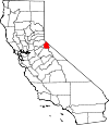
Alpine County, California Basics:


Alpine County California - Government Site

Population: 1,138
Area: 738 square miles
County seat: Markleeville
Area code(s) in use: 209 530
Time zone: PST
High school graduate or higher: 91.1%
Bachelor's degree or higher: 31.7%
Median household income: $59,931
Persons in poverty: 13.7%
Home ownership rate: 80.8%
Mean travel time to work: 23.6 minutes


Adjacent counties:
Amador  Calaveras  Douglas (NV)  El Dorado  Mono  Tuolumne  

Find in California

Map of the Alpine County area


Our detail map of Alpine County shows the Alpine County, California boundary lines and other interesting items.

Places in Alpine County, California

  Airports     show all on map

Alpine County Airport, Bear Valley Airport

  Arches     show all on map

Peep Sight

  Basins     show all on map

Clover Valley, Corral Valley, Deer Valley, Devils Corral, Fly Valley, Grouse Valley, Hermit Valley, Hope Valley, Indian Valley, Lake Valley, Little Indian Valley, Pacific Valley, Paradise Valley, Round Valley, Underwood Valley, Woodchuck Basin

  Bridges     show all on map

Centerville Bridge

  Buildings     show all on map

Alpine County Courthouse, Alpine County Free Library, Alpine County Law Library, Bear Valley Public Safety, Historical Society of Alpine County Museum, Kirkwood Volunteer Fire Department, Markleeville Volunteer Fire Department, United States Forest Service Markleeville Fire Station, Woodsford Volunteer Fire Department

  Canals     show all on map

Diamond Valley Ditch, Falke and Tillman Ditch, Millich Ditch, Snowshoe Thompson Ditch Number Two

  Cemeteries     show all on map

Washoe Cemetery

  Census     show all on map

Alpine Village Census Designated Place, Bear Valley Census Designated Place, Kirkwood Census Designated Place, Markleeville Census Designated Place, Mesa Vista Census Designated Place

  Cliffs     show all on map

Bloods Point

  Crossings     show all on map

Grays Crossing

  Dams     show all on map

Alpine 99-000 Dam, Bear Valley S H 1088 Dam, Caples Lake 97-059 Dam, Crater Lake 511-002 Dam, Heenan Lake 514 Dam, Indian Creek 1062 Dam, Kinney Meadows 513 Dam, Lost Lake East 512 Dam, Lost Lake West 512-002 Dam, Lower Blue Lake 97-062 Dam, Lower Highland Dam, Lower Kinney Lake 513-002 Dam, Lower Sunset 513-003 Dam, Meadow Lake 97-063 Dam, Reba 519 Dam, Red Lake 511-003 Dam, Scott Lake 511 Dam, Summit Lake Dam, Tamarac Lake 513-005 Dam, Twin Lakes 97-069 Dam, Union 99-005 Dam, Upper Blue Creek 97-070 Dam, Upper Kinney Lake 513-006 Dam, Upper Sunset Lake 513-007 Dam, Utica 99-006 Dam, Wet Meadows 513-008 Dam

  Falls     show all on map

Carson Falls, Llewellyn Falls

  Flats     show all on map

Avalanche Meadow, Bear Tree Meadow, Beaver Meadow, Bloods Meadow, Bloomfield Meadow, Border Ruffian Flat, Centerville Flat, Charity Valley, Clark Fork Meadow, Cliff Meadow, Company Meadows, Coyote Meadow, Dumonts Meadows, Emigrant Valley, English Meadow, Faith Valley, Falls Meadows, Forest City Flat, Gabbott Meadow, Haypress Flat, Hiram Meadow, Horse Meadow, Iceberg Meadow, Lower Gardner Meadow, Martell Flat, Milk Ranch Meadow, Pleasant Valley, Poison Flat, Raymond Meadows, Rodriguez Flat, Rose Meadow, Sagehen Flat, Sand Flat, Sandy Meadow, Sheep Meadow, Silver King Valley, Stanislaus Meadow, Tryon Meadow, Upper Gardner Meadow, Wet Meadows, Willow Flat, Willow Meadow, Wolf Creek Meadow

  Gaps     show all on map

Armstrong Pass, Carson Pass, Ebbetts Pass, Luther Pass, Monitor Pass, Saint Marys Pass, Wolf Creek Pass

  Lakes     show all on map

Asa Lake, Bear Lake, Beebe Lake, Bull Lake, Bull Run Lake, Burnside Lake, Caples Lake, Corrie Lochan, Crater Lake, Curtz Lake, Deadwood Lake, Dorothy Lake, Dry Lake, Duck Lake, Elephant Rock Lake, Emigrant Lake, Evergreen Lake, Fourth of July Lake, Frog Lake, Frog Lake, Golden Lake, Granite Lake, Grouse Lake, Half Moon Lake, Heiser Lake, Hellhole Lake, Highland Lakes, Lily Pad Lake, Lost Lake, Lost Lakes, Lower Beebe Lake, Lower Kinney Lake, Lower Sunset Lake, Meiss Lake, Mosquito Lake, Mud Lake, Mud Lake, Noble Lake, Poison Lake, Raymond Lake, Rice Lake, Rock Lake, Round Top Lake, Scotts Lake, Scout Carson Lake, Sherrold Lake, Summit Lake, Summit Lake, Summit Lake, Summit Meadow Lake, Sword Lake, Tamarack Lake, Upper Kinney Lake, Wheeler Lake, Whitecliff Lake, Winnemucca Lake, Wolf Creek Lake, Woods Lake

  Locales     show all on map

Adams Camp, Alpine Station, Alpine Station, Arnot Branch Campground (historical), Backpackers Campground, Badaraco Camp, Barney Riley, Bear Valley Ski Area, Bloods Toll Station Historical Site, Bloomfield Campground, Blue Lakes Trailhead, Camp Irene, Caples Lake Campground, Caples Lake Maintenance Station, Carson Pass Scenic Viewpoint, Cedar Camp, Centerville (historical), Centerville Flat Campground, Chickaree Picnic Area, Clark Fork Campground, Connells Cow Camp, Crystal Springs Campground, Damsite Campground, Dangberg Camp, Del Rio Camp GSA, Dressler, Ebbetts Pass Trailhead, Hangmans Bridge, Hermit Valley Campground, Highland Lakes Campground, Hope Valley Campground, Hope Valley Resort, Indian Creek Campground, Kirkwood Ski Area, Kit Carson Campground, Lake Alpine Campground, Liahona Camp, Little Antelope Pack Station, Lower Blue Lake Campground, Markleeville Campground, Middle Creek Campground, Monte Wolf Upper Cabin, Monty Wolf Cabin, Mosquito Lakes Campground, Mosquito Lakes Picnic Area, Mount Reba Ski Area, Overflow Campground, Pacific Crest Trailhead, Pacific Valley Campground, Peaceful Pines Campground, Pine Marten Campground, Quaking Aspen Campground, Red Vista, Riverview Campground (historical), Sand Flat Campground, Sequoia Camp GSA, Shingle Mill Flat, Silver Creek Campground, Silver Valley Campground, Silvertip Campground, Snowshoe Springs Campground, Snowshoe Thompson Historical SIte, Soda Springs Station, Stevenot Camp, The Elbow, Toiyabe Campground, Turtle Rock Campgrounds, Upper Blue Lake Campground, Vaquero Camp, Vaquero Camp, Wolf Creek Campground, Woods Lake Campground

  Mines     show all on map

Acacia Mine, Alhambra Mine, Alpine Mine, Brewers Mine, Burns Gravel Pit, Burnside Mine, Cal-Pine Mine, Curtz Mine, Excheque Mine, Globe Mine, Gould and Curry Mine, Heise Boulder Quarry, Isabella Tunnel, IXL Mine, Lady Franklin Mine, Lady Washington Mine, Leviathan Mine, Lincoln Mine, Lost Cabin Mine, Merrill Borrow Pit, Morningstar Mine, Mountain Mine, Pennsylvania Mine, Red Gap Mine, Rippon Mine, Sunshine Mine, Zaca Mine

  Parks     show all on map

Grover Hot Springs State Park, Indian Creek Recreation Lands, Old Emigrant Trail Historical Marker, Snowshoe Thompson Historical Mon, Snowshoe Thompson Historical Monument, Turtle Rock County Park, Wester Park

  Pillars     show all on map

Kit Carson, Silver Mountain Mineral Monument, Slick Rock

  Populated Places     show all on map

Alpine Village, Bear Valley, Cape Horn, Centerville (historical), Fredericksburg, Kirkwood, Lake Alpine, Loope, Marklee Village, Markleeville, Mesa Vista, Mount Bullion (historical), Paynesville, Peaceful Pines, Shay Creek Summer Home Area, Silver Mountain (historical), Sorensens, Woodfords

  Post Offices     show all on map

Lake Alpine Post Office (historical), Markleeville Post Office, Silver Mountain Post Office, Woodfords Post Office (historical)

  Reserves     show all on map

Carson-Iceberg Wilderness

  Reservoirs     show all on map

Heenan Lake, Indian Creek Reservoir, Kinney Reservoir, Lake Alpine, Lower Blue Lake, Meadow Lake, Red Lake, Scotts Lake, Spicer Meadow Reservoir, Stevens Lake, Tamarack Lake, Twin Lake, Twin Lakes Reservoir, Union Reservoir, Upper Blue Lake, Upper Sunset Lake, Utica Reservoir, Wet Meadows Reservoir

  Ridges     show all on map

Bloods Ridge, Forestdale Divide, Squaw Ridge

  Schools     show all on map

Alpine County Elementary Community Day School, Alpine County Secondary Community Day School, Bear Valley Elementary School, Diamond Valley Elementary School, Woodfords High School

  Springs     show all on map

Big Spring, Grover Hot Springs, Hot Springs, Indian Spring, Soda Spring

  Streams     show all on map

Arnot Creek, Barney Riley Creek, Bear Creek, Blue Creek, Boulder Creek, Bryant Creek, Bryant Creek, Buck Creek, Bull Run Creek, Cache Creek, Carson Slough, Charity Valley Creek, Clark Fork, Corral Valley Creek, Cottonwood Creek, Coyote Valley Creek, Deer Creek, Devils Creek, Disaster Creek, Dixon Creek, Duck Creek, Eagle Creek, East Fork Carson River, Elbow Creek, Elder Creek, Emigrant Creek, Fence Creek, Forestdale Creek, Grouse Creek, Grouse Creek, Hawkins Creek, Heenan Creek, Hot Springs Creek, Indian Creek, Indian Creek, Jeff Davis Creek, Kinney Creek, Kirkwood Creek, Leviathan Creek, Little Teton Creek, Luther Creek, Markleeville Creek, Maxwell Creek, Meadow Creek, Middle Creek, Millberry Creek, Monitor Creek, Mountaineer Creek, Musser and Jarvis Creek, Noble Creek, Pacific Creek, Pennsylvania Creek, Pleasant Valley Creek, Poison Creek, Poison Creek, Poor Boy Creek, Randall Creek, Raymond Canyon Creek, Raymond Meadows Creek, Red Lake Creek, Sandy Meadow Creek, Sawmill Creek, Scott Creek, Shay Creek, Sheridan Creek, Silver Creek, Silver Creek, Silver King Creek, Slinkard Creek, Smiths Creek, Snodgrass Creek, Spratt Creek, Summit City Creek, Tamarack Creek, Weiser Creek, West Fork Carson River, Wilderness Creek, Willow Creek, Wolf Creek

  Summits     show all on map

Airola Peak, Antelope Peak, Arnot Peak, Black Butte, Black Dome, Boulder Peak, Bull Run Peak, Bull Run Peak, Cary Peak, Colorado Hill, Covered Wagon Peak, Dardanelles Cone, Deadwood Peak, Disaster Peak, Ebbetts Peak, Elephant Rock, Elephants Back, Fish Valley Peak, Folger Peak, Fourth of July Peak, Freel Peak, Hawkins Peak, Henry Peak, High Peak, Highland Peak, Hiram Peak, Iceberg Peak, Inspiration Point, Jeff Davis Peak, Jobs Peak, Jobs Sister, Leviathan Peak, Lightning Mountian, Lookout Peak, Markleeville Peak, Melissa Coray Peak, Mineral Mountain, Mogul Peak, Mount Reba, Osborn Hill, Pacific Grade Summit, Peep Sight Peak, Pickett Peak, Raymond Peak, Red Lake Peak, Reynolds Peak, Round Top, Silver Hill, Silver Peak, Soda Cone, Sonora Peak, Stanislaus Peak, Stevens Peak, The Dardanelles, The Iceberg, The Nipple, The Sisters, Thimble Peak, Thornburg Peak, Tryon Peak, Whitecliff Peak

  Trails     show all on map

Barney Riley Trail, Burnside Lake Trail, Charity Valley Trail, Corral Valley Trail (historical), Emigrant Trail, Fremont Carson Route, Hot Springs Trail, Sawmill Creek Trail, Silver King Trail, Transition Walk Nature Trail

  Valleys     show all on map

Acorn Canyon, Adolphus Canyon, Bagley Valley, Bee Gulch, Bull Canyon, Bull Canyon, Cary Canyon, Champion Canyon, Cloudburst Canyon, Corral Gulch, Cottonwood Canyon, Coyote Valley, Deadwood Canyon, Deep Canyon, Diamond Valley, Dixon Canyon, Dry Canyon, Dump Canyon, Dutch Valley, Eagle Gulch, Fay Canyon, Fay Canyon, Four Mile Canyon, Fredericksburg Canyon, Golden Canyon, Goskey Canyon, Hidden Canyon, Hiram Canyon, Horse Canyon, Horse Canyon, Horsethief Canyon, Hot Springs Valley, IXL Canyon, Jackass Canyon, Jackson Canyon, Jenkins Canyon, Jobs Canyon, Jones Canyon, Jones Canyon, Larson Canyon, Leviathan Canyon, Lexington Canyon, Little Cottonwood Canyon, Long Valley, Loope Canyon, Lower Fish Valley, Marshall Canyon, Merk Canyon, Millberry Canyon, Mogul Canyon, Murray Canyon, Noble Canyon, Poison Canyon, Poison Canyon, Railroad Canyon, Scossa Canyon, Slaughter Canyon, Snow Canyon, Snow Valley, Snowslide Canyon, Stuard Canyon, Stutler Canyon, Telephone Gulch, Thornburg Canyon, Upper Fish Valley, Voight Canyon, Wade Canyon, Wade Valley, West Carson Canyon, White Canyon, Woods Gulch,

Alpine County, California Population By Race (2012 estimate)

RacePopulation
WhiteAlpine County White population 833833  
American IndianAlpine County American Indian population 256256
MixedAlpine County Mixed population 3231
AsianAlpine County Asian population 1312
BlackAlpine County Black population 54
Hawaiian & Pacific IslanderAlpine County Hawaiian & Pacific Islander population 00

Additional population tables :
State population table
California population by county