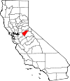
Calaveras County, California Basics:


Calaveras County California - Government Site

Population: 44,731
Area: 1020 square miles
County seat: San Andreas
Area code(s) in use: 209
Time zone: PST
High school graduate or higher: 92.8%
Bachelor's degree or higher: 20.8%
Median household income: $54,686
Persons in poverty: 10.4%
Home ownership rate: 79.1%
Mean travel time to work: 36.2 minutes


Adjacent counties:
Alpine  Amador  San Joaquin  Stanislaus  Tuolumne  

Find in California

Map of the Calaveras County area


Our detail map of Calaveras County shows the Calaveras County, California boundary lines and other interesting items.

Places in Calaveras County, California

  Airports     show all on map

Calaveras County-Maury Rasmussen Field Airport, Eagle Ridge Ranch Airport, Frog Town Airport (historical), Hunter Reservoir Heliport, Mark Twain Saint Josephs Hospital Heliport, Mother Lode Service Center Heliport

  Arches     show all on map

Natural Bridge

  Areas     show all on map

Mother Lode Acres

  Bars     show all on map

Bostick Bar, Duck Bar, French Bar, Oregon Bar, Poverty Bar, Winter Bar

  Basins     show all on map

Bear Trap Basin, Dry Hollow, Jelmini Basin, Pumpkin Hollow, Salt Spring Valley

  Bays     show all on map

Channel Arm, South Arm

  Buildings     show all on map

Altaville Melones Fire Protection District, American Legion Ambulance Station 21, American Legion Ambulance Station 22, American Legion Ambulance Station 23, American Legion Ambulance Station 24, Angels Camp Branch Calaveras County Library, Angels Camp City Hall, Angels Camp Museum, Arnold Branch Calaveras County Library, Black Bart Playhouse, Black Sheep Vinters, Bret Harte Center, Bret Harte Sanatorium, Calaveras County Courthouse, Calaveras County Government Center, Calaveras County Historical Museum, Calaveras County Law Library, Calaveras County Library, Central Calaveras Fire and Rescue Protection District Station 1 Headquarters, Central Calaveras Fire and Rescue Protection District Station 2, Central Calaveras Fire and Rescue Protection District Station 3, Central Calaveras Fire and Rescue Protection District Station 4, Central Calaveras Fire and Rescue Protection District Station 5, City of Angels Fire Department Station 1 Headquarters, City of Angels Fire Department Station 2, Copperopolis Fire Protection District Station 1 Headquarters, Copperopolis Fire Protection District Station 2, Copperopolis Fire Protection District Station 3, Department of Forestry and Fire Protection Altaville Station, Department of Forestry and Fire Protection Arnold Fire Station, Department of Forestry and Fire Protection Arnold Station, Department of Forestry and Fire Protection Copperopolis, Department of Forestry and Fire Protection Esperanza, Department of Forestry and Fire Protection Hermit Spring, Department of Forestry and Fire Protection Murphys, Department of Forestry and Fire Protection San Andreas Station, Department of Forestry and Fire Protection Vallecito Camp, Department of Forestry and Fire Protection Valley Springs, Department of Forestry and Fire Protection West Point, Ebbetts Pass Fire Protection District Station 1 Headquarters, Ebbetts Pass Fire Protection District Station 2, Ebbetts Pass Fire Protection District Station 3, Ebbetts Pass Fire Protection District Station 4, Foothill Fire Protection District Station 1 Headquarters, Foothill Fire Protection District Station 2, Independence Hall, Jenny Lind Fire Protection District Station 1 Headquarters, Jenny Lind Fire Protection District Station 2, Jenny Lind Fire Protection District Station 3, Mattley Cabin (historical), Metropolitan Cultural Center, Mitchler Hotel, Mokelumne Hill Fire Protection District, Murphys Branch Calaveras County Library, Murphys Fire Protection District Station 1 Headquarters, Murphys Fire Protection District Station 2, Native Daughters Hall, Old Timers Museum, Prince Garibardi Building, Romaggi Adobe, San Andreas Fire Protection District, San Andreas Town Hall, Tamarack Lodge, Traver Building, West Point Branch Calaveras County Library, West Point Community Hall, West Point Fire Protection District Station 1 Headquarters, West Point Fire Protection District Station 2

  Canals     show all on map

Calaveras Public Utility Ditch, Fricot Ditch, Jupiter Ditch, Rock Creek Ditch, South Ditch, South Gulch Ditch, Upper Standard Canal, Utica Ditch

  Capes     show all on map

Cypress Point

  Cemeteries     show all on map

Altaville Protestant Cemetery, Catholic Cemetery, Catholic Cemetery, Copperopolis Cemetery, Lode Cemetery, Milton Cemetery, Peoples Cemetery, Pioneer Cemetery, Serbian Cemetery, Vallecito Cemetery

  Census     show all on map

Arnold Census Designated Place, Avery Census Designated Place, Copperopolis Census Designated Place, Dorrington Census Designated Place, Forest Meadows Census Designated Place, Mokelumne Hill Census Designated Place, Mountain Ranch Census Designated Place, Murphys Census Designated Place, Rail Road Flat Census Designated Place, Rancho Calaveras Census Designated Place, San Andreas Census Designated Place, Vallecito Census Designated Place, Valley Springs Census Designated Place, Wallace Census Designated Place, West Point Census Designated Place

  Churches     show all on map

Assembly of God Church of San Andreas, Big Trees Community Bible Church, Church of Christ, Church of Christ, Community Covenant Church of San Andreas, Community Faith Center, Congregational Church, Faith Lutheran Church, First Baptist Church, First Baptist Church of West Point, First Congregational Church, Foothill Lutheran Church, Mountain Ranch Lutheran Church, Murphy's Community Church, Paloma Community Open Bible Church, Saint Andrews Catholic Church, Saint Claires Episcopal Church, Saint Matthews Episcopal Church, Saint Patricks Catholic Church, Saint Patricks Catholic Church, Saint Thomas Aquinas Church, San Andreas Seventh Day Adventist Church, Seventh Day Adventist Church, Sierra Covenant Church, Stone Corral Church, The Church of Jesus Christ of Latter Day Saints, Union Congregational Church

  Cliffs     show all on map

Calaveras Dome, McKays Point

  Crossings     show all on map

Bruce Crossing, O'Byrnes Ferry (historical), Reynolds Ferry (historical), Solinsky Crossing

  Dams     show all on map

Bevanda 495 Dam, Bingham 82 Dam, Calaveras Cement 502 Dam, Cherokee 509 Dam, Christensen Number 1 504 Dam, Copperopolis 1024 Dam, Emery 491 Dam, Ferrario 506 Dam, Fly in Acres 503 Dam, Forest Meadows 1495 Dam, Hein 1491 Dam, Hogan Dam, Holman 2006 Dam, Hunters 99-002 Dam, Jeff Davis 82-004 Dam, McCarty 500 Dam, Melones Dam (historical), Middle Fork 82-002 Dam, Mine Run 31-032 Dam, Mokelumne Hill 1084 Dam, Mountain King 501 Dam, Murphys Afterbay 97-117 Dam, Murphys Forebay 97-127 Dam, Murphys Wastewater 2024 Dam, New Hogan Dam, Pardee Dam, Pine Peak Number 4 82-003 Dam, R N Flower 507 Dam, Reid 1492 Dam, Ross 99-003 Dam, Salt Springs Valley 496 Dam, South Spillway, Tanner 1490 Dam, Tulloch 62-006 Dam, Tulloch Dam, West Point Reg 1024-002 Dam, White Pines 1024-004 Dam

  Flats     show all on map

Albany Flat, Big Meadow, Boston Flat, Bowie Flat, Brandy Flat, Buck Field, Cabbage Patch, Carson Flat, Cherokee Flat, Clark Flat, Corral Meadow, Creightons Meadow, Dead Horse Flat, Deadman Flat, Forest Meadow, French Meadow, Happy Valley, Hells Kitchen, Hunter Flat, Lily Valley, Mattley Meadow, Saint Michele Meadow, Sand Flat, Skull Flat, Smith Flat, Thompson Flat, Thompson Meadow, West Portal

  Gaps     show all on map

Bear Trap Gap, Lily Gap

  Hospitals     show all on map

Calaveras County Rural Clinic, Mark Twain Saint Josephs Hospital

  Lakes     show all on map

Blue Hole, Lion Lake

  Locales     show all on map

Airola Camp, Angels Camp Towne Center Shopping Center, Arnold California Division of Forestry Fire Station, Arnold District Ranger Office, Bailey Ridge Forest Service Station, Bar XX Ranch, Barnett, Beal Ranch, Bear Mountain Ranch, Bernascon Ranch, Big Meadow Campground, Blue Mountain Permanent Lookout Station, Buck Ranch, Buck Ranch Guard Station, Calaveras District Ranger Office, Calaveras Ranger Station, California District Forest Fire Station, Camp Forty-Niner, Camp Sugar Pine Girl Scout Camp, Camp Wolfeboro, Candy Rock, Cat Camp, Cedar Center Shopping Center, Circle XX Ranch, Cooks Ranch, Cottage Spring Campground, Cottage Springs Picnic Area, Crescent Cove Campground, Crescent Cove Picnic Area, Cuneo Camp, Dardanelles Overlook, Del Orto Camp, Dogtown, Dorrington Forest Service Station, Double Springs Ranch, Elkhorn Station, Esperanza Fire Control Station, Fillippini Ranch, Folsom Guard Station (historical), Folsom Lookout, Forest Meadows Golf Course, Fowler Lookout, Frogtown, Gann Ranch, Guffra Ranch, Hells Kitchen Vista, Indian Rock Vineyards, Inks Ranch, Kentucky House, Kran, Kuhn Ranch, La Contenta Lakes Golf and Country Club, Liberty Vista Point, Lombardi Ranch, Lombardi Ranch, Macnider Switch (historical), McCarty Ranch, McClain, McSorley Ranch, Meadowmont Golf Course, Menzies Girl Scout Camp, Middle Bar, Middletons Mark Twain Shopping Center, Milliare Winery, Mitchells Mill, Mokelumne Vista, Moore Creek Campground, Murphys Ranch, New Hogan Marina, North Grove Campground, Ospital Ranch, Parrots Ferry Bridge, Pools Station, Ramsey, Rancheria Del Rio Estanislao, Red House Ranch, Rim Rock Ranch, Rocabella Ranch, San Antonio Camp, Sand Flat Campground, Sequoia Woods Country Club and Golf Course, Sierra Vista Lookout, Six Mile Ranch, Skull Ranch, Solinsky Camp (historical), Sourgrass Campground, Squaw Hollow Campground, Stanislaus River Campground, Stone Corral Ranch, Swiss Ranch, Thompson Ranch, Thousand Hills Shopping Center, Toutch Mill, Tower Ranch, Tower Ranch, Utica Powerhouse, Valley Springs California Division of Forestry Station, Victory Dude Ranch, West Point California Division of Forestry Station, Zwinge Ranch (historical)

  Mines     show all on map

Adelia Mine, Aetna Shaft Mine, Airola Mine, Alcoyne Mine, Altaville Mine, Altaville Mine, Alto Mine, Amador Columbia Mine, Angels Deep Mine, Angels Mine, Barnhardt Mine, Belmont Osborn Mine, Bence Mine, Benson Mine, Big Seven Mine, Big Spring Mine, Black Oak Mine, Black Wonder Mine, Blue Eagle Mine, Blue Jay Mine, Bolitha Mine, Bone Hard Mine, Bosco Mine, Brown Mine, Bruner Mine, Bullion Mine, Bully Boy Mine, Bund Mine, Calaveras Central Mine, Calaveras Mine, Calaveras Shale Quarry, Calaveritas Hill Consolidated Mine, California Ophir Mine, Calmo Mine, Calmo Number Two Mine, Canepa Mine, Canepa Mine, Carson Hill Mine, Cassinelli Mine, Cataract Quarry, Central Hill Mine, Champion Mine, Chaparral Mine, Chapparal Hill Mine, Cherokee Mine, Chili Gulch Pit, Claude Prospect, Clifton Ranch Mine, Collier Mine, Columbia Mine, Copperopolis Quarry, Cotton Flat Mine, Crosette Prospect, Crystal Mine, Curiosity Mine, Curtis Mine, Davis Prospect, Dead Horse Mine, Demarest Mine, Discovery Mine, Dolling Mine, Dutchess Mine, Economic Mine, Emma Mine, Empire Mine, Empire Mine, Esmeralda Mine, Etna King Mine, Etna Mine, Evening Star Mine, Father and Son Mine, Fine Gold Mine, Finnegan Mine, Foley Mine, Foothills Pit, Foster Mine, Friendship Mine, Garibaldi Mine, Gaston Hill Mine, Ghost Mine, Gold Cliff Mine, Gold Hill Mine, Gold Hill Mine, Gold Hill Mine, Gold King Mine, Gold Knoll Mine, Golden River Mine, Golden Star Mine, Gopher Hill Mine, Great Western Mine, Greenstone Mine, Gum Boot Mine, Gwin Mine, Hackerdam Mine, Hageman Mine, Hale Mine, Hardy Mine, Heckendorm Mine, Hicks Prospect, Hidden Cave Mine, Hogate Mine, Holland Mine, Holy Ghost Mine, Humboldt Mine, Imperial Mine, Iron Rock Mine, Jack Rabbit Mine, Jeff Davis Mine, Jones Mine, Jupiter Mine, Kentucky Mine, Keystone Mine, Keystone Mine, Last Chance Mine, Lavagnino Mine, Le Roi Mine, Lightner Mine, Lightner Mine, Lindsay Mine, Little Quail Hill Mine, Lloyd Mine, Longworth Mine, Lookout Mine, Lucky Boy Mine, Lucky Jim Mine, Mable Fay Mine, Madison Mine, Maloney Prospect, Maltman Mine, Marble Spring Mine, Marble Springs Mine, Marjon Mine, Mattison Mine, McCarty Mine, McCarty Mine, McCarty Mine, McCarty Pit, McElroy Mine, McNulty Mine, Meeker Mine, Mike Brown Mine, Missouri Mine, Mohawk Mine, Mokulumne Hill Pit, Moore Mine, Morgan Mine, Morning Star Mine, Mountain King Mine, Mountain Ranch Mine, Napoleon Mine, Nellie Mine, New Hogan Quarry, New Orleans Mine, New Year Mine, North Keystone Mine, North Star Mine, North Star Mine, North Star Mine, Nugget Mine, Ohio Mine, Oriole Mine, Oro Fino Mine, Oro Plata Mine, Ozark Mine, Panuga Mine, Parnell Mine, Pedit Prospect, Peirano Ranch Mine, Penn Mine, Pierano Quarry, Pine Nut Mine, Pioneer Mine, Pluto Mine, Plymouth Rock Mine, Port Arthur Mine, Pure Quill Mine, Quail Hill Mine, Quail Hill Mine, Quarry Four, Railroad Hill Mine, Red Hawk Mine, Red Top Mine, Relief Mine, Reserve Mine, Richie Hill Mine, Riesler Ranch Mine, Right Bower Mine, Rindge Mine Number One, Rindge Mine Number Three, Romaggi and Costa Mine, Romaggi Family Mine, Rose Hill Mine, Royal Mine, Russell Mine, Sacramento Mine, Safe Deposit Mine, San Domingo Mine, Santa Ana Mine, Santa Cruz Mine, Sheep Ranch Mine, Shirley Queen Mine, Skyrocket Mine, Soltana Mine, South Shaft, Star, Starlite Mine, Starve Out Mine, Stevens Mine, Stickles Mine, Stone Prospect, Storm King Mine, Sugarloaf Mine, Sunset Mine, Tecumseh Mine, Thomas Brothers Mine, Thorpe Prospect, Triple Load Mine, Tulloch Mine, Union Mine, Union Mine, Utica Mine, Val Ranch Prospect, Vallecito Western Mine, Vanderbilt Mine, Vonich Mine, Wagon Rut Mine, Waterman Mine, Whittle Mine, Wilbur Womble Mine, Yellow Aster Mine, Yellowstone Mine

  Parks     show all on map

Acorn Recreation Area, Altaville State Historic Landmark, Brownsville State Historic Landmark, Calaveras Big Trees State Park, Copello Park, Fiddleneck Day Use Area, Jenny Lind State Historic Landmark, Leach Field, Mark Twain Monument, Mokelumne Hill State Historic Landmark, Murphys Park, Murphys State Historic Landmark, Nielsen Park, O Byrne Ferry Historical Monument, Oak Knoll Recreation Area, Sandy Gulch Field Baseball Park, Sandy Gulch State Historic Landmark, Stelte Park, Utica Park, Vallecito State Historic Landmark, Valley Springs State Historic Landmark, West Point State Historic Landmark, White Pines Park, Wrinkle Cove Day Use Area

  Pillars     show all on map

Castle Rock

  Populated Places     show all on map

Alabama Hill, Altaville, Angels Camp, Arnold, Avery, Big Bar, Big Meadow, Big Trees, Big Trees Village, Big Valley, Blue Lake Junction, Blue Lake Springs, Bummerville, Burson, Calaveritas, Camanche (historical), Camp Connell, Camp Pardee, Campo Seco, Canyon View, Carmen City, Carson Hill, Cave City, Cedar Vista, Copper Cove Subdivision, Copper Cove Village, Copperopolis, Cottage Springs, Dorrington, Douds Landing, Douglas Flat, Ebbetts Pass Highlands, Felix, Fisher Place, Fly-In Acres, Forest Meadows, Fort Jones, Fourth Crossing, Fuchs, Ganns, Glencoe, Golden Torch Trailer Park, Goodmans Corner, Grizzly Ridge, Hams, Hanford Hill, Happy Valley, Hathaway Pines, Hathaways Mountain Pines, Hodson (historical), Independence, Indian Creek, Indian Hills, Jenny Lind, Jesus Maria, La Honda Park, Lake Camanche Ranches, Lakemont Pines, Lakeside Terrace, Lilac Park, Lombardi, Lost City, Lynn Park Acres, Manuel Mill, McKay, Meadowmont, Melones, Milton, Mokelumne Hill, Mother Lode Acres, Mountain Ranch, Mountain Ranch Subdivision, Mountain Retreat, Mumbert Acres, Murphys, Norval (historical), Oak Grove, Oak Park Estates, Paloma, Pinebrook, Ponderosa Park, Porter, Quail Oaks, Rail Road Flat, Rancho Calaveras, Red Apple, Rich Gulch, Rocky Hill, San Andreas, Sandoz, Sandy Gulch, Scenic Valley Ranchos, Sheep Ranch, Sherman Acres, Skyhigh, Snowshoe Springs, South Camanche Shore, Sunset Point, Tamarack, Tamarack Springs, Telegraph City, The Shores of Poker Flat, Timber Trails, Toyanza Subdivision, Toyon, Vallecito, Valley Springs, Wallace, West Point, White Pines, Wilseyville, Wyldewood

  Post Offices     show all on map

Altaville Post Office, Angels Camp Post Office, Arnold Post Office, Avery Post Office, Bigtrees Post Office (historical), Bigtrees Post Office (historical), Burson Post Office, Camp Connell Post Office, Campo Seco Post Office, Copperopolis Post Office, Dorrington Post Office (historical), Douglasflat Post Office (historical), Gwin Mine Post Office (historical), Mokelumne Hill Post Office, Murphys Post Office, Railroad Flat Post Office (historical), San Andreas Post Office, Valley Springs Post Office, West Point Post Office

  Reservoirs     show all on map

Camanche Reservoir, Clark Reservoir, Copperopolis Reservoir, Emery Reservoir, Fly in Acres Reservoir, Gourley Reservoir, Hunter Reservoir, Kiefer Reservoir, New Hogan Lake, Old McCormick Reservoir, Pacific Placer Reservoir, Pardee Reservoir, Pinebrook Reservoir, Redhawk Lake, Ross Reservoir, Salt Spring Valley Reservoir, Schaads Reservoir, Snowshoe Lake, Tiger Creek Reservoir, Tulloch Reservoir, White Pines Lake, Wilson Lake

  Ridges     show all on map

Bailey Ridge, Bear Mountains, Big Seven Ridge, Deer Ridge, Donovan Ridge, Gales Ridge, German Ridge, Gopher Ridge, Gopher Ridge, Hogback Mountain, Homestead Ridge, Oak RIdge, Pine Ridge, Summit Level Ridge

  Schools     show all on map

Albert A Michelson Elementary School, Altaville Grammar School, Black Hill School (historical), Bret Harte High School, Calaveras High School, California Conservaton Corps Academy, Copperopolis Elementary School, Douglas Flat School (historical), Esmeralda School (historical), Evergreen School (historical), Fricot Ranch School, Hazel Fischer Elementary School, Mark Twain Elementary School, Mokelumne Hill Elementary School, O'Byrnes School (historical), Rail Road Flat Elementary School, Salt Spring Valley School (historical), San Andreas Elementary School, Vallecito High School, Vallecito Union Elementary School, Valley Springs Elementary School, West Point Alternative School, West Point Elementary School, Willow Creek School (historical)

  Springs     show all on map

Black Spring, Churchs Spring, Cold Spring, Cottage Spring, Gooseberry Spring, Hermit Spring, Hicks Spring, Mud Spring, Poison Spring, Salt Springs, San Antonio Spring, Sugar Spring, Turners Spring

  Streams     show all on map

Airola Creek, Angels Creek, Bassella Creek, Bear Creek, Bear Creek, Bear Creek, Beaver Creek, Big Meadow Creek, Big Rattlesnake Creek, Big Springs Creek, Big Trees Creek, Black Creek, Black Creek, Black Spring Creek, Bloods Creek, Blue Creek, Brower Creek, Calaveritas Creek, Camanche Creek, Campbell Creek, Carson Creek, Cedar Creek, Cherokee Creek, Clover Creek, Coopers Creek, Copper Creek, Cosgrove Creek, Cowell Creek, Coyote Creek, Dry Creek, Dry Creek, Dutch Creek, Eldorado Creek, Empire Creek, Esperanza Creek, Forest Creek, French Creek, Greenhorn Creek, Haupt Creek, Hayward Creek, Hunter Creek, Indian Creek, Indian Creek, Jack Nelson Creek, Jelmini Creek, Jesus Maria Creek, Kaye Creek, Licking Fork, Lightning Creek, Lion Creek, Little Dry Creek, Little Mokelumne River, Little Rattlesnake Creek, Loucks Creek, Love Creek, Martel Creek, Mattley Creek, Maxwell Creek, McCarty Creek, McKinney Creek, Middle Fork Mokelumne River, Mill Creek, Moore Creek, Moran Creek, Murray Creek, Nassau Creek, North Fork Calaveras River, North Fork Murray Creek, North Fork Willow Creek, O'Neil Creek, Peachys Creek, Penny Creek, Peppermint Creek, Quartz Creek, Rocky Creek, Rogers Creek, Salamander Creek, Salt Creek, San Andreas Creek, San Antonio Creek, San Domingo Creek, Sawmill Creek, Sixmile Creek, Slate Creek, Smith Creek, Snow Creek, South Fork Calaveras River, South Fork Mokelumne River, South Fork Willow Creek, Spring Valley Creek, Steele Creek, Swamp Creek, Thompson Creek, Underwood Creek, Waterman Creek, Wet Prong Salamander Creek, Whisky Creek, Willow Creek, York Creek, Youngs Creek

  Summits     show all on map

Abbotts Peak, Bald Hill, Bald Mountain, Bald Mountain, Bald Mountain, Barth Mountain, Bear Mountain, Big Dome, Blue Jay Point, Blue Mountain, Bostick Mountain, Boucher Mountain, Brunner Hill, Buck Mountain, Buena Vista Mountain, Carmen Peak, Carson Hill, Central Hill, Chili Hill, Copperopolis Mountain, Darby Knob, Deer Peak, Devils Nose, Doud Hill, Flagpole Point, Flowers Mountain, Fort Mountain, French Hill, Funk Hill, Garnet Hill, Golden Gate Hill, Halleck Hill, High Mountain, Hog Hill, Iron Mountain, Italian Point, Joaquin Peak, John Bull Peak, Lightner Peak, Mineral Mountain, Mount Ararat, Mount Ophir, Mountain Top, Negro Hill, Opal Hill, Pine Peak, Quail Hill, Quiggs Mountain, Rattlesnake Hill, Red Hill, Rocky Hill, Sand Hill (historical), Shirley Mountain, Shovel Grave, Siberia, Simmons Point, Soapstone Hill, South Hill, Stockton Hill, Sugarloaf, Sugarloaf Hill, Valley Springs Peak, Wally Hill

  Towers     show all on map

KCSO-TV (Modesto)

  Trails     show all on map

Buck Ranch Motor Wax Jeep Trail, Darby Knob Firebreak, Timber Trails

  Tunnels     show all on map

Pardee Tunnel

  Valleys     show all on map

Adobe Gulch, Bean Gulch, Bellfout Canyon, Boston Flat Gulch, Bowman Gulch, Buckham Gulch, Cataract Gulch, Chili Camp Gulch, Chili Gulch, Christian Gulch, Corral Gulch, Cottonwood Gulch, Crooked Spring Gulch, Deep Gulch, Dirty Gulch, Dunlap Gulch, Dutch Ed Gulch, Esperanza Valley, Fletcher Gulch, French Gulch, French Gulch, Geers Gulch, Grapevine Gulch, Greenhorn Gulch, Hay Gulch, Hazel Dell Gulch, Heiser Canyon, Horse Canyon, Horse Gulch, Humbug Gulch, Independence Gulch, Indian Burying Gulch, Indian Gulch, Iron Canyon, Janes Gulch, Joaquin Gulch, Krappeau Gulch, Latimer Gulch, Lombardi Gulch, Lone Gulch, Long Canyon, Long Gulch, Long Gulch, Long Gulch, Long Gulch, Long Gulch, Macks Gulch, Mariane Gulch, Martin Gulch, McAfee Gulch, Mexican Gulch, Middle Gulch, Mosquito Gulch, Murderers Gulch, Nassau Valley, Neds Gulch, North Gulch, Old Gulch, Old Woman Gulch, Onion Valley, Paramae Gulch, Pennsylvania Gulch, Peon Gulch, Peruvian Gulch, Poorman Gulch, Ramsey Gulch, Rich Gulch, Rich Gulch, Rich Gulch, Rich Gulch, Sailor Gulch, Salt Gulch, Schoolhouse Gulch, Scorpion Gulch, Shad Spring Gulch, Slocum Gulch, Snake Gulch, Spanish Gulch, Spring Gulch, Spring Gulch, Spring Gulch, Spring Valley, Spruce Gulch, Squaw Hollow, Squirrel Gulch, Straight Spring Gulch, Texas Charley Gulch, Texas Gulch, Thatchers Gulch, Two Dollar Gulch, Valentine Gulch, Volunteer Gulch, Vonich Gulch, Wades Flat Gulch, Walla Gulch, Water Gulch, Wet Gulch, Wet Gulch, Wild Goose Gulch, Wool Hollow, Yea Hoo Gulch

  Woods     show all on map

North Grove,

Calaveras County, California Population By Race (2012 estimate)

RacePopulation
WhiteCalaveras County White population 41,24241,241  
MixedCalaveras County Mixed population 1,5211,520
American IndianCalaveras County American Indian population 805805
AsianCalaveras County Asian population 626626
BlackCalaveras County Black population 447447
Hawaiian & Pacific IslanderCalaveras County Hawaiian & Pacific Islander population 8989

Additional population tables :
State population table
California population by county