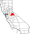
Tuolumne County, California Basics:


Tuolumne County California - Government Site

Population: 54,050
Area: 2221 square miles
County seat: Sonora
Area code(s) in use: 209
Time zone: PST
High school graduate or higher: 88.4%
Bachelor's degree or higher: 17.4%
Median household income: $48,169
Persons in poverty: 13.1%
Home ownership rate: 69.6%
Mean travel time to work: 26.0 minutes


Adjacent counties:
Alpine  Calaveras  Madera  Mariposa  Merced  Mono  Stanislaus  

Find in California

Map of the Tuolumne County area


Our detail map of Tuolumne County shows the Tuolumne County, California boundary lines and other interesting items.

Places in Tuolumne County, California

  Airports     show all on map

Bald Mountain Heliport, Columbia Airport, Columbia Heliport, Hermitage Airport, Kistler Ranch Airport, Peoria Airport, Pine Mountain Lake Airport

  Areas     show all on map

Cave Country, Harden Gardens, Tuolumne Wild and Scenic River Area

  Bars     show all on map

Deadman Bar, Otter Bar, Vermont Bar

  Basins     show all on map

Aspen Valley, Bear Valley, Big Creek Basin, Bull Run, Cooper Pocket, Glen Aulin, Lower Relief Valley, McCormick Pocket, Pate Valley, Peoria Basin, Pleasant Valley, Punch Bowl, Second Garrotte Basin, The Basin, Toms Canyon, Twain Harte Valley, Upper Relief Valley

  Bends     show all on map

Columns of the Giants, Horseshoe Bend, Hunter Bend

  Bridges     show all on map

Lumsden Bridge, Wards Ferry Bridge

  Buildings     show all on map

City of Sonora Fire Department, Claverie Building, Columbia College Fire Department Station 79, Columbia College Library, Columbia Fire Protection District, Department of Forestry and Fire Protection Skull Creek, Department of Forestry and Fire Protection Twaine Harte Forest Fire, Franklin and Wolfe Building, Groveland Community Services District Fire Department Station 1, Groveland Community Services District Fire Department Station 2, Groveland Community Services District Fire Department Station 3, Hildebrand Building, J Levy Building, Knapp Building, Leavitt and Walker Building, Magendi Building, Masonic Hall, McChesney and Mills Building, McChesney Building, Memorial Hall, Mississippi House, Miwok Cultural Center, Moccasin Creek Power House, Morgan Mansion, North Brainard Building, Parsons Memorial Lodge, PHI Air Medical, Schwartz Building, Sierra Conservation Center, Sierra Conservation Center Fire Department, Soderer and Marshall Building, Sonora City Hall, South Brainard Building, Strawberry Fire Protection District, Sugg House, Tuolumne City Fire Protection District 73, Tuolumne County Ambulance Service Station 10, Tuolumne County Ambulance Service Station 11, Tuolumne County Ambulance Service Station 20, Tuolumne County Ambulance Service Station 41, Tuolumne County Courthouse, Tuolumne County Fire Department Standard Station, Tuolumne County Fire Department Station 51 Mono Village, Tuolumne County Fire Department Station 53 Mono Village, Tuolumne County Fire Department Station 54 Long Barn Station, Tuolumne County Fire Department Station 55 Pinecrest, Tuolumne County Fire Department Station 56 Mono Vista, Tuolumne County Fire Department Station 57 Crystal Falls, Tuolumne County Fire Department Station 58 Cedar Ridge, Tuolumne County Fire Department Station 59 Sonora, Tuolumne County Fire Department Station 61 Chinese Camp, Tuolumne County Fire Department Station 62 Moccasin, Tuolumne County Fire Department Station 63 Smith, Tuolumne County Fire Department Station 64 Don Pedro, Tuolumne County Fire Department Station 76 Jamestown Station, Tuolumne County Fire Department Station 77 Mi - Wuk, Tuolumne County Free Library, Tuolumne County Law Library, Tuolumne County Museum, Tuolumne Engine Company Number 1 Fire Station, Tuolumne Rancheria Fire Department, Twain Harte Community Center, Twain Harte Community Services District Fire and Rescue Division, United States Forest Service Stanislaus National Forest

  Canals     show all on map

Algerine Ditch, Columbia Ditch, Jamestown Ditch, Lateral B, Lower Cherry Aqueduct (historical), Main Tuolumne Ditch, O'Neil Ditch, Philadelphia Ditch, Phoenix Ditch, Red Mountain Bar Siphon, San Diego Ditch, Shaws Flat Ditch, Soulsbyville Ditch

  Capes     show all on map

Beardsley Point, Buzzard Point

  Cemeteries     show all on map

Catholic Cemetery, Catholic Cemetery, Cherokee Cemetery, Independent Order of Oddfellows Cemetery, Jamestown Cemetery, Jewish Cemetery, Masonic Cemetery, Mountain Shadow Cemetery, Public Cemetery, Shaws Flat Cemetery, Sonora City Cemetery, Stent Cemetery, Tuolumne Cemetery

  Census     show all on map

Cedar Ridge Census Designated Place, Chinese Camp Census Designated Place, Cold Springs Census Designated Place, Columbia Census Designated Place, East Sonora Census Designated Place, Groveland Census Designated Place, Groveland-Big Oak Flat Census Designated Place (historical), Jamestown Census Designated Place, Long Barn Census Designated Place, Mi-Wuk Village Census Designated Place, Mono Vista Census Designated Place, Phoenix Lake Census Designated Place, Phoenix Lake-Cedar Ridge Census Designated Place (historical), Pine Mountain Lake Census Designated Place, Sierra Village Census Designated Place, Soulsbyville Census Designated Place, Stanislaus-Yosemite Division (historical), Stent Census Designated Place, Strawberry Census Designated Place, Tuolumne City Census Designated Place, Tuttletown Census Designated Place, Twain Harte Census Designated Place

  Churches     show all on map

All Saints Catholic Church, Chapel in the Pines, Community Assembly of God Church, Foothills Community Church, Jamestown Methodist Church, Morgan Chapel, Mount Calvary Lutheran Church, Mountain Lutheran Worship Church, Oak Hill Presbyterian Church, Our Lady of Mount Carmel Catholic Church, Pentecostal Church of God, Presbyterian Church of Columbia, Saint Annes Catholic Church, Saint James Episcopal Church, Saint Patricks Catholic Church, Sonora United Methodist Church, Soulsbyville United Methodist Church, Twain Harte Evangelical Free Church

  Cliffs     show all on map

East Flange Rock, Negro Jack Point

  Crossings     show all on map

Parrotts Ferry (historical)

  Dams     show all on map

Afterbay Dam, Bear Lake Dam, Beardsley Dam, Big Creek 557 Dam, Bigelow Lake 1-026 Dam, Brentwood Park 555 Dam, Buck Lake Dam, Cherry Valley Dam, Don Pedro Dam (historical), Donnells 62-005 Dam, Early Intake 9-000 Dam, Emigrant Lake Dam, Goodwin Dam, Grinding Rock 2018 Dam, Herring Creek Dam, High Emigrant Lake 1-027 Dam, Kincaid 97-072 Dam, Lake Eleanor 9-002 Dam, Leighton Dam, Leland Meadows 559 Dam, Long Lake Dam, Lower Buck Lake 1-025 Dam, Lyons 97-073 Dam, Main Strawberry 97-074 Dam, Middle Emigrant Dam, Moccasin Lower 9-004 Dam, New Don Pedro Dam, New Melones Dam, New Melones Dam, O'Shaughnessy Dam, Phoenix 97-078 Dam, Priest 9-006 Dam, Quartz 2019 Dam, Relief 97-080 Dam, San Diego Reservoir 1069 Dam, Sand Bar Flat Dam, Snowlake Dam, Spicers Meadow 99-004 Dam, Stanislaus Forebay 97-083 Dam, Tuolumne Log Pond 558 Dam, Twaine Harte 551 Dam, Y Meadow Dam, Y Meadows Dam

  Falls     show all on map

California Falls, Jawbone Falls, Le Conte Falls, Preston Falls, Rancheria Falls, Tueeulala Falls, Tuolumne Falls, Wapama Falls, Waterwheel Falls, White Cascade

  Flats     show all on map

Abernathy Meadow, Ackerson Meadow, Aspen Meadow, Barn Meadow, Bear Meadow, Beartrap Meadow, Beehive, Bell Meadow, Big Prather Meadow, Bluff Meadow, Bonds Flat, Bone Flat, Boulder Flat, Bourland Meadow, Brightman Flat, Brownes Meadow, Bull Meadow, Bummers Flat, Burch Meadow, Castle Meadow, Cedar Flat, Chipmunk Flat, Chipmunk Flat, Clavey Meadow, Clover Meadow, Cooper Meadow, Corcoran Flat, Corral Meadow, Cottonwood Meadow, Coyote Meadows, Crane Meadow, Crocker Meadow, Dana Meadows, Dodge Meadow, Drew Meadow, Dry Meadow, Eagle Meadow, Emigrant Meadow, Eureka Valley, Fahey Meadow, Femmons Meadows, Fiddlers Green, Fraser Flat, French Flat, Funks Meadow, Gardner Meadow, Grace Meadow, Grizzly Meadow, Grizzly Meadow, Grohl Meadow, Groundhog Meadow, Groundhog Meadow, Gully Meadow, Hay Meadow, Haypress Meadow, Hells Half Acre, Hodgdon Meadow, Horse and Cow Meadow, Horse Meadow, Horse Meadow, Hulls Meadows, Hungry Flat, Jones Meadow, Kassabaum Meadow, Kelly Flat, Kennedy Meadow, Kerrick Meadow, Lake Valley, Leland Meadow, Little Prather Meadow, Lord Meadow, Lunch Meadow, Marshs Flat, McCormick Meadows, McSwain Meadows, Meadows, Middle Three Meadow, Miguel Meadow, Montgomery Meadow, Moraine Flat, Pedro Flat, Peoria Flat, Pidgeon Flat, Piute Meadow, Plum Flat, Post Corral Meadow, Randalls Meadow, Rawhide Flat, Red Rock Meadow, Rodgers Meadow, Rosasco Meadow, Round Meadow, Rushing Meadow, Salt Lick Meadow, Sands Meadow, Sapps Meadow, Sardine Meadow, Saucer Meadow, Schumake Meadow, Shanahan Flat, Shoofly Meadow, Smith Meadow, Sourgrass Meadow, Spring Meadow, Studhorse Meadow, Summit Meadow, Thompson Meadow, Three Meadows, Tuolumne Meadows, Twin Meadows, Upper Three Meadow, Weed Meadow, Wet Meadow, Wheats Meadow, Whitesides Meadow, Willow Meadow, Willow Meadow, Wilson Meadow, Wolfin Meadow, Woods Meadow

  Forests     show all on map

Calaveras Bigtree National Forest (historical), Stanislaus National Forest

  Gaps     show all on map

Benson Pass, Bond Pass, Brown Bear Pass, Burro Pass, Dorothy Lake Pass, Eagle Pass, Emigrant Pass, Jawbone Pass, Mono Pass, Moody Gap, Parker Pass, Peoria Pass, Rock Island Pass, Schoettgen Pass, Seavey Pass, Styx Pass, Sugar Pine Gap, Tioga Pass, Two Dog Pass, Windy Gap

  Glaciers     show all on map

Lyell Glacier, Maclure Glacier

  Hospitals     show all on map

Sierra Hospital, Sonora Regional Medical Center Health Clinic, Sonora Regional Medical Center Main, Tuolumne General Hospital

  Islands     show all on map

Big Island (historical), Eagle Island (historical)

  Lakes     show all on map

Andrews Lake, Ardeth Lake, Arndt Lake, Avonelle Lake, Bear Lake, Bear Lake, Bearup Lake, Benson Lake, Big Island Lake, Big Lake, Bigelow Lake, Bingaman Lake, Birch Lake, Black Bear Lake, Black Hawk Lake, Blackbird Lake, Bloomer Lake, Blue Canyon Lake, Boundary Lake, Branigan Lake, Buck Lakes, Budd Lake, Burgson Lake, Camp Lake, Catfish Lake, Chain Lakes, Chewing Gum Lake, Clear Lake, Cow Meadow Lake, Coyote Lake, Deadman Lake, Deer Lake, Doe Lake, Dog Lake, Dorothy Lake, Edith Lake, Elizabeth Lake, Emigrant Lake, Emigrant Meadow Lake, Evelyn Lake, Fawn Lake, Fisher Lakes, Five Acre Lake, Flora Lake, Fraser Lakes, Frog Lake, Gaylor Lakes, Gem Lake, Granite Lake, Granite Lakes, Gravel Pit Lake, Grouse Lake, Harden Lake, Haypress Lake, Helen Lake, High Emigrant Lake, Huckleberry Lake, Hyatt Lake, Iceland Lake, Inferno Lakes, Ireland Lake, Irwin Bright Lake, Jawbone Pass Pond, Jewelry Lake, Karls Lake, Kennedy Lake, Kibbie Lake, Kole Lake, Kuna Lake, Lake Moran, Lake Vernon, Lambert Lake, Laurel Lake, Leighton Lake, Leopold Lake, Lertora Lake, Lewis Lakes, Lily Lake, Little Bear Lake, Little Otter Lake, Long Lake, Lost Lake, Lukens Lake, Maclure Lake, Mahan Lake, Many Island Lake, Mary Lake, Mattie Lake, Maxwell Lake, McCabe Lakes, McGee Lake, Middle Branigan Lake, Middle Emigrant Lake, Miller Lake, Miwok Lake, Mosquito Lake, Mud Lake, Murdock Lake, Neall Lake, Olive Lake, Onion Lake, Otter Lake, Parker Pass Lake, Peninsula Lake, Pingree Lake, Pinto Lakes, Piute Lake, Powell Lake, Pruitt Lake, Red Can Lake, Return Lake, Rhodes Lake, Ridge Lake, Rock Island Lake, Rodgers Lake, Roosevelt Lake, Rosasco Lake, Saddle Horse Lake, Sardella Lake, Shallow Lake, Shamrock Lake, Sharon Lake, Shepherd Lake, Siesta Lake, Sister Lake, Skelton Lakes, Smedberg Lake, Snow Lake, Soldier Lake, Sourgrass Lake, Spiller Lake, Spillway Lake, Spotted Fawn Lake, Starvation Lake, Summit Lake, Surprise Lake, Swamp Lake, Swamp Lake, Table Lake, Tallulah Lake, Ten Lakes, Tilden Lake, Toejam Lake, Twin Lakes, Twin Meadows Lake, Upper Branigan Lake, Upper Gaylor Lake, Upper McCabe Lake, Upper Peninsula Lake, Virginia Lake, W Lake, Waterhouse Lake, Wilma Lake, Wire Lakes, Wood Lake, Yellowhammer Lake, Young Lakes

  Locales     show all on map

American Camp Lookout, American Camp Station, Avery Ranch, Baker Campground, Baker Ranch, Baker Station, Baptist Camp, Barron Ranch, Base Line Camp (historical), Beardsley Point Picnic Area, Beaver Creek Camp (historical), Beaver Creek Campground, Bennett Juniper, Berkeley-Tuolumne Campground, Big Oak Flat District Ranger Office, Big Oak Flat Entrance, Blanchard Fire Control Station, Boyd Ranch, Bret Harte Cabin, Brightman Flat Campground, Brown Boy Cabin, Brown Girl Cabin, Buck Meadows Forest Service Station, Burgeson Ranch, California Alumni Camp, California Division of Forestry, Camp, Camp Bray, Camp Chinquapin, Camp Clavey, Camp Curry, Camp Forty Three, Camp Fourty Five, Camp Fourty Four, Camp High Sierra, Camp John Mensinger Boy Scout Camp, Camp MacBride (historical), Camp Niagara, Camp Stephens California Alumni Camp, Camp Sylvester, Camp Towenga, Camp Twentyfour, Carlon Campground, Carlon Station, Cascade Campground, Cascade Creek, Cedar Rock Lodge, Central Ferry, Cherry Valley Campground, Chinese Station, Clarkfork Horse Camp, Columbia California Division of Forestry Air Attack Base, Columbia Camp (historical), Columbia Fire Station, Cottonwood Campground (historical), Cottonwood Picnic Area, Cow Camp, Crabtree Campsite, Crane Flat Lookout, Crimea House, Crook Ranch, Dardanelles Campground, Dardanelles Outlook, Deadman Campground, Deadman Flat Scenic Viewpoint, Diamond O Boy Scout Camp, Dion R Holm Powerhouse, Dodge Ridge Ski Area, Don Pedro Camp (historical), Donnell Powerhouse, Donnell Vista Point, Donnell Vista Point Picnic Area, Dougals Picnic Area, Douglas Resort, Dry Meadow Station, Eagle Creek Camp, Early Intake Powerhouse (historical), East Flange Scenic Viewpoint, Eastman Ranch, Elliots Cabin, Emerson Ranch, Evergreen Lodge, Fahey Cabin, Faust Cabin, Five Mile Regional Center, Forebay Lookout, French Camp, Gandolfo Ranch, Gianelli Cabin, Glen Aulin High Sierra Camp, Goodwin Ranch, Graham Ranch, Grohls Upper Camp, Groveland California Division of Forestry Station, Groveland District Ranger Office, Groveland Landfill, Groveland Ranger Station, Guinn Ranch, Harden Ranch, Hatler Mill, Hawkins Ranch, Helltack Base, Herring Creek Campground, Hetch Hetchy Backpackers Campground, Hetch Hetchy Campground, Hetch Hetchy Entrance, Hetch Hetchy Ranger Station, Hodgdon Meadow Campground, Hull Creek Campground, Hunter Creek Camp Ground, Ingalls Ranch, Italian Bar, Italian Ranch, Jackass Hill, Jamestown Conservation Camp, Jawbone Forest Service Station, Jawbone Station, Jones Point Lookout (historical), Kistler Ranch, Kress Ranch, Lake Eleanor Campgound, Lake Eleanor District Ranger Office, Lake Eleanor Ranger Station, Lee Price Camp, Long Barn FD Fire Station, Lookout Point, Lost Claim Camp Ground, Lumsden Bridge Campground, Lumsden Campground, Mark Twain Cabin, Martins Cow Camp, Mather Ranger Station, Matsen Ranch, McCormick Lookout, McNutt Ranch, Meadowview Campground, Meyers Ranch, Mi Wok District Ranger Office, Mi-Wok Fire Station, Mi-Wuk Village Golf and Country Club, Middlefork Campground, Miguel Meadow Ranger Station, Mill Campground, Montezuma Mine, Moore Creek Campground, Murphy Ranch, Niagra Campground, North Mountain Lookout (historical), Oakland Recreation Camp, Odd Fellows Fire Department, Odd Fellows Rebekah Youth Camp, Old Oak Ranch, Peach Growers, Phoenix Lake Golf Course, Phoenix Powerhouse, Pigeon Flat Campground, Pine Log, Pine Mountain Lake Country Club, Pinecrest Campground, Pinecrest Lookout, Pinecrest Treatment Plant, Pioneer Trail Campground, Post Corral, Que De Porka Resort, Quinn Ranch, Rainbow Pool Campground, Rainbow Pool Picnic Area, Ralph Ranch, Richards Ranch, River Ranch, Riverside Picnic Area, Riverside Station, Robert C Kirkwood Powerhouse, Rogge Ranch, Rush Creek (historical), Rushing Ranch (historical), San Jose Recreation Camp, Sand Bar Flat Campground, Sapps Camp (historical), Sawmill Flat, Shearing Camp, Sheep Camp, Sierra Campground, Sierra Pines Golf Course, Skull Creek California Division Forestry Fire Station, Smith Station, Smoky Jack Campground (historical), Smoothwire Camp (historical), Snyder Camp, Soap Creek Pass, Sonora Sewer Farm, South Fork Campground, Spinning Wheel Forest Service Facility, Spring Gap Powerhouse, SSFD Fire Station, Strawberry Forestry Division Fire Station, Strawberry Work Center, Sudall Ranch, Summit Ranger Station, Sunset Camp (historical), Sweetwater, Sweetwater Campground, The Pines Campground, Tioga Pass Entrance, Tramway Camp, Tunnel Tree, Tuolumne Camp (historical), Tuolumne Junction Shopping Center, Tuolumne Meadows Campground, Tuolumne Meadows Lodge, Tuolumne Meadows Ranger Station, Twain Harte F D Fires Station, Twain Harte Golf Course, Wagner Ranch, Wheats Cow Camp, Whittles Upper Camp, Woods Ridge Lookout, Yosemite Lakes Park Campground

  Mines     show all on map

Alabama Mine, Alameda Mine, Anderson Mine, Anti-Chinese Mine, App Mine, Aqua Caliente Mine, Arbona Mine, Belcher Mine, Bell Mine, Black Oak Mine, Black Slate Mine, Blue Mountain Quarry, Bonanza Mine, Cardinelle Mine, Casa Madera Mine, Chickenfeed Mine, Chileno Mine, Climax Mine, Clio Mine, Columbus Mine, Confidence Mine, Contention Mine, Corona Mine, Crystal Springs Mine, Crystalline Mine, Defender Mine, Densmore Mine, Diamond Mine, Dickey Boy Mine, Dutch Mine, Eagle-Shawmut Mine, Erin-Go-Bragh Mine, Excelsior Mine, Experimental Mine, Fair Oaks Mine, Fairview Mine, Five Star Mine (historical), Ford Mine, Fortynine Mine (historical), Gagnere Mine, Gem Mine, Geraldine Mine, Gold Queen Mine, Gold Ridge Mine, Golden Gate Mine, Golden Rule Mine, Grant Mine, Gray Eagle Mine, Great Sierra Mine, Green Mine, Green Spring Mine, Habacker Mine, Haigh Quarry, Harriman Mine, Harvard Mine, Harvard Mine, Hattie Ester Mine, Hedley Mine, Henning Mine, Heslep Mine, Hess Mine, Hitchcock Mine, Humbug Mine, If I Can Mine, Indian Girl Mine, Jigger Bill Brothers Mine, Jumper Mine, Junction Mine, Kanaka Mine, Keltz Mine, Lucky Strike Mine, Lucky Strike Mine, Mackey Prospect, Mackey Prospect, Malone Prospect, Mammoth Mine, Mapes-O'Hara Mine, Marble Quarries, Marble Quarry, Marryatt Mine, Mazeppa Mine, McAlpine Mine, McCormick Mine, Miller and Holmes Prospect, Mitchell Mine, Mountain Lily Mine, New Era Mine, New York Mine, Noonday Mine, North Star Mine, Nugget Mine, Nyman Consolidated Mine, Oak Hill Mine, Oak Mesa Mine, Omega Mine, Ophir Mine, Orcutt Mine, Patterson Mine, Perconi Ranch Prospect, Poseidon Mine, Providence Mine, Punch Bowl Mine, Quigg Prospect, Rappahannock Mine, Rawhide Mine, Red Cloud Mine, Red Jacke Mine, Republic Mine, Republican Mine, Richards Prospect, Ridgeway Mine, Rifle Mine, Ripperton Mine, Russell Telegraph Mine, Ryan Mine, San Giuseppe Mine, Santa Ysabel Consolidated Mine, Shanghai Mine, Shore Mine, Sims Prospect, Sonnet Mine, Soulsby Mine, Spring Gulch Mine, Springfield Mine, Star Mine, Sullivan and Kahl Prospect, Sunnyside Mine, Sweeney Mine, Tarantula Mine, Tarantula Mine, Thunderbolt Mine, Toledo Mine, Valencia Mine, Vandelier Mine, Vine Spring Mine, Volunteer Mine, White Quarry, Wickham Mine, Wisehart Pit

  Parks     show all on map

Carkeet Community Park, Coffils Park, Columbia Historic District, Columbia State Historic Park, Groveland Wayside Park, Merlo Field Sports Complex, Mother Lode Fairgrounds, Odd Fellows High Sierra Park, Pioneer Park, Railtown 1897 State Historic Park, South Shore Recreation Area, Tuolumne Memorial Park, Tuolumne State Game Refuge, Woods Creek Rotary Park

  Pillars     show all on map

Polaris Rock, Pulpit Rock

  Populated Places     show all on map

Algerine, Aplache (historical), Apple Valley Estates, Arastraville, Aspen Valley, Belleview, Belleview Acres, Bellwood Estates, Big Oak Flat, Black Jack Bluffs, Black Oak Estates, Boards Crossing, Brentwood Park, Browns Flat, Buchanan, Buckhorn Estates, Bumblebee, Camp Earnest, Camp Pendola, Campo Seco, Cedar Pines Vista, Cedar Ridge, Cedar Rock Lodge, Chaparral Heights, Cherokee, Chinese Camp, Chupcan (historical), Cold Springs, Colfax Spring, Columbia, Columbia Village, Comstock Ranch, Confidence, Cow Creek, Crystal Falls, Cuesta Oaks, Cuesta Serena, Curtis Creek Ranch, Dardanelle, Deadwood, Diamond Bar B Ranch, East Sonora, Fairway Acres, Femmons, Gibbs Ranch, Goldmont Forest, Greenley Oaks, Groveland, Harden Flat, Heavenly Hills, Hess Mill, Hetch Hetchy Junction, High Sierra Park, Jamestown, Jupiter, Kennedy Meadow, Keystone, Lakewood Highlands, Lakewood Park, Lambert Lake Estates, Lapapu (historical), Lilac Terrace, Long Barn, Lynnwood Estates, Martinez, Mather, Melones Sunset Lake Estates, Mi-Wuk Village, Moccasin, Mono Village, Mono Vista, Monte Grande Heights, Montezuma, Mother Lode West, Numaltachi (historical), Oak Gardens Estates, Peaceful Valley, Peppermint Creek, Phoenix Lake, Phoenix Lake County Club Estates, Pinecrest, Priest, Quail Hollow, Quail Ridge Ranch, Quartz, Ralph, Rancho Poquitos, Rancho Sonora Estates, Rawhide, Rolling Hills, Saratoga Acres, Scenic Brook, Scenic Heights, Scenic View, Scraperville (historical), Second Garrotte, Sequoia, Shaws Flat, Sherwood Forest, Sierra Village, Siyante (historical), Sonora, Sonora Hills, Sonora Knolls, Sonora Meadows, Sonora Ranchettes, Soulsbyville, Spring Gap, Springfield, Squabbletown, Standard, Stanislaus, Stent, Strawberry, Sugarpine, Sunshine Camp, Sylvan Lodge, Tall Timber Camp, Tuolumne, Tuolumne City, Tuttletown, Twain Harte, Twain Harte Valley, Volponi Acres, Wagner, White Oak Estates, White Wolf, Willow Springs, Woods Crossing, Yankee Hill, Yosemite Junction

  Post Offices     show all on map

Big Oak Flat Post Office, Columbia Post Office, Dardanelle Post Office (historical), Jacksonville Post Office (historical), Jamestown Post Office, Mather Post Office (historical), Oakland Recreation Camp Post Office (historical), Pinecrest Post Office (historical), Sonora Post Office, Stent Post Office (historical), Tuolumne Post Office, Twain Harte Post Office

  Ranges     show all on map

Gravel Range, Red Hills

  Reserves     show all on map

Calaveras South Grove Natural Preserve, Carl A Anderson Redwoods Natural Preserve, Emigrant Wilderness, Yosemite Wilderness

  Reservoirs     show all on map

Beardsley Lake, Buck Lake, Buck Lake, Cherry Lake, Don Pedro Reservoir, Donnell Lake, Emigrant Lake, Herring Creek Reservoir, Herring Creek Reservoir, Hetch Hetchy Reservoir, Horse Meadow Reservoir, La Grange Reservoir, Lake Eleanor, Lakewood Park Lake, Leighton Lake, Leland Reservoir, Lyons Reservoir, Matelot Reservoir, Middle Emigrant Lake, Moccasin Reservoir, New Melones Lake, O'Neil Reservoir, Phoenix Reservoir, Pine Mountain Lake, Pinecrest Lake, Priest Reservoir, Relief Reservoir, San Diego Reservoir, Snowlake Reservoir, Y Meadows Reservoir

  Ridges     show all on map

Bailey Ridge, Butcher Knife Ridge, Cherry Ridge, Contention Ridge, Crocker Ridge, Dodge Ridge, Duckwall Ridge, Dunn Ridge, Falls Ridge, Grant Ridge, Hells Hollow Ridge, Jackass Ridge, Jawbone Ridge, Jones Point, Kibbie Ridge, Kuna Crest, Laughlin Ridge, Macomb Ridge, McNulty Ridge, Moraine Ridge, Paper Cabin Ridge, Pe�on Blanco Ridge, Riley Ridge, Saurian Crest, Sawtooth Ridge, Second Garrotte Ridge, Star Ridge, Suicide Ridge, Summit Ridge, Table Mountain, Wagner Ridge, Whittakers Dardanelles, Woods Ridge, Yankee Hill

  Schools     show all on map

Algerine School, Arastraville School, Belleview Elementary School, Big Oak Flat School, Chinese Camp Elementary School, Columbia College, Columbia Community College, Columbia Elementary School, Corner School (historical), Curtis Creek Elementary School, Dario Cassina High School, Elmore Temporary School, Jamestown Elementary School, Long Barn High School, Mother Lode Junior Academy, Pinecrest Elementary School, Poverty Hill School, Rawhide School, Servaes Temporary School, Shaws Flat-Springfield Union School, Sonora Elementary School, Sonora High School, Soulsbyville Elementary School, Summerville Elementary School, Summerville High School, Tenaya Elementary School, Tenaya School, Twain Harte Elementary School, Wards Ferry School

  Slopes     show all on map

Kelley Grade, Old Priest Grade, Priest Grade, The Slide

  Springs     show all on map

Alder Spring, Box Spring, Box Spring, Burnt Corral Spring, Camp Ida Spring, Camp Twentyone Spring, Deadwood Spring, Freeze-Out Spring, Gold Spring, Hull Creek Spring, Indian Spring, Indian Spring, Lord Spring, McNulty Spring, Merrill Spring, Milk Ranch Spring, Million Dollar Spring, Oak Leaf Spring, Pilot Peak Spring, Rackerby Jack Spring, Robert Nichols Spring, Ruby Hill Spring, Sachse Spring, Salt Spring, Salt Spring, Sam Williams Spring, Shingle Spring, Soda Springs, Stoddard Spring, Vine Spring, Walton Cabin Spring, Wet Meadows Springs, White Spring

  Streams     show all on map

Ackerson Creek, Alder Creek, Algerine Creek, Alkali Creek, Andrew Creek, Bartlett Creek, Basin Creek, Basin Creek, Bear Creek, Bear Creek, Bear Springs Creek, Bell Creek, Big Creek, Big Creek, Big Creek, Big Creek, Big Humbug Creek, Big Jackass Creek, Big Meadow Creek, Big Trees Creek, Blanket Creek, Bourland Creek, Breeze Creek, Brushy Creek, Brushy Hollow Creek, Buck Meadow Creek, Budd Creek, Bull Creek, Bull Meadow Creek, Bumblebee Creek, Camp Creek, Camp Twentyfive Creek, Campoodle Creek, Cascade Creek, Casnau Creek, Cathedral Creek, Cherry Creek, Chinaman Creek, Clavey River, Cline Creek, Cloudburst Creek, Cobbs Creek, Conness Creek, Corral Creek, Cottonwood Creek, Cottonwood Creek, Cottonwood Creek, Cow Creek, Crane Creek, Crane Creek, Curtis Creek, Dana Fork, Dardanelles Creek, Deadman Creek, Deer Creek, Deer Creek, Delaney Creek, Dingley Creek, Douglas Creek, Drew Creek, Drew Creek, Dry Creek, Dry Meadow Creek, Duckwall Creek, Dyer Creek, Eagle Creek, Eagle Creek, East Fork Cherry Creek, Eleanor Creek, Falls Creek, First Creek, Fisher Creek, Fivemile Creek, Fleming Creek, French Creek, Frog Creek, Garrotte Creek, Gasburg Creek, Gooseberry Creek, Granite Creek, Grapevine Creek, Green Spring Run, Griswold Creek, Grizzly Creek, Grouse Creek, Hatch Creek, Hells Hollow Creek, Herring Creek, Highland Creek, Hobart Creek, Hull Creek, Hunter Creek, Indian Creek, Ireland Creek, Jawbone Creek, Kanaka Creek, Kendrick Creek, Kennedy Creek, Kibbie Creek, Knight Creek, Kuna Creek, Leland Creek, Lily Creek, Lily Creek, Lion Creek, Little Beaver Creek, Little Jackass Creek, Little Reynolds Creek, Long Gulch Creek, Long Valley Creek, Looney Creek, Lost Creek, Lyell Fork, Lyons Creek, Maclure Creek, Mann Creek, Matterhorn Creek, McCabe Creek, McCormick Creek, McCormick Creek, Middle Fork Stanislaus River, Middle Tuolumne River, Miguel Creek, Mill Creek, Mill Creek, Moccasin Creek, Mormon Creek, Morrison Creek, Mountain Pass Creek, Niagara Creek, Niagara Creek, North Fork, North Fork Cherry Creek, North Fork Griswold Creek, North Fork Stanislaus River, North Fork Tuolumne River, Owl Creek, Paddle Creek, Parker Pass Creek, Peoria Creek, Peppermint Creek, Piute Creek, Piute Creek, Quigley Creek, Quilty Creek, Rafferty Creek, Rancheria Creek, Rattlesnake Creek, Reed Creek, Register Creek, Regulation Creek, Relief Creek, Return Creek, Reynolds Creek, Richards Creek, Rock Creek, Rock Creek, Roger Creek, Rose Creek, Rough and Ready Creek, Rush Creek, Rush Creek, Russell Creek, Salt Spring Creek, Sandy Wash, Second Creek, Sheering Creek, Shotgun Creek, Silver Mine Creek, Skull Creek, Skunk Creek, Slate Creek, Smoothwire Creek, Soap Creek, Soldier Creek, Sonora Creek, South Fork, South Fork Cathedral Creek, South Fork Griswold Creek, South Fork Stanislaus River, South Fork Tuolumne River, Spiller Creek, Spring Creek, Sugarpine Creek, Sullivan Creek, Summit Creek, Thirteenmile Creek, Thorps Creek, Tilden Canyon Creek, Tilden Creek, Tiltill Creek, Trout Creek, Tunnel Creek, Turnback Creek, Twomile Creek, Unicorn Creek, West Fork Big Creek, West Fork Cherry Creek, Wheats Meadow Creek, White Fir Creek, Willow Creek, Wilson Creek, Woods Creek, Woods Creek, Wrights Creek

  Summits     show all on map

Acker Peak, Ackerson Mountain, Amelia Earhart Peak, Andrews Peak, Ascension Mountain, Bald Mountain, Bald Mountain, Bald Mountain, Bald Peak, Bartlett Peak, Bath Mountain, Bear Mountain, Bell Hill, Bell Mountain, Ben Brow Hill, Bigelow Peak, Black Hawk Mountain, Blank Peak, Blewetts Point, Bourland Mountain, Buckhorn Mountain, Bull Run Rock, Burst Rock, Castle Rock, Cathedral Peak, Center Mountain, Chittenden Peak, Colby Mountain, Cold Mountain, Cone Hill, Cooper Peak, Craig Peak, Crandall Peak, Doghead Peak, Dome Rock, Domingo Peak, Double Dome Rock, Double Rock, Duckwall Mountain, Eagle Peak, Ehrnbeck Peak, Elbow Hill, Elizabeth Peak, Excelsior Mountain, Fairview Dome, Finger Peaks, Forsyth Peak, Gaylor Peak, Gillett Mountain, Grand Mountain, Granite Dome, Grapevine Point, Grey Butte, Grizzly Peak, Hammils Mountain, Haystack Peak, Hells Mountain, Hetch Hetchy Dome, Hog Mountain, Hooper Peak, Hungry Hill, Hunter Point, Joes Point, Johnson Peak, Jones Hill, Kendrick Peak, Kennebec Hill, Kennedy Peak, Keyes Peak, Kolana Rock, Kuna Peak, Le Conte Point, Leavitt Peak, Lembert Dome, Liberty Hill, Lucky Point, Mahan Peak, Mammoth Peak, Marble Mountain, Matterhorn Peak, McKee Hill, Mercur Peak, Michie Peak, Moccasin Peak, Molo Mountain, Mount Eaton, Mount Gibson, Mount Knight, Mount Lewis, Mount Maclure, Mount Provo, Murphy Peak, Nance Peak, Negro Hill, Night Cap Peak, North Mountain, North Peak, Page Mountain, Parsons Peak, Penole Peak, Peoria Mountain, Pettit Peak, Pikes Peak, Pilot Peak, Pinecrest Peak, Piute Mountain, Pothole Dome, Potter Point, Price Peak, Puppy Dome, Quarry Peak, Quartz Mountain, Rafferty Peak, Ragged Peak, Rancheria Mountain, Red Peak, Regulation Peak, Relief Peak, Repeater Hill, Richardson Peak, Rushing Mountain, Sachse Monument, Sapps Hill, Sawmill Mountain, Schofield Peak, Sheep Peak, Shepherd Crest, Shumake Knoll, Simmons Peak, Slide Mountain, Smith Peak, Snow Peak, Stanton Peak, Strawberry Peak, Sugarloaf, Taylor Hill, Telegraph Hill, The Three Chimneys, Thompson Peak, Thunder Hill, Tiltill Mountain, Tip Top Peak, Tower Peak, Tulloch Mountain, Tuolumne Peak, Twin Peaks, Unicorn Peak, Union Hill, Virginia Peak, Volunteer Peak, Wells Peak, West Peak, Wet Meadow Hill, Wheeler Peak, White Mountain, Whorl Mountain, Wildcat Point

  Towers     show all on map

KDJK-FM (Oakdale), KDJK-FM (Oakdale), KKBN-FM (Twain Harte), KTUO-FM (Sonora), KVML-AM (Sonora), KZSQ-FM (Sonora)

  Trails     show all on map

Gaylor Lakes Trail, Golden Stairs Trail, Rogge Trail, Twain Harte Horseman Trail

  Tunnels     show all on map

Brown Adit, Donnell Tunnel, Stanislaus Tunnel

  Valleys     show all on map

Blue Canyon, Blue Canyon, Blue Gulch, Brush Gulch, Butcher Knife Pocket, Camp Meeting Gulch, Canady Gulch, Cedar Gulch, Cherry Creek Canyon, Chile Gulch, Clarks Gulch, Coffin Hollow, Cold Canyon, Crazy Mule Gulch, Deadman Gulch, Deep Canyon, Devils Canyon, Dragon Gulch, Experimental Gulch, Fox Gulch, Frank Young Gulch, Gillman Gulch, Grand Canyon of the Tuolumne River, Grizzly Gulch, Grizzly Gulch, Grub Gulch, Hammill Canyon, Hardscrabble Gulch, Hells Hollow, Hetch Hetchy Valley, Jack Main Canyon, Jackson Gulch, Johnnie Gulch, Kerrick Canyon, Little Beaver Canyon, Little Hetch Hetchy Valley, Little Twin Gulch, Lone Gulch, Long Canyon, Long Gulch, Long Gulch, Long Gulch, Long Gulch, Long Valley, Louse Canyon, Lucas Gulch, Lyell Canyon, Matelot Gulch, Matterhorn Canyon, Meentzen Gulch, Mexican Gulch, Minnow Gulch, Muir Gorge, Negro Jack Gulch, Norwegian Gulch, Pigeon Gulch, Pine Valley, Poopenaut Valley, Poor Mans Gulch, Portuguese Gulch, Post Corral Canyon, Quail Gulch, Rattlesnake Gulch, Red Gulch, Rock Canyon, Rocky Gulch, Rodgers Canyon, Salter Gulch, Sawmill Gulch, Silver Gulch, Six-bit Gulch, Skunk Gulch, Slate Gulch, Slide Canyon, Smarts Gulch, Soda Canyon, Soldier Gulch, Stony Gulch, Stony Gulch, Stubblefield Canyon, Tennessee Gulch, Texas Gulch, Thompson Canyon, Tilden Canyon, Tiltill Valley, Tulloch Gulch, Twin Gulch, Twin Gulch, Virginia Canyon, Wet Gulch, Whites Gulch, Willow Gulch, Wolf Gulch

  Woods     show all on map

South Grove, Stanislaus Grove Big Trees, Tuolumne Grove,

Tuolumne County, California Population By Race (2012 estimate)

RacePopulation
WhiteTuolumne County White population 49,24049,239  
MixedTuolumne County Mixed population 1,7301,729
American IndianTuolumne County American Indian population 1,1891,189
AsianTuolumne County Asian population 649648
Hawaiian & Pacific IslanderTuolumne County Hawaiian & Pacific Islander population 108108

Additional population tables :
State population table
California population by county