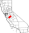
Merced County, California Basics:


Merced County California - Government Site

Population: 261,632
Area: 1935 square miles
County seat: Merced
Area code(s) in use: 209
Time zone: PST
High school graduate or higher: 66.6%
Bachelor's degree or higher: 12.5%
Median household income: $43,565
Persons in poverty: 24.6%
Home ownership rate: 54.2%
Mean travel time to work: 26.0 minutes


Adjacent counties:
Fresno  Madera  Mariposa  San Benito  Santa Clara  Stanislaus  Tuolumne  

Find in California

Map of the Merced County area


Our detail map of Merced County shows the Merced County, California boundary lines and other interesting items.

Places in Merced County, California

  Airports     show all on map

59 Duck Club Airport, Ahlem Farms Airport, Atwater Municipal Airport, Azevedo Landing Strip, Bonanza Hills Airport, Castle Airport, Dos Palos Airport, Emmett Field Airport, Gustine Airport, Hunt Farms Airport, John Myers Airport, Johnson Ranch Airport, Los Banos Municipal Airport, Merced Regional Airport/Macready Field, San Luis Reservoir Seaplane Base, Santa Nella Airport (historical), Stevinson Strip Airport, Turlock Municipal Airport, Willis Ranch Airport

  Areas     show all on map

Sandy Mush Country

  Bays     show all on map

Cottonwood Bay, Lone Oak Bay, Rotary Cove, Veterans Cove

  Beaches     show all on map

North Beach, South Beach

  Bridges     show all on map

Milliken Bridge, Santa Rita Bridge, Shaffer Bridge

  Buildings     show all on map

Air Methods Medical Transport, Atwater Branch Merced County Library, Atwater City Hall, Atwater Fire Department Station 1, Atwater Fire Department Station 2, Baker Library, Bloss House Museum, Castle Air Museum, Department of Forestry and Fire Protection Los Bannos Station, Dos Palos Branch Merced County Library, Dos Palos City Hall, Gustine Branch Merced County Library, Hilmar Community Hall, Irwin-Hilmer Branch Merced County Library, Lesher Library, Livingston Branch Merced County Library, Livingston City Hall, Los Banos Branch Merced County Library, Los Banos City Hall, Los Banos Fire Department Station 1, Los Banos Fire Department Station 2, Merced City Fire Department Station 51 Headquarters, Merced City Fire Department Station 52, Merced City Fire Department Station 53, Merced City Fire Department Station 54, Merced City Fire Department Station 55, Merced City Hall, Merced County Courthouse, Merced County Fire Department Station 62 Castle, Merced County Fire Department Station 63 Winton, Merced County Fire Department Station 64 Cressey, Merced County Fire Department Station 65 Snelling, Merced County Fire Department Station 71 Los Banos, Merced County Fire Department Station 72 Santa Nella, Merced County Fire Department Station 73 Los Banos, Merced County Fire Department Station 74 Gustine, Merced County Fire Department Station 75 Dos Palos Wye, Merced County Fire Department Station 76 Dos Palos, Merced County Fire Department Station 81 Merced Headquarters, Merced County Fire Department Station 82, Merced County Fire Department Station 83 El Nido, Merced County Fire Department Station 84 Le Grand, Merced County Fire Department Station 85 McKee, Merced County Fire Department Station 86 Planada, Merced County Fire Department Station 91 Delhi, Merced County Fire Department Station 92 Ballico, Merced County Fire Department Station 95 Hilmar, Merced County Fire Department Station 96 Livingston, Merced County Fire Department Station 97 Stevinson, Merced County Human Services Agency, Merced County Jail, Merced County Juvenile Hall, Merced County Law Library, Merced County Library, Merced Museum, Merced Womans Club, Milken Museum, Riggs Ambulance Service, Romero Visitors Center, San Luis Pump-Generator Plant, Stevinson Branch Merced County Library, United States Penitentiary Atwater, Valley Theatre (historical), Veterans Memorial Building, Veterans Memorial Building, Veterans Memorial Hall, West Side Community Ambulance Newman, West Side Community Ambulance Santa Nella, Yosemite Wildlife Museum

  Canals     show all on map

Adams Ditch, Agatha Canal, Arena Canal, Arroyo Canal, Arundel Lateral, Atwater Canal, Atwater Drain, Avenue Martin Lateral, Belmont Drain, Benedict Lateral, Bennett Ditch, Bird Lateral, Bloss Lateral, Borland Lateral, Boundary Drain, Boundary Drain Number Five, Boundary Drain Number Five-Two, Bradley Lateral, Buhach Lateral, Cadera Lateral, Casad Lateral, Casebeer Road Lateral, Caton Lateral, Circle Island Drain, Clark Ditch, Colony Branch Number Five, Colony Branch Number Four, Colony Branch Number Three Canal, Colony Branch Number Two Canal, Colony Main Canal, Community Ditch, Cotton Lateral, County Road Ditch, Cowden Ditch, Cowell Ditch, Crane Lateral, Cressey Lateral, Cressey Lateral East, Cross Ditch Number Two, Curtner Lateral, Dairy Field Ditch, Dairy Field Ditch Number One, Dairy Field Drain Number Two, Davis Lateral, Deane Canal, Deane Drain, Deckert Lateral, Delta Canal, Delta Drain, Delta Number One Canal, Delta-Mendota Canal, Dibblee Lateral, Diversion Canal, Eagle Ditch, East Ashe Lateral, East Delta Canal, East Delta Canal, East Side Canal, East Side Irrigation Canal, Eastside Bypass, El Capitan Canal, El Nido Canal, Escaladian Shaw Canal, Escano Branch Number One Ditch, Escano Ditch, Fairfield Canal, Fairfield Canal, Farmdale Lateral, Field Drain, Fisher Lateral, Fremont Canal, Gadwall Canal, Garibaldi Lateral, Geis Ditch, Gertrude Lateral, Givens Lateral, Grimes Lateral, Gurr Lateral, Hadley Lateral, Hammatt Lateral, Hartley Lateral, Helm Ditch, Henderson Lateral, Henderson Lateral, Hereford Drain, Hesse Lateral, Hilmar Drain, Hinds Lateral, Howard Lateral, Hunter Lateral, Island Canal B, Island Canal C, Island Canal D, Island Field Drain, Ivett Lateral, Kesterson Ditch, King Lateral, Koff Lateral, Laguna Canal, Lateral Five, Lateral Four, Lateral Number Eight, Lateral Number Seven, Lateral Number Six, Le Grand Canal, Le Grand Canal, Leatherman Lateral, Lehner Lateral, Levee Drain, Lingard Lateral, Little Ward Canal, Livingston Canal, Livingston Drain, Lone Tree Canal, Loop Ditch, Loop Ditch Number One, Loop Ditch Number Two, Lower Dallas Lateral, Lower Golf Lateral, Lucerne Ditch, Machado Ditch, Main Ashe Lateral, Main Canal, Main Canal, Mariposa Bypass, Mattos Drain, McConnell Livingston Lateral, McCoy Lateral, McGilvray Lateral, McSwain Lateral, Meadowbrook Lateral, Merced Lateral, Middle Dallas Lateral, Middle Ditch, Middle Lateral, Midway Canal, Midway Canal, Midway Swamp Ditch, Mitchell Drain, Mud Slough Bypass, Nealon Lateral, Newman Waste-Way, North Bloom Lateral, North Bypass Ditch, North Side Canal, O'Donnell Lateral, Orchard Ditch, Outside Canal, Pachaud Lateral, Paden Drain, Parker Lateral, Parr Lateral, Parriera Drain, Pick Anderson Bypass, Pick Anderson Drain, Pilger Lateral, Planada Canal, Poso Drain, Reinero Drain, Rice Drain, Riverside Canal, Riverside Ditch, Rotterdam Lateral, Rubino Ditch, Russel Lateral, Russell Lateral, Salt Slough Ditch, Salt Slough Island Canal, San Juan Canal, San Juan Drain, San Juan Drain Number Three, San Juan Number One Levy Canal, San Luis Canal, San Luis Drain Number One, San Luis Spillway Ditch, San Luis Wasteway, San Pedro Canal, Santa Fe Canal, Santa Rita Ditch, Santa Rita Drain, Schmidt Ditch, Sells Lateral, Shain Drain, Sharon Lateral, Silva Drain, Siphon Ditch, Sixmile Drain, South Bloom Lateral, South Bypass Lift Ditch, South Pick Anderson Lift Ditch, Spilker Lateral, Sproul Lateral, Stadtler Drain, Steiner Drain, Steiner Lateral, Stevinson Lower Lateral, Stevinson Upper Lateral, Stickney Lateral, Stoddard Lateral, Sullivan Extension, Swenson Lateral, Tambellini Ditch, Temple Santa Rita Canal, Temple Santa Rita Extension Canal, Tetzlaff Lateral, Thornton Lateral, Tin Flume Lateral, Titus Lateral, Toscano Ditch, Tower Lateral, Trindade Drain, Upper Dallas Lateral, Upper Golf Lateral, Vaughn Lateral, Wakefield Lateral, Washington Lateral, Watson Lateral, West Buhach Lateral, West Delta Canal, West Delta Drain, West San Juan Drain, West San Juan Drain Number One, West Santa Rita Drain, Western States Drain, Willow Tree Ditch, Winton Lateral, Wood Slough Drain, Yosemite Lateral, Zentner Lateral

  Capes     show all on map

Indian Point, Quien Sabe Point

  Cemeteries     show all on map

Calvary Cemetery, Calvary Cemetery, Evergreen Cemetery, Helm-Turner Cemetery, Hopeton Cemetery, Los Banos Cemetery, North Hilmar Cemetery, San Joaquin Valley National Cemetery, South Hilmar Cemetery, Stevinson Sunnyside Cemetery, Winton Cemetery

  Census     show all on map

Ballico Census Designated Place, Bear Creek Census Designated Place, Cressey Census Designated Place, Delhi Census Designated Place, Dos Palos Y Census Designated Place, El Nido Census Designated Place, Franklin Census Designated Place, Hilmar-Irwin Census Designated Place, Le Grand Census Designated Place, McSwain Census Designated Place, Planada Census Designated Place, Santa Nella Census Designated Place, Snelling Census Designated Place, South Dos Palos Census Designated Place, Stevinson Census Designated Place, Tuttle Census Designated Place, University of California Merced Census Designated Place, Volta Census Designated Place, Winton Census Designated Place

  Churches     show all on map

Antioch Baptist Church, Apostolic Assembly Church, Apostolic Tabernacle, Ariel Dear Found Family Church, Atwater Baptist Church, Atwater Christian Life Church, Atwater United Methodist Church, Bear Creek Community Church, Bethany Church of God in Christ, Bethesda Apostolic Faith Church, Calvario Centro Cristiano, Calvary Assembly of God Church, Calvary Baptist Church, Central Presbyterian Church, Church of Christ, Church of Christ, Church of Christ, Church of Christ, Church of Christ, Church of God in Christ, Church of the Nazarene, Cornerstone Worship Center Pentecostal Church, Cortez Presbyterian Church, Cottonwood Church (historical), Eastside Church of Christ, El Nido Missionary Baptist Church, Emmanuel Baptist Church, Ephesus Apostolic Church, Evergreen Christian Center, First Assembly of God Church, First Baptist Church, First Baptist Church, First Baptist Church, First Christian Church (historical), First Church of Christ Scientist, First Church of God, First Church of God, First Southern Baptist Church of Winton, Free Will Baptist Church, Friendship Baptist Church, Grace Fellowship Foursquare Church, Gustine Community Presbyterian Church, Harvest Christian Center, Holy Cross Lutheran Church, Iglesia Bautista de la Comunidad, Islamic Center of Merced, Keep Hope Alive Christian Center, Landmark Tabernacle, Living Water Christian Fellowship Church, Merced Bethel Seventh Day Adventist Church, Merced Revival Center, Mision Cristiana Pricipe de Paz, Missionary Baptist Church of Merced, Mount Olive Baptist Church, Mount Zion Lighthouse Full Gospel Church, New Faith Tabernacle Church of God in Christ, New Life Assembly of God Church, Olive East Seventh Day Adventist Church, Our Lady of Mercy Roman Catholic Church, Our Lady of Miracles Church, Our Redeemer Lutheran Church, Pentecostal Church of God, Reorganized Church of Jesus Christ of Latter Day Saints, Sacred Heart Roman Catholic Church, Saint Anthonys Roman Catholic Church, Saint Judes Roman Catholic Church, Saint Lukes Episcopal Church, Saint Lukes Episcopal Church, Saint Matthew Baptist Church, Saint Nicholas Episcopal Church, Saint Patricks Roman Catholic Church, Saint Pauls Lutheran Church, Salvation Army Laotian Ministries, Second Baptist Church, Seventh Day Adventist Church, Sierra Presbyterian Church, The Church of Jesus Christ of Latter Day Saints, The Church of Jesus Christ of Latter Day Saints, United Methodist Church of Merced, Unity Church of Merced, Valley Baptist Church, Victory Baptist Church, Westside Christian Center, Yosemite Church

  Crossings     show all on map

Fremont Ford, Old Dickenson Ferry (historical)

  Dams     show all on map

Beutel Dam, Burns Creek Dam, Crocker Dam, Crocker Diversion 58-000 Dam, El Nido Dam, Kelsey 662 Dam, Lake Yosemite 58-003 Dam, Los Banos Detention Dam, Los Banos Sewage 2023 Dam, Merced Falls Diversion Dam, Miles Creek Dam, Monnett Dam, Mustang Creek 666 Dam, O'Neill Dam, Oneill Dam, Oneill Forebay Dike Dam, Puglizevich Dam, San Luis Dam, San Luis Dike Dam, Snelling Diversion Dam

  Flats     show all on map

Arroyo Padre Flat, Carrisalito Flat, Henry Miller Field, Wisenor Flat

  Gaps     show all on map

Buck Pass, Frenchs Pass, The Narrows

  Guts     show all on map

Bear Slough, Bravel Slough, Camp Thirteen Slough, Chamberlain Slough, Dana Slough, Deadmans Slough, Deep Slough, Hopeton Slough, Mariposa Slough, Middle Branch Salt Slough, Middle Slough, North Slough Mariposa Creek, Poso Slough, Salt Slough, Sand Slough, Santa Rita Slough, Shag Slough, Snake Slough, South Slough, Wood Slough

  Hospitals     show all on map

Anberry Rehabilitation Hospital, Bloss Memorial Hospital, Dos Palos Memorial Hospital, Marie Green Psychiatric Center Psychiatric Health Facility, Memorial Hospital Los Banos, Mercy Medical Center Dominican, Mercy Medical Center Merced, West Side Hospital

  Islands     show all on map

Circle Island, San Luis Island, Scout Island, Tunnel Island, Turner Island

  Lakes     show all on map

Big Buttonwillow Lake, Big Water Lake, Dry Lake, East Branch Salt Slough, Flat Pond, Lake Honda, Little Buttonwillow Lake, Lower Ruth Lake, Mammoth Lake, Upper Ruth Lake, Well Pond, Wolf Lake

  Locales     show all on map

A and D Dairy, Agatha Gun Club, Ahlem Farms, Airport Industrial Park, Anchor J Dairy, Applegate Park Zoo, Arburua Ranch, Arroyo Farm (historical), Atwater Business Park, Atwater Plaza Shopping Center, Atwater Town Center Shopping Center, Azevedo Dairy, Basalt Campground, Bay City Gun Club, Bear Creek Shopping Center, Bear Creek Village Shopping Center, Bellevue Ranch, Belmont Ranch, Bettencourt and Marson Dairy, Big Drake Gun Club, Big Water Gun Club, Bonanza, Borba Dairy Farms, Brasil Dairy, Brito Gun Club, Camp 13 (historical), Camp McConnell, Canal Farm Shopping Center, Carmel Gun Club, Chateau Duck Club, Chowchilla Ranch, Circle Six Ranch, Clauss Dairy Farms, College Green Shopping Center, Colony Farm, Coon Duck Club, Cottonwood Gun Club, Coyote Springs Area Campground, Crane Ranch, Creegan, D and D Holsteins Dairy, Delta Ranch, Dores Dairy, Dos Amigos Pumping Plant, Double Creek Ranch, Double D Dairy, Eagle Ranch (historical), Erreca Ranch, Exeter Farms, Faust Family Dairy, Five H Farms, Flynn Duck Club, Fore Bay Golf Club, Four Corners, Fremont Ford, Fremont Ranch (historical), Gable Ranch, Gallo Bamboo Dairy, Gallo Bear Creek Dairy, Gallo Colombard Dairy, Gallo Cottonwood Dairy, Gaston Bide Ranch (historical), Gilroy Gun Club, Gonzales Ranch, Gotfreid Ranch, Gustine Gun Club, Haley Ranch (historical), Hereford Ranch, Highway 33 Egg Ranch, Highway 59 Landfill, Hillcrest Dairy, Hogland Ranch, Hollister Gun Club, Homen Dairy Farms, Hoogendam Dairy, Howard Ranch, Ingomar Gun Club, Ingomar Ranch, La Paloma Ranch, Laguna Seca Ranch, Langan Ranch (historical), Le Grand Sewage Disposal, Linora Pumping Station, Livingston Substation, Lone Tree Camp (historical), Lone Tree Gun Club, Los Banos Fire Control Station, Los Banos Game Bird Farm, Los Banos Gun Club, Lucerne Ranch, Lucky Shopping Center, M and C Dairy, Manteca Gun Club, Mayo Dairy Number 1, McNamara Ranch, Meadows Area Campground, Medeiros Area Campground, Menefee Ranch, Merced County Honor Farm, Merced Golf Club, Merced Mall Shopping Center, Merced Sewage Disposal, Merced Substation, Midway Ranch (historical), Milk Made Dairy, Miller and Lux Ranch, Model Market Shopping Center, Modesto Gun Club, National Shopping Center, Negro Hill, Newman Gun Club, Nine Old Men Hunt Club, Nylund Dairy Number 1, Nyman Brothers Dairy, O'Banion Gun Club, Oakland Gun Club, Outside Creek Elementary School, P H Ranch, Pfeiffer Ranch, R V Dairy, Rancho Del Rey Golf Course, Red Top, Riverside Ranch, Rock - Shar Dairy, Rodoni Dairy Farms, Romero Overlook, Rubino Gun Club, Salinas Gun Club, San Jose Gun Club, San Juan Ranch, San Luis Creek Area Campground, San Luis Plaza Shopping Center, San Luis Ranch, San Luis Ranch (historical), Sandy Mush Ranch, Santa Cruz Gun Club, Santa Cruz Gun Club, Santa Nella Shopping Center, Santa Rita Ranch, Segaita Gun Club, Sherman Dairy, Sierra Gun Club, Sierra Vista Dairy, Silveira Dairy, Six Spot Gun Club, Sportsman Ranch, Sportsmens Gun Club, Standard Gun Club, Stevinson Home Ranch, Sunny Side-Rainbow Hunt Club, Sunwest Jersey Dairy, Temple Gun Club (historical), Terrels Gun Club, Town and Country Shopping Center, Tri-City Gun Club, Triangle Gun Club, Turlock Country Club, Turner Ranch, Underwood Gun Club, Underwood Ranch (historical), V and R Dairy, Veldhuis North Dairy, Vieira Dairy Farm, Visalia Dux Club, Vista Farms Duck Club, Vista Verde Dairy, Waltz Ranch, Wells Nut Farm, Whistler Point Area Campground, Wickstrom Dairy, Wickstrom Jersey Farms, Wilson Substation, Woo Ranch, Yellow Jacket Gun Club, Yosemite Jersey Dairy, Yosemite North Shopping Center, Zimmerman Gun Club

  Military     show all on map

Castle Air Force Base (historical)

  Mines     show all on map

Carson Pit, Clark Pit, Flintkote Pit, Los Banos Creek Pit, Stayton Mine

  Parks     show all on map

Ada Givens Park, Airport Park, Andy Albiani Park, Applegate Park, Arakelian Park, Atwater Memorial Ballpark, Ballico Park, Basalt Day Use Area, Bella Vista Park, Black Rascal Creek Park, Bloss Park, Bob Hart Park, Burbank Park, Canal Farm State Historic Landmark, Court House Square Park, Dinosaur Point Boat Launch Area, Dos Amigos Management Area, E L Walters Park, Fahrens Park, Flanagan Park, George J. Hatfield State Recreation Area, Great Valley Grasslands State Park, Great Valley Grasslands State Park, Hagaman Park, Harry P Schmidt Park, Heller Park, Henderson Park, Henry Miller Park, Joe Herb Park, Kesterson National Wildlife Refuge, Leonard Park, Livingston Memorial Park, Los Banos Fairgrounds Park, Los Banos Regional Park, Los Banos State Waterfowl Area, Lower Cottonwood Creek Wildlife Area, Macias Park, Macready Park, Manuel Bairos Park, McConnell State Recreation Area, McNamara Park, Merced National Wildlife Refuge, O'Bannion County Park, O'Neill Forebay Wildlife Area, Osborn Park, Page Park, Pioneer Park, Rahilly Park, Ralston Park, San Luis National Wildlife Refuge, San Luis Reservoir State Recreation Area, San Luis Reservoir Wildlife Area, Santa Fe Park, Shattuck Park, Sherwood Park, Tower Park, Upper Cottonwood Creek Wildlife Area, Veterans Park, Volta State Wildlife Area, Winton Community Park

  Populated Places     show all on map

Abbato (historical), Amsterdam, Arena, Arundel (historical), Athlone, Atwater, Ballico, Bear Creek, Bellevue (historical), Brito, Buhach, Burchell (historical), Calpack, Castle Gardens, Cortez, Cressey, Cuba (historical), Delhi, Dickenson (historical), Dos Palos, Dos Palos Y, Edendale (historical), El Nido, Fergus, Fluhr, Gadwall (historical), Gustine, Hamburg Farms, Hilmar, Hoff (historical), Hopeton, Ingomar, Irwin, Kadota, La Branza (historical), Le Grand, Lingard, Linora (historical), Livingston, Los Banos, Marguerite (historical), Merced, Merced Falls, Nairn (historical), Plainsburg, Planada, Santa Nella Village, Santa Rita Park, Snelling, South Dos Palos, Stevinson, The Grove, Trent, Tuttle, Volta, Winton

  Post Offices     show all on map

Atwater Post Office, Ballico Post Office, Castle Air Force Base Post Office (historical), Delhi Post Office, Dos Palos Post Office, Gustine Post Office, Livingston Post Office, Los Banos Post Office, Merced Post Office, Snelling Post Office, Winton Post Office

  Reservoirs     show all on map

Bass Lake, Bear Hide Lake, Burns Lake, Diamond Lake, Dinosaur Lake, El Nido Reservoir, Kelsey Reservoir, Los Banos Reservoir, Nun Lake, O'Neill Forebay, San Luis Holding Reservoir, San Luis Reservoir, Tule Lake, Yosemite Lake

  Ridges     show all on map

Mustang Ridge, Ortigalita Ridge, Peckham Ridge

  Schools     show all on map

Ada Givens Elementary School, Aileen Colburn Elementary School, Alicia Reyes Elementary School, Anderson School (historical), Appling School (historical), Arena School (historical), Ariel Dear Academy, Arundel School (historical), Atwater High School, Ballico Elementary School, Barfield School (historical), Bellevue Elementary School, Buhacn Grammar School, Campus Park Elementary School, Canal School, Center School (historical), Challenger Learning Center, Charles Wright Elementary School, Charleston School, Cottonwood School, Cressey Elementary School, Cunningham School (historical), Delhi Development Center, Dickenson School (historical), Don B Chenoweth Elementary School, Dos Palos Elementary School, Dos Palos High School, East Merced High School, Eden School (historical), El Capitan Elementary School, El Capitan School (historical), El Nido Elementary School, Elim Elementary School, Elmer Wood Elementary School, Eschscholtzia School (historical), Farmdale School (historical), Frank Sparkes Elementary School, Franklin Elementary School, Fruitland Christian Preschool, Fruitland School (historical), Galen Clark Kindergarten, Galen Clark School (historical), George Christian Elementary School, Granada High School, Gustine Elementary School, Gustine High School, Gustine Middle School, Hamburg Ranch School (historical), Helmar School (historical), Henry Miller Elementary School, Herbert Hoover Intermediate School, Hilmar Senior High School, Hopeton School, John Fremont Elementary School, John Muir Elementary School, Johnson School, Jordan School (historical), Joseph Le Conte School (historical), Lakeside School (historical), Le Conte Kindergarten, Le Grand Elementary School, Le Grand School, Le Grand Union High School, Leontine Gracey Elementary School, Livingston High School, Livingston Intermediate School, Lone Tree School (historical), Los Banos Elementary School, Los Banos High School, Los Banos Junior High School, Luther Burbank Elementary School, Madison School (historical), Margaret Sheehy Elementary School, McSwain Elementary School, Merced Adult School, Merced College, Merced Colony School (historical), Merquin Elementary School, Mitchell Elementary School, Monroe School (historical), Mountain View School (historical), New Hope Foundation School, North Merced Union High School, Occidental School (historical), Ortigalita School (historical), Our Lady of Fatima School, Our Lady of Mercy School, Our Lady of Miracles Education Center, Peggy Heller Elementary School, Plainsburg Elementary School, Planada Elementary School, Prairie Flower School (historical), R M Miano Elementary School, Riverside School, Robla School (historical), Romero School, Romero School, Rotterdam School (historical), Rudolph Rivera Intermediate School, Russell School (historical), Saint Anthony School, Saint Judes School, San Luis High School, Schendel Elementary School, Selma Herndon Elementary School, Shaffer Elementary School, Snelling-Merced Falls Elementary School, Sunset School (historical), Sybil N Crookham Elementary School, Tenaya Intermediate School, Thomas Olaeta Elementary School, Tuttle Grammar School (historical), University of California - Merced, Vincent School, Vineyard School (historical), Volta Elementary School, Washington Elementary School, Weaver Elementary School, West End School (historical), West Side Union High School, Winton Middle School, Witmer School (historical)

  Springs     show all on map

Buckeye Spring, Carranza Spring, Carrisalito Spring, Carrisalito Springs, Coyote Spring, Domengine Spring, Frazier Spring, La Baig Spring, Langston Spring, Log Trough Spring, Lucky Spring, O'Connells Spring, Piedra Azul Spring, Pigs Bath Tub, Reeves Spring, Salt Spring, Stack Spring, Sunburnt Spring, Thirtyfive Spring, Willow Spring, Windmill Spring

  Streams     show all on map

Bear Creek, Black Rascal Creek, Boundary Drain, Boundary Drain Number One, Browns Creek, Burns Creek, Canal Creek, Carrisalito Creek, Chileno Creek, Chowchilla River, Cottonwood Creek, Cottonwood Creek, Deadman Creek, Devils Glen, Devon Drain, Dry Creek, Duck Slough, Dutchman Creek, Edendale Creek, Fahrens Creek, Garzas Creek, Hartley Slough, Hayward Creek, Hidden Creek, Ingalsbe Slough, Jones Drain, Laguna Seca Creek, Los Banos Creek, Mariposa Creek, Merced River, Miles Creek, Miner Creek, Mud Slough, Mud Slough, Mustang Creek, North Fork Los Banos Creek, Old Chowchilla Creek, Old Poso Slough, Ortigalita Creek, Owens Creek, Parkinson Creek, Piedra Azul Creek, Portuguese Creek, Quinto Creek, Rincon Creek, Romero Creek, Salt Creek, Salt Creek, Salt Slough, San Luis Creek, South Fork Dry Creek, South Fork Los Banos Creek, South Slough, Spicer Creek, Stoney Creek, Stony Creek, Wildcat Creek

  Summits     show all on map

Antimony Peak, Basalt Hill, Bullard Mountain, Cathedral Peak, China Hat, Haystack Mountain, Laveaga Peak, Lookout Mountain, Mariposa Peak, Mount Ararat, Ortigalita Peak, Red Hill, Saint Marys Peak, Spikes Peak, Sugarloaf, Sweeney Hill, Table Top Mountain, Twin Peaks

  Swamps     show all on map

Olson Pond

  Towers     show all on map

KABX-FM (Merced), KDAT-FM (Merced), KLBS-AM (Los Banos), KLOQ-AM (Merced), KNTO-FM (Livingston), KSNN-FM (Los Banos), KVMG-TV (Merced), KVRK-FM (Atwater), KXDA-FM (Chowchilla), KXDE-FM (Merced), KYOS-AM (Merced)

  Valleys     show all on map

Big Deer Canyon, Big Pine Canyon, Herrero Canyon, Hoffman Canyon, Jeffers Canyon, Little Deer Canyon, Little Pine Canyon, Los Banos Valley, Molina Canyon, Orognen Canyon, Piedra Azul Canyon, Ruby Canyon, Soda Gulch, Sulphur Spring Gulch, Tile Canyon, Wildcat Canyon, Williams Canyon, Woodchopper Canyon

  Wells     show all on map

Eagle Well, Lower Well, Upper Well

  Woods     show all on map

Los Banos Odd Fellows Grove,

Merced County, California Population By Race (2012 estimate)

RacePopulation
WhiteMerced County White population 214,277214,276  
AsianMerced County Asian population 21,19221,192
BlackMerced County Black population 11,25011,250
MixedMerced County Mixed population 7,5877,587
American IndianMerced County American Indian population 6,5416,540
Hawaiian & Pacific IslanderMerced County Hawaiian & Pacific Islander population 1,0471,046

Additional population tables :
State population table
California population by county