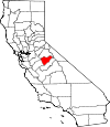
Mariposa County, California Basics:


Mariposa County California - Government Site

Population: 17,888
Area: 1449 square miles
County seat: Mariposa
Area code(s) in use: 209
Time zone: PST
High school graduate or higher: 89.4%
Bachelor's degree or higher: 19.9%
Median household income: $52,584
Persons in poverty: 14.7%
Home ownership rate: 72.1%
Mean travel time to work: 32.4 minutes


Adjacent counties:
Madera  Merced  Stanislaus  Tuolumne  

Find in California

Map of the Mariposa County area


Our detail map of Mariposa County shows the Mariposa County, California boundary lines and other interesting items.

Places in Mariposa County, California

  Airports     show all on map

Grupe Ranch Airport, Manzanita Airport, Mariposa-Yosemite Airport

  Bars     show all on map

Peachtree Bar

  Basins     show all on map

Dark Hole, Guadalupe Valley

  Bays     show all on map

Cotton Arm, Temperance Arm

  Benches     show all on map

Buckhorn Flat, The Rostrum

  Bends     show all on map

Horseshoe Bend

  Bridges     show all on map

Ahwahnee Bridge, Clarks Bridge, El Capitan Bridge, Happy Isles Bridge, Pohono Bridge, Sentinel Bridge, Stoneman Bridge, Sugar Pine Bridge, Tenaya Bridge

  Buildings     show all on map

California Forestry and Fire Protection Madera - Mariposa - Merced Unit Mariposa Fire Station, California State Mining and Mineral Museum, Coulterville Community Club House, Delaware North Company Fire Department Yosemite, Department of Forestry and Fire Protection Catheys Valley Fire Station, Department of Forestry and Fire Protection Coulterville Fire Station, Department of Forestry and Fire Protection Hornitos Fire Station, Department of Forestry and Fire Protection Mount Bullion Conservation Camp, Department of Forestry and Fire Protection Usona Fire Station, El Portal Community Hall, Greeley Hill Community Club, Hetch Hetchy Railroad Museum, Leconte Memorial Lodge, Mariposa County Courthouse, Mariposa County Fire Department Company 21 Midpines, Mariposa County Fire Department Company 22 Mariposa Public Utility District Fire Station 1, Mariposa County Fire Department Company 23 Catheys Valley, Mariposa County Fire Department Company 24 Don Pedro, Mariposa County Fire Department Company 25 Mount Bullion / Airport, Mariposa County Fire Department Company 26 Coulterville, Mariposa County Fire Department Company 27 Morman Bar, Mariposa County Fire Department Company 29 Lushmeadows, Mariposa County Fire Department Company 31 Greeley Hill, Mariposa County Fire Department Company 32 Ponderosa Basin, Mariposa County Fire Department Company 33 Fish Camp, Mariposa County Fire Department Company 36 Hunters Valley, Mariposa County Fire Department Company 37 Bootjack, Mariposa County Law Library, Mariposa Museum and History Center, Mariposa Public Utility District Fire Department Station 2 Headquarters, Mercy Medical Transport, Rangers' Club, Savage Trading Post, Snow Creek Ranger Cabin, The Ahwahnee, Yosemite Fire and Rescue

  Capes     show all on map

Casa Diablo, Jasper Point, Marble Point, Roosevelt Point

  Cemeteries     show all on map

Catheys Valley Cemetery, Granite Spring Cemetery, Pate Cemetery, Saint Joseph Cemetery, Santa Cruz Cemetery, White Rock Cemetery

  Census     show all on map

Bear Valley Census Designated Place, Bootjack Census Designated Place, Buck Meadows Census Designated Place, Catheys Valley Census Designated Place, Coultervillle Census Designated Place, El Portal Census Designated Place, Fish Camp Census Designated Place, Greeley Hill Census Designated Place, Hornitos Census Designated Place, Lake Don Pedro Census Designated Place, Mariposa Census Designated Place, Midpines Census Designated Place, Mount Bullion Census Designated Place, Wawona Census Designated Place, Yosemite Valley Census Designated Place

  Churches     show all on map

Church of Christ, First Baptist Church, Hillside Baptist Church, Mariposa Assembly of God Church, Mariposa Foursquare Church, Mariposa United Methodist Church, Saint Josephs Catholic Church, Seventh Day Adventist Church, Sierra Faith Center, Wildwood Community Church

  Cliffs     show all on map

Bunnell Cliff, Cascade Cliffs, Castle Cliffs, Cathedral Rocks, Crocker Point, Dewey Point, Diving Board, Fireplace Bluffs, Glacier Point, Leaning Tower, Panorama Cliff, Profile Cliff, Rockslides, Sierra Point, Stanford Point, The Fissures, Yosemite Point

  Crossings     show all on map

Split Rock Ferry (historical)

  Dams     show all on map

Bear Dam, Cascade Dam, Green Valley 673 Dam, Hendricks 675 Dam, Mariposa Dam, McMahon 674 Dam, McSwain 58-004 Dam, Metzger 676 Dam, New Exchequer Dam, New Exchequer Dam, Owens Dam, Stockton Creek 672 Dam

  Falls     show all on map

Bridalveil Fall, Bunnell Cascade, Chilnualna Fall, Chinquapin Falls, Foresta Falls, Illilouette Falls, Lehamite Falls, Little Nellie Falls, Lower Yosemite Fall, Nevada Fall, Pywiack Cascade, Ribbon Fall, Royal Arch Cascade, Sentinel Fall, Silver Apron, Silver Strand Falls, Snow Creek Falls, Staircase Falls, The Cascades, Upper Yosemite Falls, Vernal Fall, Wildcat Falls, Yosemite Falls

  Flats     show all on map

Ahwahnee Meadow, Anderson Flat, Big Grizzly Flat, Big Meadow, Bridalveil Meadow, Bull Run Valley, Canty Meadow, Carson Flat, China Flat, Cold Spring Meadow, Coleman Flat, Crane Flat, Date Flat, Deer Flat, Domingo Flat, Eagle Peak Meadows, Echo Valley, Elevenmile Meadow, Empire Meadows, Gin Flat, Goat Meadow, Halfmoon Meadow, Herbeck Flat, John Allen Flat, Jones Flat, Jordan Flat, Kassabaum Flats, Leidig Meadow, Little Grizzly Flat, Long Meadow, Lost Bear Meadow, Lost Valley, McCabe Flat, McGurk Meadow, Mono Meadow, Monroe Meadows, Nelson Cove, O'Neals Meadow, Payne Flat, Peregoy Meadow, Pigeon Flat, Pohono Meadow, Porcupine Flat, Pothole Meadows, Rancheria Flat, Ribbon Meadow, Snow Flat, Sonny Meadows, Starr King Meadow, Stoneman Meadow, Summit Meadow, Tamarack Flat, Tarantula Flat, Trabucco Flat, Turner Meadow, Washington Flat, Westfall Meadows, Whiskey Flat, Whisky Flat

  Gaps     show all on map

Badger Pass, Battalion Pass, Cathedral Pass, Cathewood Saddle, Fortynine Gap, Granite Creek Saddle, Roundtree Saddle, Sheep Gap, Ten Lakes Pass, The Gateway, Tuolumne Pass, Vogelsang Pass

  Hospitals     show all on map

John C Fremont Healthcare District

  Islands     show all on map

Happy Isles

  Lakes     show all on map

Babcock Lake, Bernice Lake, Boothe Lake, Cathedral Lakes, Cathey Pond, Chilnualna Lakes, Echo Lake, Edson Lake, El Capitan Meadow, Emerald Pool, Emeric Lake, Fletcher Lake, Gallison Lake, Giles Pond, Grant Lakes, Hanging Basket Lake, Hart Lakes, Hidden Lake, Lost Lake, Matthes Lake, May Lake, Merced Lake, Mildred Lake, Mirror Lake, Nelson Lake, Obelisk Lake, Ostrander Lake, Polly Dome Lakes, Reymann Lake, Starr King Lake, Sunrise Lakes, Tenaya Lake, Toledo Pond, Townsley Lake, Upper Fletcher Lake, Vogelsang Lake, Wegner Lake

  Locales     show all on map

Acorn Lodge, Arch Rock Entrance, Artist Point, Badger Pass Ski Area, Bear Valley Sub-Station, Benton Mills (historical), Bonds Store (historical), Bridalveil Campground, Carson, Cat Town, Cathay Fire Control Station, Cathedral Beach Picnic Area, Cedarbrook, Chase Ranch, Chinquapin, Clark Point, Crane Flat Ranger Station (historical), Crowsfoot Campground, Crowsfoot Campground (historical), Day Ranch, Deer Camp, Discovery View, El Capitan Picnic Area, Ferguson Dump, Fort Monroe (historical), Goat Camp, Grizzly Giant, Group Camp, Guadalupe Lookout, Happy Camp, Harris Ranch (historical), Harris Ranch Mill, Hayes Camp (historical), Hazel Green Ranch, Henness Ridge Lookout, Hodgdon Ranch (historical), Housekeeping Camp, Indian Flat Campground, Indian Flat Guard Station, Inspiration Point, Jenkins Ranch, Jerseydale Campground, Jerseydale Work Center, Jordan Oak, Kinsley, Lone Sequoia Campground, Lower Pines Campground, Lower River Campground, Mariposa County Landfill, Mariposa Guard Station, Mariposa Ranger Station, May Lake High Sierra Camp, McCauley Ranch, McDiermid Guard Station, Merced Lake High Sierra Camp, Merced Lake Ranger Station, Miami Mountain Lookout, Mono Camp, Mount Bullion Youth Conservation Camp, Mount Ophir, North Pines Campground, Pendola Gardens, Pioneer Yosemite History Center, Porcupine Flat Campground, Rainbow View, Redbud Picnic Area, Redington Ranch, Rolfe Ranch (historical), Savages Trading Post, Sentinel Beach Picnic Area, Signal Group Campground, Signal Peak Lookout, Smith Peak Lookout, South Entrance, South Fork, Stonehouse, Stovepipe, Stovepipe Campsite, Summerdale Campground, Summit Campground, Summit Inn, Sunnyside Campground, Sunrise High Sierra Camp, Tamarack Flat Campground, Tenaya Lake Campground, Timber Lodge, Timberloft, Toledo, Trabucco Gardens, Trumbull Lookout, Tunnel Tree, Twin Bridges, Upper Pines Campground, Upper River Campground, Usona Fire Station, Valley View, Virginia Mine, Vogelsang High Sierra Camp, Washburn Point, Wawohna Campground, Wawona Campground, Wawona Golf Course, Webb Station, Westfall Picnic Area, White Rock Fire Control Station, Williams Ranch, Worman Mill, Yosemite Creek Campground, Yosemite Lodge

  Mines     show all on map

Adelaide Mine, Akoz Mine, Argo Mine, Bandarita Mine, Black Spider Prospect, Blue Moon Mine, Bob McKee Mine, Bondurant Mine, Brill and Herley Prospect, Bruschi Mine, Buffalo Mine, Bull Pine Mine, Burr Mine, Buzzard Roost Mine, Champion Mine, Colorado Mine, Comet Mine, Cotton Creek Mine, Diltz Mine, Domingas Mine, Early Mine, Feliciana Mine, Four Jacks Mine, Francis Mine, French Mine, Garibaldi Mine, Gold Coin Mine, Golden Key Mine, Goodview Mine, Granite King Mine, Great Northern Mine, Green Dragon Mine, Hasloe Mine, Hills Mine, Horseshoe Bend Mine, Iron Duke Mine, Johnnie Green Mine, Josephine Mine, Juniper Mine, Juniper Mine, King Solomon Mine, Klondike Mine, Last Chance Mine, Lookout Mine, Lucky Quartz Mine, Malvina Mine, Mandarin-Empire Deposit, Marble Spring Mine, Mariposa Mine, Mary Harrison Mine, Ming Prospect, Moore Hill Mine, Morning Star Mine, Mount Gaines Mine, Mountain King Mine, New Years Mine, Number Nine Mine, Nutmeg Mine, Oaks and Reese Mine, Orange Blossom Mine, Oriental Deposit, Oro Rico Mine, Owl Mine, Permit Mine, Pine Tree Mine, Pocahontas Mine, Pyramid Mine, Quail Mine, Queen Specimen Mine, Red Ball Prospect, Red Banks Placer Mine, Red Cloud Mine, Red Cloud Mines, Riverside Chrome Mine, Ruth Pierce Mine, Saint Marys Mine, San Jose Mine, Schoolhouse Mine, Schroeder Mine, Silver-Lead Mine, Solambo Mine, Sonora Marble Agregates Quarry, Sweetwater Mine, Texas Hill Mines, Toad Mine, Wheeler Gulch Mine, White Rock Mine, White Rock Mine, Yang Prospect, Yellowstone Mine

  Parks     show all on map

Bagby Recreation Area, Barrett Cove Recreation Area, Camp Curry Historic District, Catheys Valley Park, Coulterville Main Street Historic District, Coulterville Park, Darrah Park, El Portal Park, Hornitos Park, Horseshoe Bend Recreation Area, Hunters Valley Point Recreation Area, Mariposa County Fairgrounds, Mariposa Park, Mariposa Town Historic District, McClure Point Recreation Area, Midpines Park, Yosemite National Park

  Pillars     show all on map

Arrowhead Spire, Bald Rock, Cathedral Spires, Church Tower, Columbia Rock, Courthouse Rock, Coyote Rocks, Eagle Tower, Elephant Rock, Gunsight, K P Pinnacle, Lost Arrow, Lower Brother, May Rock, Middle Brother, Pulpit Rock, Quartz Rock, Royal Arches, Sentinel Rock, Split Pinnacle, Washington Column, Watkins Pinnacles

  Populated Places     show all on map

Agua Fria, Bagby, Barrett, Bear Valley, Ben Hur, Blanchard, Bootjack, Briceburg, Bridgeport, Buck Meadows, Buena Vista, Catheys Valley, Clearing House, Coulterville, Curry Village, Darrah, Dogtown, El Portal, Elliott Corner, Fish Camp, Foresta, Granite Springs, Greeley Hill, Hayward, Hite Cove, Hokokwito (historical), Hornitos, Incline, Indian Gulch, Jerseydale, Kumaini (historical), Macheto (historical), Mariposa, Midpines, Mormon Bar, Mount Bullion, Newtown (historical), North Wawona, North Wawona (historical), Notomidula (historical), Ponderosa Basin, Sakaya (historical), South Wawona, South Wawona (historical), Wawona, Wiskala (historical), Yosemite Village, Yosemite West

  Post Offices     show all on map

Camp Curry Post Office (historical), Curry Village Post Office (historical), El Portal Post Office, Fish Camp Post Office, Hites Cove Post Office (historical), Hornitos Post Office, Mariposa Post Office, Miami Post Office (historical), Yosemite Lodge Post Office (historical), Yosemite Village Post Office

  Ranges     show all on map

Chowchilla Mountains, Oat Hills, Sierra Nevada

  Reservoirs     show all on map

Bear Reservoir, Lake McClure, Mariposa Reservoir, Owens Reservoir, Petes Pond

  Ridges     show all on map

Bandarita Ridge, Bear Wallow Spur, Bridalveil Moraine, Brush Ridge, Cemetery Ridge, Cockscomb, El Capitan Moraine, Ferguson Ridge, Footman Ridge, Fugua Ridge, Gimasol Ridge, Granite Ridge, Henness Ridge, Horizon Ridge, Horse Ridge, Illilouette Ridge, Indian Ridge, Juniper Ridge, Matthes Crest, Medial Moraine, Mockingbird Ridge, Montgomery Ridge, Mullen Ridge, Pilot Ridge, Piney Ridge, Pinoche Ridge, Portuguese Ridge, Rattlesnake Ridge, Scott Ridge, Shanghai Ridge, Smith Ridge, Snyder Ridge, Soapstone Ridge, Stockton Ridge, Sweetwater Ridge, Turner Ridge, Windless Ridge

  Schools     show all on map

Bear Creek School, Bear Valley School, Ben Hur School, Buckingham Mountain School, Bull Creek School, Catheys Valley Elementary School, Chowchilla School, Colorado School, Coulterville High School, Coulterville-Greenley Elementary School, El Portal Elementary School, Granite Spring School (historical), Greeley School, Green Mountain School, Hornitos School, Indian Peak School, Mariposa County High School, Mariposa Elementary School, Mariposa Junior High School, Oakgrove School, Oakvale School, Quartzburg School, Sebastopol School, Spring Hill High School, Wawona Elementary School, Yosemite School

  Slopes     show all on map

Rocky Point, Washburn Slide

  Springs     show all on map

Apple Tree Spring, Barrel Spring, Barrel Spring, Bathtub Spring, Big Spring, Black Spring, Cold Spring, Fern Spring, Fremont Spring, Iron Spring, Morning Star Spring, Moss Spring, Sheepcamp Spring

  Streams     show all on map

Agua Fria Creek, Alder Creek, Artist Creek, Avalanche Creek, Bean Creek, Bear Creek, Becknell Creek, Big Creek, Big Grizzly Creek, Bishop Creek, Blacks Creek, Blackstone Creek, Blade Creek, Bluejay Creek, Boneyard Creek, Bridalveil Creek, Buckeye Creek, Buckhorn Creek, Buena Vista Creek, Bull Creek, Bull Run, Camp Meeting Creek, Carson Creek, Cascade Creek, Cathedral Fork, Cavallada Creek, Chapman Creek, Chilnualna Creek, Clark Fork, Clark Fork Illilouette Creek, Corbet Creek, Cotton Creek, Cow Creek, Coyote Creek, Crane Creek, Cuneo Creek, De Long Creek, Deadman Creek, Deer Lick Creek, Dutch Creek, Eagle Creek, Eagle Peak Creek, East Fork Buckeye Creek, East Fork Piney Creek, Echo Creek, Eldorado Creek, Elevenmile Creek, Emeric Creek, Feliciana Creek, Fireplace Creek, Fletcher Creek, Florence Creek, Fox Creek, Ganns Creek, Granite Creek, Graveyard Creek, Gray Creek, Gray Peak Fork, Greaser Creek, Grouse Creek, Guadalupe Creek, Hazel Green Creek, Henness Branch, Hoffmann Creek, Hoover Creek, Hornitos Creek, Horse Creek, Humbug Creek, Illilouette Creek, Indian Canyon Creek, Indian Creek, Iron Creek, Italian Creek, Jones Creek, Jordan Creek, Laurel Creek, Lehamite Creek, Lewis Creek, Little Crane Creek, Little Grizzly Creek, Long Canyon Creek, Magoon Creek, Maxwell Creek, Meadow Brook, Moore Creek, Mosquito Creek, Moss Creek, Murphy Creek, Myers Creek, North Crane Creek, North Fork Merced River, Odom Creek, Oliver Creek, Owl Creek, Owl Creek, Pegleg Creek, Piney Creek, Plumbar Creek, Porcupine Creek, Rail Creek, Rancheria Creek, Raynor Creek, Red Creek, Ribbon Creek, Royal Arch Creek, Rush Creek, Sand Creek, Saxon Creek, Scott Creek, Sentinel Creek, Sherlock Creek, Skelton Creek, Smith Creek, Snow Creek, Snow Creek, South Fork Merced River, Split Rock Creek, Spring Creek, Squirrel Creek, Stockton Creek, Strawberry Creek, Sunrise Creek, Sweetwater Creek, Tamarack Creek, Temperance Creek, Tenaya Creek, Toledo Creek, Trabucco Creek, Virginia Creek, West Fork Chowchilla River, West Fork Jordan Creek, White Oak Creek, Whitlock Creek, Wildcat Creek, Willow Creek, Willow Creek, Yaqui Creek, Yosemite Creek, Zip Creek

  Summits     show all on map

Ahwiyah Point, Bald Hill, Bald Mountain, Bald Rock, Basket Dome, Big Grizzly Mountain, Black Mountain, Boundary Hill, Brown Peak, Buck Point, Buckeye Hill, Buckhorn Peak, Buckingham Mountain, Bullion Hill, Bullion Knob, Bullion Mountain, Bunnell Point, Butler Mountain, Catheys Mountain, Cemetery Hill, Chowchilla Mountain, Clouds Rest, Coalpit Hill, Columbia Finger, Copper Hill, Cow and Calf Mountain, Crow Peak, Crows Nest, Devil Peak, Devils Dance Floor, Dudley Hill, Eagle Peak, Eagle Peak, Echo Peaks, El Capitan, Feliciana Mountain, Flat Top Mountain, Fletcher Peak, Frank Harris Point, Fremont Peak, Garnet Point, Goat Meadow Snow Play Mountain, Greeley Hill, Green Mountain, Grizzly Peak, Guadalupe Mountains, Half Dome, Hobron Hill, Hogan Mountain, Horseshoe Bend Mountain, Hunter Valley Mountain, Illinois Hill, Indian Mountain, Indian Peak, Indian Peak, Indian Rock, Iron Mountain, Jackass Mountain, Jenkins Hill, Jenkins Hill, Kirby Peak, Knob Hill, Lacy Hill, Liberty Cap, Little Grizzly Mountain, Lookout Mountain, Louise Point, Magoon Hill, McCauley Hill, Medlicott Dome, Monotti Hill, Moore Hill, Moraine Dome, Moran Point, Mount Broderick, Mount Clark, Mount Hoffmann, Mount Savage, Mount Starr King, Mount Watkins, Negro Hill, North Dome, Old Inspiration Point, Olmstead Point, Ostrander Rocks, Paloni Mountain, Panorama Point, Pe�on Blanco Peak, Pe�on Blanco Point, Pilot Peak, Pinoche Peak, Polly Dome, Pywiack Dome, Quarter Domes, Quartz Mountain, Quartz Mountain, Quartzite Peak, Red Mountain, Round Hills, Santa Cruz Mountain, Sentinel Dome, Shingle Hill, Shultz Mountain, Silver Knob, Smith Peak, Smoky Mountain, Split Rock, Squaw Hill, Streeter Mountain, Striped Rock, Stumpfield Mountain, Sunrise Mountain, Sweetwater Point, Table Mountain, Taft Point, Telegraph Hill, Tenaya Peak, Texas Hill, The Pinnacles, Three Brothers, Three Buttes, Tresidder Peak, Trumbull Peak, Turtleback Dome, Union Point, Virginia Point, Vogelsang Peak, Wamelo Rock, Ward Mountain, Wawona Dome, Wawona Point, Wildcat Mountain, Wildcat Mountain, Williams Peak

  Towers     show all on map

KAAT-FM (Oakhurst), KAMB-FM (Merced), KCIV-FM (Mount Bullion), KEFR-FM (Le Grand), KHRA-FM (Mariposa), KMPO-FM (Modesto), KUBB-FM (Mariposa)

  Trails     show all on map

Chilnualna Fall Trail, Clouds Rest Trail, Eagle Peak Trail, El Capitan Trail (historical), Four Mile Trail, Half Dome Trail, Hetch Hetchy Trail (historical), Hite Cove Trail, Jenkins Hill Trail, Mist Trail, Mono Meadow Trail, North Dome Trail (historical), Panorama Trail, Pilot Ridge Trail, Pinoche Peak Trail, Pohono Trail, Ponderosa Way, Ponderosa Way, Sunrise and Tuolumne Meadows Trail (historical), Ten Lakes Trail, Tenaya Lake and Tuolumne Meadows Trail (historical), Yosemite Falls Trail

  Tunnels     show all on map

Wawona Tunnel

  Valleys     show all on map

Australia Gulch, Bellyache Canyon, Bonell Gulch, Brushy Canyon, Catheys Valley, China Gulch, Chinese Gulch, Clark Canyon, Clarks Valley, Coe Gulch, Cold Canyon, Cow and Calf Gulch, Cranberry Gulch, Dan Sullivan Gulch, David Gulch, Devil Gulch, Drunken Gulch, Dry Gulch, El Capitan Gully, Flyaway Gulch, Gentry Gulch, Givins Gulch, Good Gulch, Greaser Gulch, Green Gulch, Half Way Gulch, Hall Gulch, Halls Gulch, Ham Coward Gulch, Hell Hollow, Hoffs Gulch, Horse Gulch, Hunter Valley, Illilouette Gorge, Indian Canyon, Indian Gulch, Indian Gulch, La Mineta Gulch, Lewis Gulch, Little Yosemite Valley, Log Cabin Gulch, Lyons Gulch, Mahoney Gulch, Marble Gulch, McBrides Gulch, McBrights Gulch, Merced Gorge, Miller Gulch, Mono Gulch, Montgomery Gulch, Moss Canyon, Ned Gulch, Ned Gulch, North Fork Halls Gulch, Norwegian Gulch, Nutmeg Gulch, Paps Gulch, Picture Gallery Gulch, Pigeon Gulch, Porath Gulch, Rancho del Oro Gulch, Raster Gulch, Rattlesnake Gulch, Rocky Gulch, Scotch Gulch, Sims Cove, Skunk Gulch, Slate Gulch, Snyder Gulch, Solomon Gulch, Specimen Gulch, Spring Gulch, Tailings Gulch, Tenaya Canyon, Texas Gulch, Toledo Gulch, Victoria Gulch, Wagner Valley, Wheeler Gulch, Whites Gulch, Yaqui Gulch, Yosemite Valley

  Woods     show all on map

Mariposa Grove, Merced Grove,

Mariposa County, California Population By Race (2012 estimate)

RacePopulation
WhiteMariposa County White population 16,20716,206  
MixedMariposa County Mixed population 662661
American IndianMariposa County American Indian population 572572
AsianMariposa County Asian population 233232
BlackMariposa County Black population 179178
Hawaiian & Pacific IslanderMariposa County Hawaiian & Pacific Islander population 3635

Additional population tables :
State population table
California population by county