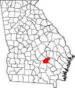
Jeff Davis County, Georgia Basics:


Jeff Davis County Georgia - Government Site

Population: 15,119
Area: 331 square miles
County seat: Hazlehurst
Area code(s) in use: 912
Time zone: EST
High school graduate or higher: 78.7%
Bachelor's degree or higher: 11.4%
Median household income: $35,203
Persons in poverty: 25.8%
Home ownership rate: 69.6%
Mean travel time to work: 23.1 minutes


Adjacent counties:
Appling  Bacon  Coffee  Montgomery  Telfair  Toombs  Wheeler  

Find in Georgia

Map of the Jeff Davis County area


Our detail map of Jeff Davis County shows the Jeff Davis County, Georgia boundary lines and other interesting items.

Places in Jeff Davis County, Georgia

  Airports     show all on map

Hazlehurst Airport

  Buildings     show all on map

Hazlehurst City Hall, Hazlehurst Fire Department Station 1, Hazlehurst Fire Department Station 2, Hazlehurst Police Department, Jeff Davis County Courthouse, Jeff Davis County Detention Center, Jeff Davis County Fire Department Station 2, Jeff Davis County Fire Department Station 3 Altamaha, Jeff Davis County Fire Department Station 4 Satilla, Jeff Davis County Fire Department Station 5 Snipesville, Jeff Davis County Sheriff's Office

  Cemeteries     show all on map

Bazemore Cemetery, Carter Cemetery, Ebenezer Cemetery, Harris and McDew Cemetery, Hester Cemetery, Hinson Cemetery, Hinson Cemetery, Lynn Cemetery, McEachin Cemetery, Palms Memorial Gardens, Rolland Cemetery, Simmons Cemetery, Wilcox andHall Cemetery, Williams Cemetery, Wilson Cemetery, Yawn Cemetery

  Census     show all on map

Satilla Census Designated Place

  Churches     show all on map

Barrel Head Church (historical), Bethany Church, Big Bethel Church, Bridgeford Church, Byrd Church, Carver Church, Ebenezer Church (historical), Elbethel Church, Elizabeth Baptist Church, Elizabeth Church, Elizabeth Church (historical), Eureka Church, First Baptist Church, Good Shepherd Church, Hallspur Church, Hearns Chapel (historical), Kingdom Hall Church, Kirkland Grove Church, Liberty Church, Morgan Chapel Baptist Church, Mount Zion Church, North Gate Baptist Church, Oak Grove Baptist Church, Oak Hill Church (historical), Oak Ridge Church (historical), Oakland Church, Oakview Church, Peoples Church, Philadelphia Church, Philadelphia Church, Piney Grove Church, Rocky Branch Church, Saint Matthews Church, Satilla Church, Snipesville Church, Stones Chapel, Thompsons Chapel (historical), Union Springs Church, Williams Chapel (historical)

  Crossings     show all on map

Ashleys Ferry (historical), Burketts Ferry (historical), Lumber City Ferry (historical), Manns Ferry (historical), Town Bluff Ferry (historical)

  Dams     show all on map

Cook Lake Dam, Cook Lake Dam North, Floyd Lake Dam, Miller Lake Dam, Okuinn Lake Dam, Okuinn Lake Dam, Sears Lake Dam

  Hospitals     show all on map

Jeff Davis Hospital

  Locales     show all on map

Haddock Landing, Haddocks Landing, Half Moon Landing, Halls Spur, Hard Bargain Landing, Hinsons Still (historical), Hinsons Still (historical), Jeff Davis Country Club, Johnsons Mill (historical), McEachins Woodyard Landing, Mims Mill (historical), Parish Still (historical), Red Bluff Landing, Rocky Hammock Landing, Round Bluff Landing, Skippers Landing, Town Bluff Landing, Warehouse Landing

  Parks     show all on map

Bullard Creek Wildlife Management Area

  Populated Places     show all on map

Bingham (historical), Brooker, Denton, Ellis (historical), Goldsmith (historical), Hazlehurst, Kirkland, Maysie (historical), Orico (historical), Paceville (historical), Quinn (historical), Roper, Satilla, Snipesville, Tallahassee

  Post Offices     show all on map

Hazlehurst Post Office

  Reservoirs     show all on map

Cook Lake, Cook Lake North, Floyd Lake, Miller Lake, Okuinn Lake, Okuinn Lake, Sears Lake

  Schools     show all on map

Barrel Head School (historical), Jeff Davis High School, Jeff Davis Junior High School, Jeff Davis School, Palmetto School (historical), Pine Forest School (historical), Snipes School (historical), Union Grove School (historical), Union School (historical)

  Streams     show all on map

Big Branch, Bullards Creek, Burket Creek, Currie Creek, Dale Branch, Fox Branch, Gully Creek, Little Satilla Creek, Long Branch, Mill Branch, Mill Branch, Moccasin Creek, Newton Creek, Old Field Branch, Rocky Branch, Town Creek, Whitehead Creek

  Towers     show all on map

Bullards Creek Lookout Tower, WVOH-AM (Hazelhurst), WVOH-FM (Hazlehurst),

Jeff Davis County, Georgia Population By Race (2012 estimate)

RacePopulation
WhiteJeff Davis County White population 12,48812,488  
BlackJeff Davis County Black population 2,2982,298
MixedJeff Davis County Mixed population 136136
American IndianJeff Davis County American Indian population 9190
Hawaiian & Pacific IslanderJeff Davis County Hawaiian & Pacific Islander population 00

Additional population tables :
State population table
Georgia population by county