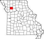
Caldwell County, Missouri Basics:


Caldwell County Missouri - Government Site

Population: 9,130
Area: 426 square miles
County seat: Kingston
Area code(s) in use: 816 660
Time zone: CST
High school graduate or higher: 87.1%
Bachelor's degree or higher: 14.4%
Median household income: $41,324
Persons in poverty: 14.9%
Home ownership rate: 73.2%
Mean travel time to work: 33.3 minutes


Adjacent counties:
Carroll  Clinton  Daviess  DeKalb  Livingston  Ray  

Find in Missouri

Map of the Caldwell County area


Our detail map of Caldwell County shows the Caldwell County, Missouri boundary lines and other interesting items.

Places in Caldwell County, Missouri

  Airports     show all on map

CCC Airport, Cliff Scott Airport, Mayes Homestead Airport, Wright Landing Field

  Bridges     show all on map

Gould Farm Bridge, Stoner Bridge

  Buildings     show all on map

Braymer Volunteer Fire Department, Breckenridge Fire Department, Breckenridge Volunteer Fire Department, Caldwell County Sheriff's Office, Cowgill Town and Country Fire Department, Hamilton Fire Department, Kidder - Altamont - Winston Volunteer Fire Protection District Kidder, Kingston Fire Department, Polo Police Department, Polo Volunteer Fire and Rescue Department

  Cemeteries     show all on map

Bowman Cemetery, Braymer Evergreen Cemetery, Brown Cemetery, Cameron Memorial Gardens, Cates Cemetery, Cowgill Cemetery, Dixon Cemetery, Dunkard Cemetery, Dustin Cemetery, Estes Cemetery, Guffey Cemetery, Highland Cemetery, Hill Cemetery, Hopewell Cemetery, Kenney Cemetery, Kidder Cemetery, Kingston Cemetery, Mayes Cemetery, McDaniel Cemetery, Mirabile Cemetery, Morris Cemetery, Paxton Cemetery, Prairie Ridge Cemetery, Rose Hill Cemetery, Sloan Cemetery, Wiley Cemetery, Zeikle Cemetery, Zimmerman Cemetery

  Churches     show all on map

Far West Church (historical), Grand View Church, Hopewell Church, Kendall Church, Log Creek Church, Nazarene Church, Unity Chapel (historical)

  Dams     show all on map

Bunker Hill Lake Dam, Byron Simpson Lake Dam, City of Breckenridge Dam, Clark Lake Dam, Creason Lake Dam, Hamilton City Water Plant Dam, Hicks Lake Dam, John Simpson Lake Dam, Kampen Lake Section 20 Dam, Mann Lake Dam, Martin Lake Section 4 Dam, Niehaus Brothers Lake Dam, Number 534 Dam, Pallas Lake Dam, Sieck Lake Dam, Simmons Lake Dam, Sloan Lake Dam, Timber Lake Dam

  Locales     show all on map

Fern Hill, Rock Ford

  Parks     show all on map

Bonanza State Wildlife Area, Tait Memorial Park

  Populated Places     show all on map

Barwick, Black Oak, Bonanza, Braymer, Breckenridge, Catawba, Cowgill, Easterville, Elk Grove, Far West, Friendship, Gould Farm, Hamilton, Hauns Mill, Kerr, Kidder, Kingston, Mirabile, Nettleton, New York, Polo, Prairie Ridge, Proctorville, Salem, Shantytown, Shoal, Tassa Grove

  Post Offices     show all on map

Elmont Post Office, Muddy Post Office

  Reservoirs     show all on map

Braymer Lake, Breckenridge Reservoir, Bunker Hill Lake, Byron Simpson Lake, Clark Lake, Creason Lake, Hamilton Reservoir, Hicks Lake, Mann Lake, Martin Lake Section 4, Number 167 Reservoir, Owens Lake, Pallas Lake, Penny Lake, Sieck Lake, Simmons Lake, Sloan Lake, Timber Lake

  Ridges     show all on map

Yankee Ridge

  Schools     show all on map

Advance School, Baker Hill School (historical), Barwick School (historical), Bethany School (historical), Bethel School, Black Oak School (historical), Bonanza School (historical), Braymer Elementary School, Braymer High School, Breckenridge Elementary School, Breckenridge High School, Brown Jug School (historical), Brush Hill School, Buffalo School (historical), Catawba School, Center Prairie School (historical), Center School (historical), Corner School (historical), Cottage Grove School (historical), Cottonwood School (historical), Cowgill Elementary School, Dillon School (historical), Dodge School, Eagle School, Easterville School (historical), Ed Johnson School, Elk Grove School (historical), Elm Grove School (historical), Eureka School (historical), Excelsior School, Excelsior School (historical), Fairview School, Far West School (historical), Frog Pond School, Goddard School, Granville School (historical), Hamilton Accelerated Elementary School, Hamilton Middle School, Harrison School (historical), Hazel View School, Hazel View School (historical), Houghton School (historical), Hunter School (historical), Independence School (historical), Jewell School, Kingston Elementary School, Kinney School (historical), Lafayette School (historical), Layton School, Liberty Bell School, Liberty Eagle School, Liberty School, Locust Grove School, Locust Grove School (historical), Log Creek School (historical), Lone Star School (historical), Lovely Ridge School (historical), Manson School (historical), Mill Creek School (historical), Mirabile Center School (historical), Mirabile Elementary School, Mound School (historical), Mount Pleasant School, Musser School, Neely School, New Houghton School (historical), New York Elementary School, North Victory School, Noyes School, Oak Grove School, Oakland School (historical), Owen School, Penney High School, Pickett School, Pleasant Grove School (historical), Pleasant Hill School, Pleasant Ridge School (historical), Plum Creek School (historical), Polo Elementary School, Polo High School, Prairie Gem School (historical), Prairie Ridge School (historical), Prairie Town School (historical), Proctorville School, Radical School (historical), Railroad School, Riggle School, South Victory School, Spring Hill School (historical), Spring Valley School (historical), Toben Valley School, Turkey Creek School, Van Note School, Victory School (historical), West Prairie School (historical), Wolf Grove School (historical), Wright School, Wyckoff School (historical), Yankee Ridge School (historical)

  Streams     show all on map

Brush Creek, Brushy Creek, Brushy Creek, Cottonwood Creek, Crabapple Creek, Dead Oak Branch, East Sheep Creek, Flat Creek, Goose Creek, Jim Creek, Jordan Branch, Little Otter Creek, Log Creek, Long Branch, Long Branch, Long Creek, Mill Creek, North Mud Creek, Otter Creek, Panther Creek, Plum Creek, Radical Creek, Sheep Creek, South Prong Crooked River, Spring Branch, Steer Creek, Stevenson Creek, Tom Creek, Tub Creek, Turkey Creek, West Sheep Creek, Willow Branch, Willow Creek

  Summits     show all on map

Needmore Hill,

Caldwell County, Missouri Population By Race (2012 estimate)

RacePopulation
WhiteCaldwell County White population 8,8568,856  
MixedCaldwell County Mixed population 155155
BlackCaldwell County Black population 5554
American IndianCaldwell County American Indian population 4645
AsianCaldwell County Asian population 1818
Hawaiian & Pacific IslanderCaldwell County Hawaiian & Pacific Islander population 00

Additional population tables :
State population table
Missouri population by county