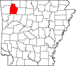
Madison County, Arkansas Basics:


Madison County Arkansas - Government Site

Population: 15,615
Area: 834 square miles
County seat: Huntsville
Area code(s) in use: 479
Time zone: CST
High school graduate or higher: 74.8%
Bachelor's degree or higher: 10.8%
Median household income: $33,481
Persons in poverty: 23.9%
Home ownership rate: 75.4%
Mean travel time to work: 30.2 minutes


Adjacent counties:
Benton  Carroll  Crawford  Franklin  Johnson  Newton  Washington  

Find in Arkansas

Map of the Madison County area


Our detail map of Madison County shows the Madison County, Arkansas boundary lines and other interesting items.

Places in Madison County, Arkansas

  Airports     show all on map

Huntsville Memorial Hospital Heliport, Huntsville Municipal Airport, Lollars Creek Farm Airport, Ozark Skies Airpark

  Buildings     show all on map

Bohannan Mount Volunteer Fire Department, Boston - Pettigrew Volunteer Fire Department, Clifty Volunteer Fire Station, Forum - Alabam Volunteer Fire Department Station 1, Forum - Alabam Volunteer Fire Department Station 2, Hindsville Volunteer Fire Department, Huntsville Fire Department, Huntsville Police Department, Japton Volunteer Fire Department, Kingston Fire Department, Madison County Emergency Medical Service, Madison County Sheriff's Office, Marble Fire Department, Saint Paul Fire Department, Smyrna Volunteer Fire Department, Wesley Volunteer Fire Department, Witter - Aurora Volunteer Fire Department

  Cemeteries     show all on map

Adkins Cemetery, Aurora Cemetery, Bell Cemetery, Bethel Cemetery, Boatrigth Cemetery, Bohannan Cemetery, Brashears Cemetery, Brashears Cemetery, Cannady Cemetery, Captain Smiths Cemetery, Carlock Cemetery, Carpenter Cemetery, Cherry Creek Cemetery, Combs Cemetery, Cove Cemetery, Cragar Cemetery, Denny Cemetery, Dripping Springs Cemetery, Dunaway Cemetery, Duncan Cemetery, Dutton Cemetery, Eagle Gap Cemetery, Farmer Cemetery, Fritts Cemetery, Greasy Creek Cemetery, Grose Cemetery, Hawkins Cemetery, Hawkins Cemetery, Henderson Creek Cemetery, Hickory Creek Cemetery, Horn Cemetery, Jackson Creek Cemetery, Johnson Cemetery, Jones Cemetery, Kilgore Cemetery, Kingston Cemetery, Ledbetter Cemetery, Liberty Cemetery, Loy Cemetery, Marshall Cemetery, Martin Cemetery, McBroom Cemetery, McClain Cemetery, Merl Cemetery, Mill Creek Cemetery, Mount Liberty Cemetery, Mount Olive Cemetery, Parker Cemetery, Parker-Boydston Cemetery, Pemberton Cemetery, Pine Grove Cemetery, Pinnacle Cemetery, Prater Cemetery, Ratford Cemetery, Reeves Cemetery, Riverside Cemetery, Rockhouse Cemetery, Scissom Cemetery, Stringum Cemetery, Upper Campground Cemetery, Vaughan Cemetery, Venus Cemetery, Wade Cemetery, Walnut Grove Cemetery, Watson Cemetery, Wesley Cemetery, Williams Cemetery, Williams Cemetery, Worley Cemetery

  Churches     show all on map

Assembly of God Church, Aurora Church, Big Sandy Church, Bohannan Community Church, Bohannan Mountain Church, Boston Chapel, Boston Church, Brannon Church, Church of Christ, Church of Christ, Cobb Creek Church, Colbaugh Church, Combs Church, Crosses Creek Church, Drakes Creek Church, Elizabeth Church, Hickory Grove Church, Jones Community Church, Langley Church, Lone Star Church, Lower Campground Church, Lower Smyrna Church, Lower Wharton Church, Montgomery Chapel, Mountain Grove Church, Mountain Springs Church, Mountain View Church, New Home Church, Oak Grove Mission, Ogden Church, Rock Church, Sharon Church, Upper Smyrna Church, Upper Wharton Church, Venus Church

  Cliffs     show all on map

Joe Salee Bluff

  Crossings     show all on map

Denny Ford, Parker Ford, Rocky Ford

  Dams     show all on map

City of Huntsville Lake Dam, Hindsville Lake Dam

  Gaps     show all on map

John White Gap, Kelly Gap, Kilgore Gap, Locust Gap, Mitchell Gap, Muddy Gap, Postoak Gap, Wheeler Gap

  Hospitals     show all on map

Boston Mountain Rural Health, Huntsville Memorial Hospital

  Lakes     show all on map

Dills Lakes

  Locales     show all on map

Noark Camp, Spoke Plant

  Parks     show all on map

McIlroy State Game Management Area, Withrow Springs State Park

  Populated Places     show all on map

Alabam, Asher, Aurora, Boston, Brannon, Brashears, Buckeye, Cannon Creek, Chaplin (historical), Clifty, Combs, Cross Roads, Crosses, Delaney, Drakes Creek, Dutton, Forum, Georgetown, Harmony, Hartwell, Health, Hindsville, Huntsville, Japton, Jordan (historical), Kingston, Loy, Mante (historical), Marble, Old Alabam, Patrick, Pettigrew, Purdy, Red Star, Reynolds, Rock, Rockhouse, Roxton, Saint Paul, Thompson, Thorney, Townsley (historical), Truth (historical), Venquin (historical), Venus, Weathers, Wesley, West Liberty, Wharton, Whitener, Witter

  Post Offices     show all on map

Combs Post Office, Forum Post Office, Pettigrew Post Office, Wesley Post Office

  Reservoirs     show all on map

City of Huntsville Lake, Hindsville Lake

  Ridges     show all on map

Horn Ridge, Nubbin Ridge, Ribbon Ridge, Russell Ridge, Sailor Ridge, Smith Ridge, Watson Ridge

  Schools     show all on map

Accident School (historical), Accident School (historical), Alabam School (historical), Ball Creek School (historical), Clear Creek School, Crosses Creek School (historical), Delaney Creek School (historical), Duncan School (historical), Enterprise School (historical), Fairview School (historical), Ferrel Creek School (historical), Good Hope School (historical), Good Luck School (historical), Greenwood School (historical), Huntsville High School, Huntsville Middle School, Kingston Elementary School, Kingston High School, Mountain Grove School (historical), Pinnacle School (historical), Plain View School (historical), Possum Creek School (historical), Saint Paul Elementary School, Saint Paul High School, Watson Intermediate School, Watson Primary School

  Springs     show all on map

Burchette Spring, Elm Spring, Withrow Springs

  Streams     show all on map

Abner Branch, Anderson Branch, Baldwin Creek, Ball Creek, Beech Hurricane Creek, Berry Branch, Big Clifty Creek, Big Onion Creek, Boatright Creek, Cannon Creek, Cave Creek, Cherry Creek, Clear Creek, Coon Branch, Coon Creek, Crosses Creek, Dabney Creek, Delaney Creek, Dog Branch, Drakes Creek, Dry Creek, Dry Fork, Dry Fork, East Fleming Creek, East Greasy Creek, East Prong White River, Felkins Creek, Ferrel Creek, Fleming Creek, Foster Creek, Fritts Creek, Glade Creek, Greasy Creek, Gregory Branch, Gusses Creek, Hartwell Creek, Henderson Creek, Hickory Creek, Hock Creek, Holman Creek, Houston Creek, Hughes Creek, Jackson Creek, Kecks Creek, Kilgore Branch, Lick Branch, Lollars Creek, Long Branch, Lumpkin Creek, Maxwell Creek, McConnell Branch, McHenry Branch, Mill Creek, Mink Creek, Mitchell Branch, Mitchell Branch, Mitchell Branch, Mossy Creek, Ogden Creek, Panther Creek, Panther Creek, Patrick Branch, Pigeon Creek, Pine Creek, Pine Creek, Pine Creek, Pollys Branch, Possum Creek, Reed Creek, Ritchey Branch, Rockhouse Creek, Seals Creek, Shooting Creek, Sinking Creek, Smyrna Branch, Snow Branch, Soda Cave Creek, Spanker Branch, Sugar Creek, Sweden Creek, Thomas Creek, Thorney Branch, Town Branch, Warm Fork, West Greasy Creek, Wharton Creek

  Summits     show all on map

Allard Mountain, Allen Knob, Anderson Knob, Arms Mountain, Baker Knob, Barker Knob, Big Sandy Mountain, Bluff Field Mountain, Bohannan Mountain, Boone Mountain, Boyd Mountain, Bradshaw Mountain, Bushart Mountain, Carlock Mountain, Chimney Rock Mountain, Cooper Mountain, Diera Mountain, Eubanks Mountain, Faulkner Mountain, Fly Gap Mountain, Garrett Mountain, Grose Mountain, Hall Mountain, High Davey Mountain, High Rock Mountain, Horine Mountain, Isaac Knob, Jackson Knob, Jones Mountain, Keck Knob, Keefer Mountain, Kenars Mountain, Lacy Mountain, Ledbetter Mountain, Logan Mountain, Mack Mountain, Mahaffey Knob, Massey Mountain, McArthur Mountain, McCullah Hill, Moore Mountain, Negro Mountain, Panther Knob, Parker Hill, Parker Mountain, Parson Hill, Penitentiary Mountain, Phelps Mountain, Phillips Mountain, Pinnacle Mountain, Polecat Mountain, Pool Knob, Potato Knob, Purdy Mountain, Reynolds Mountain, Round Mountain, Roundtop Mountain, Samuel Mountain, Sandstone Mountain, Slaven Mountain, Stacy Mountain, Standley Mountain, Sugar Tree Mountain, Swain Mountain, Tater Hill, Vandeventer Mountain, Vaughan Mountain, Venus Mountain, Whittmore Mountain, Yates Mountain

  Towers     show all on map

Boston Lookout Tower, Forum Lookout Tower, KFAY-FM (Huntsville), KFAY-FM (Huntsville)

  Valleys     show all on map

Adkins Hollow, Bear Hollow, Black Hollow, Canner Hollow, Carroll Anderson Hollow, Cedar Hollow, Clifty Hollow, Cockran Hollow, Colder Hollow, Cook Hollow, Cook Hollow, Cooper Hollow, Cove Hollow, Cowcumber Hollow, Davis Hollow, Dunaway Hollow, Elam Hollow, Elkins Hollow, Flat Rock Hollow, Granny Paddin Hollow, Greens Hollow, Hanney Hollow, Harlow Hollow, Hartwell Hollow, Hawkins Hollow, Hooper Hollow, Horn Hollow, Houston Hollow, Hoxey Hollow, Jackie Hollow, Jelico Hollow, Keck Hollow, Keg Hollow, Kettle Hollow, Kirk Hollow, Lake Hollow, Lick Hollow, Long Hollow, Lynch Hollow, Lynn Hollow, Mantie Hollow, Marksburg Hollow, Maxwell Hollow, McKnight Hollow, Moody Hollow, Morgan Hollow, Parsley Hollow, Patsy Hollow, Pemberton Hollow, Pennywinkle Hollow, Pour Off Hollow, Poyner Hollow, Rays Cove, Reeves Hollow, Reynolds Hollow, Ridley Hollow, Rocky Hollow, Rogers Hollow, Rowe Hollow, Sam Talen Hollow, Scotland Hollow, Skinner Hollow, Slow Tom Hollow, Smelley Hollow, Spoke Plant Hollow, Stone Jar Hollow, Stringum Hollow, Sugar Camp Hollow, Sugarcamp Hollow, Tarkiln Hollow, Tate Hollow, Turpentine Hollow, Tweedy Hollow, Walker Hollow, Walnut Hollow, Ward Hollow, Washy Hollow, Wetland Hollow, Whispering Hollow, Williams Hollow, Williams Hollow, Wist Hollow, Wolf Pen Hollow, Woods Hollow,

Madison County, Arkansas Population By Race (2012 estimate)

RacePopulation
WhiteMadison County White population 14,97514,974  
American IndianMadison County American Indian population 250249
MixedMadison County Mixed population 234234
AsianMadison County Asian population 9493
BlackMadison County Black population 6262
Hawaiian & Pacific IslanderMadison County Hawaiian & Pacific Islander population 1615

Additional population tables :
State population table
Arkansas population by county