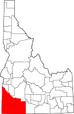
Owyhee County, Idaho Basics:


Owyhee County Idaho - Government Site

Population: 11,458
Area: 7666 square miles
County seat: Murphy
Area code(s) in use: 208
Time zone: MST
High school graduate or higher: 74.9%
Bachelor's degree or higher: 8.7%
Median household income: $33,626
Persons in poverty: 25.2%
Home ownership rate: 64.3%
Mean travel time to work: 26.5 minutes


Adjacent counties:
Ada  Canyon  Elko (NV)  Elmore  Humboldt (NV)  Malheur (OR)  Twin Falls  
Find in Idaho

Map of the Owyhee County area


Our detail map of Owyhee County shows the Owyhee County, Idaho boundary lines and other interesting items.

Places in Owyhee County, Idaho

  Airports     show all on map

Cliffs Landing Strip, Grasmere Airport, Homedale Municipal Airport, Murphy Airport, Murphy Hot Springs Airport, Owen Ranches Inc Airport, Riddle Airport, Sunrise Skypark, Triangle Airstrip, Young Landing Area

  Arches     show all on map

The Arch

  Areas     show all on map

Bighorn Country, Bruneau Duck Ponds, Bruneau Dunes, Columbet Table, Cranes Nest, Crows Nest, Squaw Gardens, The Monuments, Three Forks

  Arroyos     show all on map

Crows Nest Draw

  Basins     show all on map

Antelope Basin, Antelope Basin, Avondale Basin, Baxter Basin, Black Rock Pocket, Browns Basin, Browns Basin, Bull Basin, Bull Basin, Bull Basin, Bullhead Basin, Buncel Basin, Coal Mine Basin, Con Shea Basin, Cowboy Basin, Crab Creek Basin, D Bar Basin, Diamond Basin, Dishpan, Dove Spring, Dutch Oven, Frying Pan Basin, Henley Basin, Horse Basin, Juniper Basin, Kimbal Basin, Little Horse Basin, Little Jacks Creek Basin, Nickel Creek Pocket, Noble Basin, Piute Basin, Pixley Basin, Rattlesnake Basin, Red Basin, Reservation Basin, Sagebrush Basin, Sands Basin, Shares Basin, Sommercamp Basin, Spring Creek Basin, Striker Basin, Strode Basin, Texas Basin, Wagon Box Basin, Walcot Basin, White Cow Basin

  Bays     show all on map

Bruneau Arm, Nortons Bay

  Beaches     show all on map

Hot Springs Bench

  Bends     show all on map

Big Bend of Sheep Creek, Big Holes, Coyote Hole

  Bridges     show all on map

Guffey Railroad Bridge, Indian Cove Bridge, Loveridge Bridge, Twin Bridges

  Buildings     show all on map

Bruneau Fire Department, Grand View Ambulance Service, Grand View Fire Department, Homedale Fire Department, Homedale Police Department, Marsing Ambulance Service, Marsing Rural Fire District, Murphy - Reynolds - Wilson Fire Protection District, Owyhee County Sheriff's Office, Silver City Fire and Rescue Station, Wilson Community Hall

  Canals     show all on map

A Line Canal, B Line Canal, Beck Ditch (historical), Beeroth Canal, Benham Canal, Bernard Ditch, Bieroth Canal, Buckaroo Ditch, C Line Canal, Coates Drain, Cowan Ditch, East Valley Mound Wasteway, Five and Seventenths Canal, Gem District D Canal, Grand View Irrigation District Canal, Horstman Drain, Hot Spring Canal, McDowell Lateral, Murphy Drain, Murphy Mutual Canal, Murray Ditch, Opalene Ditch, Patch Canal, Patch Canal, Shoofly Canal, South Canal, South Side Canal, Sugar Valley Wash, Town Ditch, West Branch Sage Creek Drain

  Capes     show all on map

Crappie Point, Dukes, Harvey Point, Hill Pasture Point, J-P Point, Little Point, Lookout Point, Pleasant Valley V, Saddle Point, Wickahoney Point, Willies Point

  Cemeteries     show all on map

Hot Springs Cemetery, Jacob Reuben Graves, Marsing-Homedale Cemetery, Miller Creek Cemetery, O X Cemetery, Pioneer Cemetery, Pleasant Valley Cemetery, Stone Cemetery, Wilson Cemetery

  Census     show all on map

Murphy Census Designated Place

  Channels     show all on map

Narrows

  Cliffs     show all on map

Bear Creek Point, Black Rock, Black Rocks, Castle Rock, City of Rocks, Coal Bank, Murphy Rim, Tent Creek Point, Wilson Bluff, Windy Point, Windy Point

  Craters     show all on map

Crater Hole

  Crossings     show all on map

Bengeochea Crossing, Big Bend Crossing, Black Rock Crossing, Bull Creek Crossing, Cat Creek Crossing, Crawfish Crossing, Deadhorse Crossing, Duncan Creek Crossing, Lower Black Butte Crossing, Marshall Butte Crossing, Old Bend Crossing, Post Office Crossing, Salls Crossing, Savage Crossing, Smith Crossing, Three Mile Crossing, Wickahoney Crossing

  Dams     show all on map

Alder Dam, Big Blue Creek Dam, Billings Dam, Brace Dam, Brown Dam, Brown Dam, Buckaroo Dam, Burton Dam, Bybee Dam, C J Strike Dam, Delamar Tailings Dam, Diamond A Dam, Foland Dam, Foreman Dam, Four Corners Dam, Grasmere Dam, Hagberry Dam, Hardesty-Cherry Creek Dam, Hardisty and Wilson Dam, Harris Dam, Hulet Dam, Josephine Creek Dam, Juniper Creek Dam, King Dam, Little Blue Creek Dam, Lone Tree Dam, Louisa Creek Dam, Mountain View Dam, Nettleton Dam, Nougue Dam, Pacific Land Company Dam, Paine Creek Dam, Pershall Dam, Pot Hole Creek Dam, Rattlesnake Creek Dam, Rock Creek Dam, Scrappy Creek Dam, Shoofly Dam, Slack Dam, Snow Creek Dam, Sommerville Dam, Spencer Dam, Squaw Creek Dam, Strickland Dam, Texas Basin Dam, Tindall Dam, Turner Butte Dam, Tyson Dam, Upper Duncan Creek Dam

  Falls     show all on map

Camel Falls, Jump Creek Falls, The Falls

  Flats     show all on map

Aikers Field, Antelope Flat, Beaver Flat, Ben Mills Flat, Bernards Bedground, Big Flat, Brace Flat, Broken Wagon Flat, Buck Flat, Buck Pasture, Bull Lake, Bull Meadow, Burnam Flat, Chicken Flat, China Flat, Chipmunk Meadow, Clover Flat, Cow Meadow, Coyote Flat, Crows Nest, Crows Nest Flat, Doe Flat, Fork Meadow, Gertrudes Meadow, Grassy Flat, Halogeton Flat, Hawes Pasture, Hill Pasture, Horse Flat, Indian Hay Meadows, Indian Meadows, Jacks Creek Meadows, Jarvis Pasture, Joiner Flat, Krutschmer Field, Linehan Flat, Manada Flat, Moss Flat, Mud Flat, Mud Flat, Mud Flat, Mud Flats, Murphy Flat, Nichol Flat, North Sinker Flat, Nugent Meadows, Oregon Lake, Peer Field, Rentile Field, Rock Flat, Ryan Pasture, Rye Patch, Smith Meadow, Sommercamp Flat (historical), Squaw Flat, Squaw Meadows, SS Field, State Line Meadows, State Line Meadows, Stauffer Flat, Summit Flat, Summit Flat, Summit Flat, Thomas Flats, Three Forks Meadow, Tobacco Meadow, Toy Flat, Triangle Flat, Turk Meadow, Twentymile Flat, Wagner Field, Wids Meadow, Wilson Pasture, Wilson Pasture

  Gaps     show all on map

Big Horse Basin Gap, Half Moon Pass, Hyde Saddle, Little Half Moon Pass, Little Horse Basin Gap, Pickett Creek Saddle, The Saddle, Toy Pass

  Islands     show all on map

Argy Island, Bayha Island, Becky Island, Blacks Island (historical), Cottontail Island, Edgington Island (historical), Gold Isle, Heltons Island, Hermit Island, Loveridge Island (historical), Popike Island, Rippee Island, Walters Island, Wilkins Island, Wright Island

  Lakes     show all on map

Barinaga Lake, Battle Creek Lakes, Big Lake, Big Lake, Big Lakes, Burnt Lake, Catholic Lake, CCC Rock Pond, Cedar Tree Trail Lakes, Cottle Lake, Cove Arm Lake, Crane Falls Lake, Crater Lake, Crawfish Spring, Dry Lake, Dunes Lake, Fivemile Lake, Flat Draw Reservoir, Freeland Watering, Harris Lake, Harris Lake, Henry Lake, Hewitt Watering, Hole in Rock Lake, Horse Lake, Idaho Lake, Indian Lake, Inside Lakes, James Lake, Jim Bob Reservoir, Johnston Lakes, Jordan Creek, Juniper Basin Reservoir, Juniper Lake, Juniper Lake, Lake Pit Reservoir, Leo Waterhole, Little Jarvis Lake, Long Lake, Long Pull Reservoir, Monument Lake, Mosquito Lake Reservoir, O X Lake, Paws Water, Poison Creek Reservoir, Poison Creek Reservoir, Post Office Reservoir, Rattlesnake Draw Reservoir, Rock Lake, Rocky Lake, Ross Lake, Ross Lake, Rough Lake, Sailor Creek Lake, Salvador Lake, Scarborough Waterhole, Sheep Creek Pond, Thomas Lakes, Tindall Water Hole Two, Triguero Lake, Twin Lakes, Twin Lakes, Twin Lakes, Upper Twin Lakes, Valley Waterhole, White Lake, Wilson Lake

  Locales     show all on map

45 Ranch, 45 Windmill, Al Sadie Ranch, Albert Taylor Place, Arendt Homestead, Bacon Rind Gate, Barber Cabin, Battle Creek Ranch, Bengoechea Cabin, Big Springs Ranch, Blackstone Ranch, Blue Creek Crossing, Bonus Cove Ranch, Boy Scout Camp (historical), Brace Ranch, Bruneau Guard Station, Buck Camp, Buckhorn, Buckhorn Corrals, Bull Basin Camp, Bush Ranch, C Ranch, Castangetta Halfway House, Castro Ranch, Clover Flat Ranch, Cottonwood Campground, Cove Recreation Site, Cowan Homestead, Craig Camp, Crutcher Crossing, Cumberland Mill, Dell Dick Windmill, Dougal Ranch, Emigrant Crossing (historical), Fairview, Flying H Ranch, Frank Triguero Homestead, Fred Hall Homestead, Gabica Ranch, Ghost Ranch, Gilmore Ranch, Goat Pens, Gordy Ranch, Hanley Cabin, Happy Home Place, Hart Ranch, Hodge Station (historical), Holman Cabin, Homer Bedal Homestead, Horse Trap, Indian Bathtub, Indian Batt Cabin, Indian Cove, Jacks Creek Crossing, Johnston Cabin, Johnstons Camp, Jones Ranch, Juniper Basin Ranch, Juniper Ranch, Juniper Station, Katies Desert Place, Larios Camp, Little Valley Compressor Station, Little Valley School, Lone Tree Ranch, Lower Battle Creek Crossing, Lowrey Ranch, Mahannah Cabin, Middle Windmill, Mill, Monasterio Ranch, Montini Ranch, Morrow Ranch, Otter Massacre Site, Parker Place, Parker Ranch, Payne Cabin, Piute Basin Camp, Poison Creek Stage Station, Portlock Ranch, Post Camp, Priest Ranch, Ratliff Place, Red Cabin, Roy Johnson Ranch (historical), Ruby City, Rutherford Ranch, Sego Place, Share (historical), Shoofly Ranch, Snow Cabin, Sommercamp, Spencer Camp, Spring Ranch, Squaw Camp, Stanley Cabin, Star Ranch, Star Valley Ranch, State Line Camp, Stateline Windmill, Stone Corral, Tate Place, The Garden, The Pete, The Rocks, The Trap, The Windmill, Three Forks, Tindall Ranch, Tindall Ranch, Tokembamy Ranch, Twenty-Two Bar Desert Place, Twin Springs Ranch, Upper Battle Creek Crossing, Wagontown, Warm Springs Ferry, White Homestead, Whites House (historical), Whitson Ranch, Wild Horse Spring Ruins, Wiley Ranch, Windmill Number 1, Windmill Number 2, Windmill Number 3, Winter Camp, Winter Spring Picnic Area

  Military     show all on map

Camp Three Forks (historical), Juniper Butte Annex Range, Saylor Creek Range

  Mines     show all on map

Afterthought Mine, Alta Mine, Amie Number One, Amie Number Two, Banner Mine, Bergh Mine, Black Jack Mine, Bluebird Mine, Bluejacket Mine, Brunzell Mine, Cape Horn Mine, Chatauqua Mine (historical), Crescent Mine, Daisy Mine, De Lamar Mine, Dewey Mine, Doughboy Mine, Erdman Mine, Garfield Mine, Glen Silver Pit Number 1, Glen Silver Pit Number 2, Golconda Mine, Golden Crown Mine, Golden Cycle Mine, Henrietta Mine, Hornet Mine, Humboldt Mine, Ida Belle Mine, Idaho Mine, Jefferson Mine, Laxey Mine, Lobe Mine, Matteson Mine, Monarca Mine, Morning Star Mine, Nellie Ann Mine, North De Lamar Pit, Ohio Mine (historical), Oro Fino Mine, Perseverance Mine, Placer Mine, Poorman Mine, Rising Star Mine, Silver City Mine, Silver Queen Mine, Silver Rock Mine, Silver Vault Mine (historical), Sommercamp Mine (historical), Sommercamp Pit, Sonneman Mine, Standard Mine, Summit Mine, Texas Mine, The Post Mine, Tip Top Mine, Trade Dollar Mine, Treasure Vault Mine, Venus Mine, Voscha Mine (historical), Wahl Mine (historical)

  Parks     show all on map

Bruneau Dunes State Park, Locust Park, Snake River Bird of Prey Natural Area, Snake River Birds of Prey Area

  Pillars     show all on map

Crane Rock

  Plains     show all on map

Blackstone Desert, Bruneau Desert, Diamond A Desert, Inside Desert, J-P Desert, Y P Desert

  Populated Places     show all on map

Bengoechea Place, Bruneau, Buncel Place, Carothers Place (historical), China Hat, Claytonia, Cliffs, Collier Place, Comical Turn, Cottonwood (historical), Crill Place, Dans Place, De Lamar, Democrat, Dew Drop Place, Dewey, Dickens Place, Dickshooter, Doyle Place, Dry Forty, Empire City (historical), Fairylawn, Flint, Four Corners, Frost Place, Givens Hot Springs, Grand View, Grasmere, Guffey, Harvey Place, Homedale, Hot Springs, James Place, Little Sugar Loaf, Marsing, Miller Creek Settlement, Morgan Place, Murphy, Murphy Hot Springs, Oreana, Owyhee Heights, Petersons Crossing, Pleasant Valley Place, Reynolds, Rickard Crossing, Riddle, Rockville, Sands (historical), Silver City, Sinker (historical), Slacks Corner, South Mountain, Spiry Place, Telegraph Hill, Three Creek, Tindall (historical), Triangle, Wickahoney, Wilson

  Post Offices     show all on map

De Lamar Post Office (historical)

  Ranges     show all on map

Grassy Hills, Owyhee Mountains, Sheep Hills, Silver City Range

  Reserves     show all on map

Claytonia Pond Wildlife Habitat Area, Indian Cove Wildlife Habitat Area

  Reservoirs     show all on map

Aikers Reservoir, Anderson Reservoir, Antelope Flat Reservoir, Antelope Reservoir, Arrow Point Reservoir, Avery Reservoir, Badger Reservoir, Bald Mountain Reservoir, Beck Reservoir, Bennett Reservoir, Bert Monday Reservoir, Big Bend Reservoir, Big Blue Creek Reservoir, Big Pass Reservoir, Big Sagehen Reservoir, Billings Reservoir, Bitterbrush Reservoir, Black Canyon Reservoir, Black Leg Reservoir, Blackstone Reservoir, Blue Creek Reservoir, Bower Reservoir, Boyle Creek Reservoir, Brace Reservoir, Breakdown Reservoir, Broken Wagon Flat Reservoir, Brush Corral Reservoir Number Two, Buckhorn Reservoir, Bull Camp Reservoir, Bull Creek Reservoir, Bull Frame Reservoirs, Bullhead Reservoir, Buncel Reservoir, Burkhart Reservoir, Burts Reservoir, Butch Reservoir, Bybee Reservoir, C J Strike Reservoir, Canter Spring Reservoir, Center Lambert Reservoir, Chimney Pot Reservoir, Cinnabar Reservoir, Clay Bottom Reservoir, Cleveland Reservoir, Correction Reservoir, Cottonwood Trail Pond, Cowan Reservoir, Coyote Flat Reservoir, Coyote Hole Reservoir, Crows Nest Lake, D Bar Reservoir, Daves Reservoir, Dead Tree Reservoir, Dickshooter Reservoir, Dougal Reservoir, Dry Canyon Reservoir, Dry Creek Reservoir, Dry Creek Reservoir, Dry Creek Reservoir Number Eight, Dry Creek Reservoir Number Eleven, Dry Creek Reservoir Number Five, Dry Creek Reservoir Number Four, Dry Creek Reservoir Number Nine, Dry Creek Reservoir Number Seven, Dry Creek Reservoir Number Six, Dry Creek Reservoir Number Ten, Dry Creek Reservoir Number Three, Dry Creek Reservoir Number Two, Dryden Reservoir, Duncan Creek Reservoir, East Goose Creek Pond, East Horse Basin Reservoir, Eds Defeat Reservoir, Elk Reservoir, Felix Reservoir, Flat Top Reservoir, Foremans Reservoir, Forster Reservoir, Four Corners Reservoir, Grasmere Reservoir, Grassy Hills Reservoir, Grassy Hills Reservoir Number Three, Grassy Hills Reservoir Number Two, Hackberry Reservoir, Harris Creek Reservoir, Harveys Canyon Reservoir, Harveys V Reservoir, Hinton Reservoir, Homer Wells Reservoir, Horse Butte Storage Tank, Horseshoe Reservoir, Hulet-Sinker Creek Reservoir, Indian Battleground Reservoir, Indian Creek Reservoir, Inside Reservoir, Jacks Creek Reservoir, Jackson Reservoir, Jarvis Pasture Reservoir Number One, Jarvis Pasture Reservoir Number Three, Jarvis Pasture Reservoir Number Two, Jims Reservoir, Joes Folly Reservoir, John G Reservoir, Johnson Reservoir, Juniper Basin Reservoir, Jus Reservoir, Kecks Reservoir, Kimball Basin Reservoir, Kincaid Reservoir, Lahtinen Spring Reservoir, Last Chance Reservoir, Little Blue Creek Reservoir, Little Blue Table Reservoir, Little Grassy Reservoir, Little Horse Basin Reservoir, Little Juniper Basin Reservoir, Lower Antelope Reservoir, Lower Battle Creek Crossing Reservoir Number 1, Lower Nichol Flat Reservoir, McGregor Reservoir, Middle Bench Reservoir, Millin Reservoir, Monasterio-Jacks Creek Reservoir, Mountain View Lake, Mud Reservoir, Mud Springs Pond, Nickel Creek Reservoir, North Big Springs Reservoir, North Lambert Reservoir, North Lookout Reservoir, Otter Reservoir, Owens Reservoir, Packsaddle Reservoir, Payne Creek Reservoir, Petition Reservoir, Piute Basin Reservoir, Piute Creek Reservoir, Pole Creek Reservoir Number Five, Pole Creek Reservoir Number Four, Pole Creek Reservoir Number One, Pole Creek Reservoir Number Three, Pole Creek Reservoir Number Two, Porcupine Reservoir, Pot Hole Reservoir, Pothole Reservoir, Potter Reservoir, Rattlesnake Reservoir, Rays Reservoir, Rim Rock Reservoir, Rock Point Reservoir, Rodeo Lake Reservoir, Roger Smith Reservoir, Sams Pond, Sandy Reservoir, Seventy-One Draw Reservoir, Sewell Reservoir, Shea Reservoir, Shearing Corral Reservoir, Shirk Reservoir, Shoofly Reservoir, Slate Reservoir, Sorrel Reservoir, South Bench Reservoir, South Big Springs Reservoir, South Lambert Reservoir, Spencer Reservoir, Squaw Creek Reservoir, Squaw Meadows Reservoir Number One, Squaw Meadows Reservoir Number Three, Squaw Meadows Reservoir Number Two, Star Reservoir, State Line Reservoir, Stump Reservoir, Succor Creek Reservoir, Sundown Reservoir, SW Gate Gulch Reservoir, Table Reservoir, Tent Creek Reservoir, Texas Basin Reservoir, Timber Draw Reservoir, Tindall Reservoir, Triangle Reservoir, Turner Reservoir, Twin Lakes Reservoir, Twin Reservoirs, Twin Valley Reservoir, Two Mile Limit Reservoir, Upper Antelope Reservoir, Upper East Fork Shoofly Reservoir, Upper John G Reservoir, Upper Piute Creek Reservoir, Upper Rattlesnake Reservoir, Upper Slope Reservoir, Upper Walcot Basin Reservoir, Walcot Basin Reservoir, Warm Springs Reservoir, Weather Station Reservoir, West Horse Basin Reservoir, West Rim Reservoir Number 1, Whickney Tree Reservoir, Whitby Reservoir, White Horse Reservoir, White Rock Reservoir, Whites Reservoir, Wiley Reservoir, Wiley Reservoir, Willies Reservoir, Willow Creek Reservoir, Y P Reservoir Number 1, Y P Reservoir Number 33, Y Reservoir, Yatahoney Reservoir Number 1, Yatahoney Reservoir Number 2

  Ridges     show all on map

Antelope Ridge, Bedstead Ridge, Big Point, Big Ridge, Big Tree, Blue Ridge, China Point, Combination Ridge, Defeat Ridge, Dickshooter Ridge, Drollinger Ridge, Flatiron Ridge, Grassy Ridge, Henderson Point, Horse Race Ridge, Indian Ridge, Long Ridge, Mammoth Ridge, Peters Point, Potosi Ridge, Purser Ridge, Rose Ridge, Swisher Ridge, Twin Springs Ridge

  Schools     show all on map

Birch Creek School (historical), Bruneau Elementary School, Castle Creek School, Edson School, Grand View Elementary School, Homedale Elementary School, Homedale Junior-Senior High School, Marsing High School, Marsing Intermediate School, Marsing Primary School, Opalene School (historical), Oreana School (historical), Pleasant Valley Elementary - Junior High School, Rimrock Junior-Senior High School, Rimrock Junior-Senior High School, Three Creek Elementary School

  Slopes     show all on map

The Badlands

  Springs     show all on map

Ace Spring, Albert Spring, Alibi Spring, Alkali Spring, Alto Spring, Angleworm Spring, Antelope Spring, Antelope Spring, Antelope Spring, Antelope Spring, Antelope Spring, Antelope Spring, Antelope Spring, Arrow Spring, Avandale Spring, Babbington Spring Number 2, Bald Mountain Spring, Banks Spring, Bare Hill Spring, Barrel Spring, Basin Spring, Basque Spring, Bat Hot Spring (historical), Bat Spring, Battle Creek Crossing Waterhole Number 1, Battle Creek Crossing Waterhole Number 2, Beaver Creek Springs, Bedstead Spring, Between the Fields Spring, Big Boggy Spring, Big Springs, Big Springs, Big Willlow Spring, Bills Spring, Black Horse Spring, Blackstock Spring, Blue Clay Pit Spring, Boggy Spring, Boghole Spring, Boni Spring, Bottle Spring, Briar Spring, Brunzell Spring, Buck Gulch Spring, Buck Spring, Buckaroo Spring, Buckaroo Spring, Bucket Spring, Buckroo Spring, Buckskin Spring, Bull Basin Spring, Bull Spring, Bull Spring, C C C Spring, Camp Spring, Carter Spring, Castlehead Spring, Cat Spring, Cavannah Spring, Cavieta Spring, Ccc Spring, Charity Spring, Chicken Spring, Chimney Spring, Chokecherry Spring, Chubby Spring, Clover Spring, Coal Spring, Cold Spring, Cold Spring, Cold Springs, Conners Spring, Connors Spring, Corta Spring, Cottonwood Spring, Cougar Spring, Cougar Spring, Cow Spring, Coyote Pup Spring, Coyote Spring, Crab Spring, Craig Spring, Crest Spring, Crossroads Spring, Crows Nest Spring, Damon Springs, Dave Shea Spring, Davis Spring, De Lamar Spring, Dead Horse Spring, Dead Horse Spring, Deaf Joe Spring, Deep Creek Spring, Deer Water, Diamond Creek Spring, Dougal Waterhole, Dougherty Springs, Doyle Mountain Spring, Driscol Spring, Drollinger Spring, Dry Hole Spring, Dry Lake Spring, Dug Spring, Dukes V Spring, Duncan Creek Spring, Dutcher Spring, Eagle Spring, East Spring, Eds Spring, Evans Lick Spring, Falls Hot Springs, Fenwick Spring, Five Spring, Florence Spring, Frying Pan Spring, Frying Pan Spring, Gardner Spring, Giusti Spring, Goodman Gulch Spring, Goose Creek Spring, Gooseberry Spring, Grace Spring, Granite Spring, Granite Spring, Granite Springs, Grasshopper Spring, Griffith Spring, Half Moon Spring, Hardiman Spring, Hawks Nest Spring, Head of the Ditch Springs, Heifer Spring, Heifer Springs, Henderson Springs, Henley Spring, Hicks Springs, Higgins Spring, Hillside Spring, Holmes Spring, Homestead Spring, Horsehead Spring, Horsehead Spring, Hutch Springs, Ibex Spring, Idaho Spring, Indian Hot Springs, Indian Meadows Spring, Jackass Spring, Jean Heazle Spring, Jimmy Cappel Spring, Johnstone Spring, Juniper Spring, Juniper Spring, Kane Spring, Kettle Spring, Kiyi Spring, Last Chance Spring, Last Chance Spring, Lemonade Spring, Lineham Spring, Little Half Moon Spring, Little Jackass Spring, Little Kane Spring, Little Tigert Spring, Little Willow Spring, Lone Tree Spring, Lone Tree Spring, Lone Willow Spring, Long Tom Troughs, Long Valley Spring, Lost Valley Springs, Lower Birch Spring, Lower Flat Spring, Lower Hogpen Spring, Macks Creek Spring, Magic Hot Springs, Mahogany Spring, Marmaduke Spring, Martin Spring, Meadow Spring, Milk Spring, Minks Drink, Monahan Spring, Moonshine Spring, Moonshine Spring, Moorcastle Springs, Mounment Springs, Mud Flat Spring, Mud Spring, Mud Springs, Nichols Spring, Nickel Creek Spring, Noon Creek Spring, Otter Springs, Pack Hook Spring, Parker Spring, Pence Hot Spring, Peppermint Spring, Pinkston Spring, Poacher Spring, Point of Rocks Spring, Poison Gulch Spring, Portland Gulch Spring, Rabbit Springs, Rat Spring, Rattlesnake Spring, Rattlesnake Springs, Raymond Spring, Reservation Spring, Rim Spring, Rizzi Spring, Roan Spring, Roaring Spring, Rock Spring, Rock Spring, Rock Spring, Rock Spring, Rodeo Spring, Roll Inn Spring, Rose Briar Spring, Rose Creek Spring, Ross Spring, Ryegrass Spring, Ryegrass Spring, Saddlehorse Spring, Sage Hen Springs, Sagehen Spring, Sagehen Springs, Sam Noble Spring, Sand Spring, Scott Spring, Section Twentyseven Spring, Sheep Spring, Sheep Spring, Sheepherder Spring, Shoofly Springs, Skamfer Spring, Skull Spring, Slide Spring, Snow Creek Spring, Snowmaker Spring, Soda Spring, Sommercamp Spring, South Spring, Spring Ranch Spring, Squaw Spring, Squaw Spring, Stageroad Spring, Stanford Spring, Stanford Spring, Star Ranch Spring, State 40 Spring, Station Spring, Stoneman Creek Spring, Stoneman Spring, Stove Spring, Success Spring, Sullivan Spring, Summit Spring, Summit Spring Number One, Summit Spring Number Two, Summit Springs, Surprise Spring, Swamp Spring, Swisher Spring, T L Spring, Tandem Spring, Teacup Spring, Teakettle Spring, Teds Spring, Texas Basin Spring, The Potholes, Thistle Spring, Thomas Creek Spring, Thorne Spring, Three Forks Summit Springs, Three Springs, Tiddie Spring, Tigert Spring, Tony Springs, Toy Seep, Trail Spring, Triplet Spring, Trout Spring, Tub Spring, Turner Spring, Turner Spring, Twin Spring, Twin Springs, Twin Springs, Twin Springs, Twin Springs, Two Springs, Upper Birch Spring, Upper Hogpen Spring, Upper Lost Valley Spring, Upper Rats Nest Spring, Warm Springs, Watchabob Springs, Weaner Spring, West Spring, Whiteside Spring, Wild Horse Spring, Wildcat Spring, Wildhorse Spring, Wildhorse Springs, Willingger Spring, Willinicker Spring, Willow Spring, Willow Spring, Willow Spring, Willow Spring, Wilson Creek Spring, Windy Point Spring, Wonder Spring, Yarrow Spring

  Streams     show all on map

Alder Creek, Alder Creek, Alkali Creek, Anne Valley Creek, Axe Creek, Babbington Creek, Bates Creek, Battle Creek, Bear Creek, Beaver Creek, Bell Creek, Big Boulder Creek, Big Flat Creek, Big Jacks Creek, Big Sawmill Creek, Big Springs Creek, Billy Shaw Slough, Birch Creek, Black Leg Creek, Blue Creek, Bogus Creek, Boyle Creek, Briar Creek, Bridge Creek, Bridge Creek, Browns Creek, Browns Creek, Browns Creek, Bruneau River, Brush Creek, Buck Creek, Buck Creek, Buck Creek, Buckaroo Creek, Bull Basin Creek, Bull Creek, Bull Frame Creek, Cabin Creek, Camas Creek, Camas Slough, Camel Creek, Carter Creek, Castle Creek, Castle Creek, Cat Creek, Cat Creek, Catherine Creek, Cave Creek, Cherry Creek, Chicken Creek, Chimney Creek, China Creek, China Creek, Cloudburst Wash, Clover Creek, Clover Creek, Cold Spring Creek, Columbet Creek, Combination Creek, Corral Creek, Corral Creek, Corral Creek, Cosmopolitan Creek, Cottle Creek, Cottonwood Creek, Cottonwood Creek, Cottonwood Creek, Cottonwood Creek, Cottonwood Creek, Cottonwood Creek, Cottonwood Creek, Cougar Creek, Cougar Creek, Cow Creek, Cow Creek, Cow Valley Creek, Cowboy Creek, Coyote Creek, Coyote Creek, Crab Creek, Crane Creek, Crooked Creek, Crows Nest Creek, Cunningham Creek, Current Creek, Damon Trail Creek, Dead Horse Creek, Deadwood Creek, Deep Creek, Deep Creek, Deer Creek, Deer Creek, Diamond Creek, Dickshooter Creek, Ditch Creek, Dobson Creek, Dons Creek, Dorsey Creek, Dougherty Creek, Dry Creek, Dry Creek, Dry Creek, Dryden Creek, Duck Creek, Dukes Creek, Duncan Creek, Dutcher Creek, East Creek, East Fork Bull Creek, East Fork Devil Creek, East Fork Goose Creek, East Fork Jarbidge River, East Fork Pixley Creek, East Fork Pleasant Valley Creek, East Fork Reynolds Creek, East Fork Shoofly Creek, East Fork Sinker Creek, East Fork Squaw Creek, East Fork Trout Creek, Fall Creek, Farrot Creek, Field Creek, Figure Four Creek, Flat Creek, Flint Creek, Fossil Creek, French Creek, Garbutt Wash, Garten Creek, Gerdie Creek, Gilmore Creek, Goose Creek, Granite Creek, Grave Creek, Gray Eagle Creek, Hardtrigger Creek, Harris Creek, Hart Creek, Hayes Creek, Heifer Springs Creek, Helen Creek, Hells Creek, Hidden Valley Creek, Horse Creek, Horse Ranch Creek, Horse Thief Creek, Hot Creek, Howl Creek, Hurry Back Creek, Hurry Up Creek, Indian Creek, Indian Creek, Iron Mine Creek, Jackass Creek, Jacks Creek, Jacks Creek, Jackson Creek, Jarbidge River, Jensen Wash, Jenson Drain, Jobe Creek, Josephine Creek, Jump Creek, Juniper Creek, Juniper Creek, Juniper Creek, Lightning Creek, Lightning Creek, Little Alder Creek, Little Blue Creek, Little Browns Creek, Little Cottonwood Creek, Little Cow Creek, Little Hardtrigger Creek, Little Hart Creek, Little Jacks Creek, Little Jackson Creek, Little McBride Creek, Little Owyhee River, Little Poison Creek, Little Sawmill Creek, Little Smith Creek, Little Spring Creek, Little Squaw Creek, Little Succor Creek, Little Thomas Creek, Lone Juniper Creek, Lone Tree Creek, Long Meadow Creek, Long Tom Creek, Louisa Creek, Louse Creek, Louse Creek, Lunch Creek, Macks Creek, Magpie Creek, Mammoth Creek, Marys Creek, McKeeth Wash, Meadow Creek, Meadow Creek, Middle Fork Devil Creek, Middle Fork Hardtrigger Creek, Mill Creek, Miller Creek, Miller Water, Minear Creek, Moonshine Creek, Moorcastle Creek, Moores Creek, Mud Creek, Murphy Creek, Nanny Creek, Nickel Creek, Nip and Tuck Creek, Nit Creek, Noon Creek, North Boulder Creek, North Fork Castle Creek, North Fork Macks Creek, North Fork Sinker Creek, O X Prong, Old Man Creek, Otter Creek, Owl Creek, Parkins Drain, Payne Creek, Peach Creek, Pedracini Fork, Petes Creek, Pickett Creek, Pig Creek, Piute Creek, Pixley Creek, Pleasant Valley Creek, Pleasant Valley Creek, Poison Creek, Poison Creek, Poison Creek, Poison Creek, Pole Bridge Creek, Pole Creek, Pole Creek, Pole Creek, Pole Creek, Pole Creek, Pole Creek, Porcupine Creek, Posey Creek, Pot Hole Creek, Presby Creek, Rabbit Creek, Rail Creek, Rattlesnake Creek, Rattlesnake Creek, Rattlesnake Creek, Red Basin Creek, Reynolds Creek, Rock Creek, Rock Creek, Rose Creek, Ross Pasture Creek, Ross Pasture Creek, Ross Slough, Sage Creek, Sailor Creek, Salmon Creek, Salt Creek, Scorpion Creek, Scotch Bob Creek, Scott Creek, Sheep Creek, Sheep Creek, Sheep Creek, Shoofly Creek, Shoofly Creek, Sinker Creek, Skunk Creek, Slack Creek, Slacks Creek, Slaughterhouse Creek, Smith Creek, Snow Creek, Snow Creek, Snow Creek, Soda Creek, South Boulder Creek, South Fork Boyle Creek, South Fork Castle Creek, South Fork Diamond Creek, South Fork Macks Creek, South Fork Owyhee River, South Fork Pickett Creek, South Fork Rabbit Creek, South Fork Sinker Creek, South Mountain Creek, Spring Creek, Spring Creek, Spring Creek, Squaw Creek, Squaw Creek, Stonehouse Creek, Stoneman Creek, Succor Creek, Sugar Creek, Summit Springs Creek, Sunshine Valley Creek, Swisher Creek, Tent Creek, Thacker Slough, Thomas Creek, Three Creek, Tiddie Creek, Trap Creek, Triangle Creek, Trout Creek, West Creek, West Fork Buck Creek, West Fork Bull Creek, West Fork Devil Creek, West Fork Goose Creek, West Fork Reynolds Creek, West Fork Shoofly Creek, West Fork Sinker Creek, West Fork Squaw Creek, West Fork Trout Creek, West Spring Creek, Whiskey Creek, White Horse Creek, Wickahoney Creek, Wickiup Creek, Williams Creek, Willies Creek, Willow Fork, Wilson Creek, Wilson Creek, Wilson Creek, Yatahoney Creek

  Summits     show all on map

45 Hill, Ant Hill, Arch Table, Austin Butte, Avery Table, Bald Mountain, Bald Mountain, Bald Mountain, Bare Hill, Between the Creeks, Big Hill, Big Springs Butte, Black Butte, Black Butte, Black Butte, Black Butte, Black Mountain, Black Rock, Black Stone, Black Table, Black Warrior, Boni Table, Boone Peak, Buck Mountain, Bull Camp Butte, Bull Creek Point, Burnt Butte, Buster Butte, Captain Butte, Castle Butte, Castro Table, Catholic Butte, Cavaney Hill, Cavieta Hill, Chalk Hills, China Butte, Cinnabar Mountain, Clover Butte, Clover Mountain, Coonskin Butte, Crab Spring Butte, Crabb Butte, Crows Nest Butte, DeLamar Mountain, Dewey Peak, Dollar Butte, Dorsey Table, Doyle Mountain, Dryden Peak, Elephant Butte, Federal Butte, Flat Top Butte, Flatiron Butte, Flatiron Butte, Flattop Butte, Florida Mountain, Fossil Butte, French John Hill, Gedney Butte, Gerdie Hill, Getaway Mountain, Glass Hill, Graveyard Point, Guffey Butte, Hayden Peak, Hemingway Butte, Herds V, Horse Butte, Horse Hill, Horse Hill, Indian Butte, Jackass Butte, Jims Peak, June Grass Table, Juniper Butte, Juniper Mountain, Lambert Table, Lead Mountain, Little Blue Table, Little Grassy Hill, Long Butte, Lookout Butte, Lookout Butte, Marshall Butte, Middle Butte, Miller Water Table, Monument Butte, Mosquito Lake Butte, Mud Flat Hill, New York Summit, Nickel Creek Table, Notch Butte, Notch Butte, Otter Buttes, Pence Butte, Pence Butte, Piute Butte, Piute Butte, Pleasant Valley Table, Poison Butte, Poison Butte, Pot Hole Butte, Quicksilver Mountain, Rattlesnake Butte, Red Mountain, Rizzi Table, Rooster Comb Peak, Rough Mountain, Rough Mountain, Rough Mountain, Sailor Cap Butte, Salmon Butte, Sawpit Peak, Shares Snout, Sinker Butte, Sinker Creek Butte, Slack Mountain, Slacks Mountain, Soldier Cap, Sommer Camp Mountain, South Mountain, Spain Hill, Spencer Butte, Split Rock, Spring Butte, Squaw Butte, Star Ranch Table, Statue Hills, Stormy Hill, Sugar Loaf, Sugarloaf, Sugarloaf, Swisher Mountain, Table Butte, Table Rock, Tennessee Mountain, The Big Hill, The Buttes, The Dome, The Hat, The Island, The Tongue, The Tules, Tims Peak, Toy Mountain, Triplet Butte, Turner Butte, Turner Table, Turntable Mountain, Twin Butte, Twin Buttes, Twin Buttes, Twin Peaks, War Eagle Mountain, Whiskey Mountain, Whitehorse Butte, Wild Horse Butte, Wild Horse Table, Wilson Peak, Windy Point, Windy Point, Winter Camp Butte

  Swamps     show all on map

Donabahba Yogee

  Trails     show all on map

Batt Trail, Big I Grade, Cedar Tree Trail, Damon Trail, Forty-Four Trail, Grasshopper Trail, Oregon Trail - South Alternate, Parker Trail, Red Trail, Roberson Trail, Rough Trail, Ryegrass Trail, Tindall Trail, Triguero Trail, White Trail

  Tunnels     show all on map

Sinker Tunnel

  Valleys     show all on map

Aikers Draw, Alkali Draw, Anne Valley, Arch Canyon, Astor Gulch, Bald Mountain Canyon, Barnes Gulch, Berry Gulch, Big Draw, Big Lake Draw, Bill DeAlder Draw, Black Canyon, Black Leg Box Canyon, Blackrock Gulch, Blacksmith Gulch, Blue Gulch, Booneville Gulch, Box Canyon, Broken Wagon Draw, Browns Gulch, Bruneau Canyon, Bruneau Valley, Buck Flat Draw, Buck Gulch, Buck Gulch, Bull Gulch, Cave Draw, Cedar Draw, Cemetery Gulch, Chariot Gulch, Cherry Gulch, Chilly Gulch, China Gulch, Cloudburst Culch, Cloudburst Wash, Coffee Gulch, Coffee Gulch, Connors Canyon, Corral Gulch, Cottonwood Draw, Cougar Canyon, Cow Valley, Cow Valley, Cow Valley Canyon, Crowbar Gulch, Cumberland Gulch, Curtis Draw, Deadman Gulch, Deep Creek Canon, Dry Canyon, Dukes Hole, Eagle Cove, East Fork Bruneau Canyon, East Fork Red Canyon, Estes Draw, French Gulch, Freshwater Draw, Gamble Gulch, Gardner Gulch, Gertie Gulch, Glass Gulch, Goodman Gulch, Granite Spring Draw, Half Moon Gulch, Halfway Gulch, Halfway Gulch, Hamilton Gulch, Hard Up Gulch, Hays Canyon, Hays Canyon, Hidden Valley, Higgins Draw, Hinke Gulch, Hogpen Gulch, Holdup Canyon, Hole in the Ground, Hole Up Canyon, Indian Cove, Jackson Gulch, Jacobs Gulch, Jarbidge Canyon, Johnson Gulch, Johnston Draw, Jump Creek Canyon, Juniper Draw, Juniper Draw, Juniper Tree Draw, Kelly Park, Last Chance Gulch, Leviathan Gulch, Little Box Canyon, Little Valley, Long Draw, Long Draw, Long Draw, Long Gulch, Long Valley, Lost Valley, Loveridge Gulch, Lower Swale, Mahogany Gulch, Maws Gulch, Mine Gulch, Mud Flat Draw, Mule Creek Canyon, Nancy Gulch, Negro Gulch, Newsome Gulch, North Fork Peters Gulch, Norton Canyon, Old Man Canyon, Opalene Gulch, Oro Fino Gulch, Peters Gulch, Picnic Gulch, Pleasant Valley, Pleasant Valley, Poison Gulch, Portland Gulch, Pot Hole Canyon, Purjue Canyon, Rats Nest Gulch, Rattlesnake Canyon, Rattlesnake Draw, Red Canyon, Reservation Gulch, Rich Gulch, Riley Gulch, Rodeo Gulch, Sage Hen Gulch, Sage Hen Gulch, Sand Canyon, Sawpit Gulch, Schoolhouse Gulch, Seventy One Gulch, Seventy-One Draw, Sheep Trail Canyon, Sheepshead Draw, Shirttail Gulch, Silver Cord Gulch, Sinker Canyon, Slaughterhouse Gulch, Slaughterhouse Gulch, Split Rock Canyon, Star Valley, Stewart Gulch, Stiff Tree Draw, Stobie Gulch, Strickland Canyon, Striker Basin Gulch, Sugar Valley, Sullivan Gulch, Sunshine Valley, Tennessee Gulch, Timber Draw, Triplet Canyon, Triplet Canyon, Twentymile Gulch, Twilight Gulch, Upper Swale, Vinson Wash, Vulcan Gulch, Washington Gulch, Waterhouse Gulch, Waterspout Draw, Webfoot Gulch, West Fork Cougar Canyon, West Fork Red Canyon, West Spring Seep Gulch, Westgate Gulch, Whiskey Draw, Wildcat Canyon, Wildcat Canyon, Wilkins Gulch, Willies Canyon, Winchester Gulch, Wood Canyon, Wood Road Gulch, Zeno Canyon

  Wells     show all on map

Ant Hill Well, Battle Creek Well, Buck Flat Well, Cat Creek Well, Diamond Basin Well, Dishpan Well, Feeny Wells, Heil Well, Hole in Rock, Sailor Creek Well, Shirk Well, Three Creek Well, Whiterock Well,

Owyhee County, Idaho Population By Race (2012 estimate)

RacePopulation
WhiteOwyhee County White population 10,51810,518  
American IndianOwyhee County American Indian population 527527
MixedOwyhee County Mixed population 206206
AsianOwyhee County Asian population 9291
Hawaiian & Pacific IslanderOwyhee County Hawaiian & Pacific Islander population 2322

Additional population tables :
State population table
Idaho population by county