Clay County, Indiana Basics:


Clay County Indiana - Government Site

Population: 26,860
Area: 358 square miles
County seat: Brazil
Area code(s) in use: 812
Time zone: EST
High school graduate or higher: 87.2%
Bachelor's degree or higher: 13.2%
Median household income: $46,817
Persons in poverty: 14.3%
Home ownership rate: 78.3%
Mean travel time to work: 26.2 minutes

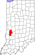
Adjacent counties:
Greene  Owen  Parke  Putnam  Sullivan  Vigo  

Find in Indiana

Map of the Clay County area


Our detail map of Clay County shows the Clay County, Indiana boundary lines and other interesting items.

Places in Clay County, Indiana

  Airports     show all on map

Booe Airport, Brazil Clay County Airport

  Bridges     show all on map

Feederdam Bridge, Neal Mill Bridge

  Buildings     show all on map

Air Evacuation Lifeteam 39, Bowling Green Volunteer Fire Department, Brazil City Fire Department, Brazil Fire Department, Center Point and Community Volunteer Fire Department, Clay City - Harrison Township Volunteer Fire Department, Clay County Search and Rescue, Cory Volunteer Fire Department, Dick Johnson Volunteer Fire Department, Jackson Township Volunteer Fire Department Brazil Station, Lewis Township Fire Company, Poland Community Volunteer Fire Department, Posey Township Clay County Volunteer Fire Department, Van Buren Volunteer Fire Department

  Canals     show all on map

Conneley Ditch, Lafferty Ditch, Lateral Number Four

  Cemeteries     show all on map

Archer Cemetery, Billtown Cemetery, Cagle Cemetery, Calcutta Cemetery, Carter Cemetery, Clearview Cemetery, Cole Cemetery, Cottage Hill Cemetery, Duncan Cemetery, Fairview Cemetery, Funk Cemetery, German Cemetery, Goshorn Memorial Park, Greenwell Cemetery, Gremes Cemetery, Harris Cemetery, Kealber Cemetery, Killion Cemetery, Liechty Cemetery, Maple Grove Cemetery, Maple Grove Cemetery, Moss Cemetery, Mount Calvary Cemetery, Neidlinger Cemetery, Nier Cemetery, Oak Grove Cemetery, Old Union Cemetery, Orchard Cemetery, Owens Cemetery, Pell Cemetery, Pell Cemetery, Perth Cemetery, Poff Cemetery, Poplar Cemetery, Redman Cemetery, Rhule Cemetery, Roberts Cemetery, Saint Marys Cemetery, Sampson Cemetery, Sanders Cemetery, Sink Cemetery, Sixmile Cemetery, Snoddy Cemetery, Stagg Cemetery, Stunkard Cemetery, Summit Lawn Cemetery, Wesley Chapel Cemetery, Wilkerson Cemetery, Wilson Cemetery, Zenor Cemetery, Zenor Cemetery, Zion Gummere Cemetery

  Census     show all on map

Coalmont Census Designated Place

  Churches     show all on map

Asbury Church, Berea Church, Bethel Church, Briley Chapel, Clay Prairie Church, Ebenezer Church, Fairview Church, Fatch Chapel, Friendly Grove Church, Hope Church, Little Flock Church, Maple Grove Church, Mount Carmel Church, Mount Lebanon Church, Mount Zion Church, New Wilson Church, North Union Church, Peniel Church, Pleasant Grove Church, Rock Run Church, Saint Johns Church, Sharon Church, Swalley Chapel, Union Chapel, Union Church, Wesley Chapel, Zion Church, Zion Church

  Dams     show all on map

Bowles Lake Dam, Izaak Walton Lake Dam, Lake in the Woods Dam, Risslers Lake Dam, Twin Beach Lake Dam, Water Works Lake Dam

  Flats     show all on map

Clay Prairie, Eel River Prairie, Wheeler Prairie

  Hospitals     show all on map

Saint Vincent Clay Hospital

  Lakes     show all on map

Dietz Lake, Muir Lake, Muir Lake

  Locales     show all on map

Wabash Camp Ground

  Mines     show all on map

Ashboro North Pit

  Parks     show all on map

Camp Na-Wa-Kwa, Hendrix Park, Shakamak State Park

  Populated Places     show all on map

Art, Ashboro, Asherville, Barrick Corner, Bee Ridge, Benwood, Billtown, Billville, Bogle Corner, Bowling Green, Brazil, Brunswick, Buchanan Corner, Calcutta, Carbon, Cardonia, Center Point, Clay City, Cloverland, Coalmont, Cory, Cottage Hill, Danville, Donaldsonville, Eel River, Harmony, Hoffman Crossing, Hoosierville, Howesville, Knightsville, Lap Corner, Mechanicsburg, Middlebury, New Brunswick, Old Hill, Perth, Poland, Pontiac, Prairie City, Purdy Hill, Roadman Corner, Saline City, Shady Lane, Six Points, Staunton, Stearleyville, Turner, Twin Beach, Wickville

  Post Offices     show all on map

Coffee Post Office (historical)

  Reservoirs     show all on map

Bowles Lake, Izaak Walton Lake, Lake in the Woods, Lake of the Woods, Risslers Lake, Tapawingo Lake, Twin Beach Lake, Water Works Lake

  Schools     show all on map

Bee Ridge School, Brazil High School, Brazil Junior High School, East Side Elementary School, Jackson School, Jackson Township Elementary School, Meridian Street Elementary School, Pinckey School, Staunton Elementary School, Staunton High School, Van Buren Elementary School, Van Buren High School

  Streams     show all on map

Ahlemeyer Branch, Aqua Creek, Ash Run, Bee Creek, Benwood Run, Bethel Run, Big Creek, Big Slough, Billy Creek, Birch Creek, Buck Creek, Cardonia Run, Clear Branch, Coal Run, Cottage Run, Dam Brook, Dick Run, East Brook, East Fork Birch Creek, Fairwood Drain, Gun Creek, Harm Run, Harmony Drain, Hog Creek, Johnson Run, Jordan Creek, Kid Run, Kilns Creek, Knob Creek, Landing Run, Little Birch Creek, Little Slough, McIntyre Creek, National Run, Orchard Run, Pell Brook, Peniel Run, Poff Brook, Prairie Creek, Purdy Run, Rio West Run, Roberts Brook, School Brook, Stunkard Run, Susan Brothers Creek, Tillman Creek, Turkey Creek, Van Buren Creek, Wesley Drain, White Oak Creek

  Summits     show all on map

Cromwell Hill, Drake Hill, Vinegar Hill

  Towers     show all on map

WBDJ-FM (Brazil), WWCM-AM (Brazil),

Clay County, Indiana Population By Race (2012 estimate)

RacePopulation
WhiteClay County White population 26,32326,322  
MixedClay County Mixed population 242241
BlackClay County Black population 134134
American IndianClay County American Indian population 8180
Hawaiian & Pacific IslanderClay County Hawaiian & Pacific Islander population 00

Additional population tables :
State population table
Indiana population by county