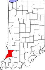
Knox County, Indiana Basics:


Knox County Indiana - Government Site

Population: 38,018
Area: 516 square miles
County seat: Vincennes
Area code(s) in use: 812
Time zone: CST
High school graduate or higher: 85.8%
Bachelor's degree or higher: 14.6%
Median household income: $41,089
Persons in poverty: 15.2%
Home ownership rate: 69.1%
Mean travel time to work: 19.6 minutes


Adjacent counties:
Crawford (IL)  Daviess  Gibson  Greene  Lawrence (IL)  Pike  Sullivan  Wabash (IL)  

Find in Indiana

Map of the Knox County area


Our detail map of Knox County shows the Knox County, Indiana boundary lines and other interesting items.

Places in Knox County, Indiana

  Airports     show all on map

Bandmill Field Airport, Ed-Air Airport, Eickholtz Airport, Godahavit Airport, Klein Airport, Marchino Field Airport, N'Meier Airport, Snider Field Airport, T & T Airport, Ueding Airport, Vincennes Executive Inn Airport

  Basins     show all on map

Cane Green Bottom

  Bends     show all on map

Horseshoe Cutoff, Sevenmile Bend

  Bridges     show all on map

Lincoln Memorial Bridge

  Buildings     show all on map

Bicknell Fire Department, Bicknell Vigo Township Fire Department, Bicknell Volunteer Fire Department, Don Holter and Son Ambulance, Edwardsport Volunteer Fire Department, Freelandville Volunteer Fire Department, Harrison Township Volunteer Fire Department, Johnson - Decker Township Volunteer Fire Department, Johnson Township Volunteer Fire Department, Johnson Township Volunteer Fire Department, Knox County Emergency Medical Services Bicknell, Knox County Emergency Medical Services Main Station, Oaktown Busseron Township Volunteer Fire Department, Palmyra Township Fire Department, Sandborn Volunteer Fire Department, Steen Township Volunteer Fire Department, Vigo Township Volunteer Fire Department, Vincennes Fire Department Station 1, Vincennes Fire Department Station 2, Vincennes Fire Department Station 3, Vincennes Fire Department Station 4, Vincennes Township Fire Department Station 10, Vincennes Township Fire Department Station 5, Vincennes Township Fire Department Station 6, Vincennes Township Fire Department Station 7 Headquarters, Washington Township Volunteer Fire Department Bruceville

  Canals     show all on map

Black Armuth Ditch, Brown Ditch, Calico Slash Ditch, City Ditch, Eke Drainage System Ditch, Frick Ditch, Friskney Ditch, Hill Ditch, Kessinger Ditch, Kuhn Ditch, Linnewebber Ditch, Lower Shaker Prairie Ditch, Mantle Ditch, Miller Ditch, Old Swan Pond Ditch, Oliphant Ditch, Patrick Ditch, Pickel Ditch, Purdy-Marsh Ditch, Roberson Ditch, Steen Ditch, Swan Pond Ditch, Thompson Ditch, Tilley Ditch, Vieke Drainage System Ditch, Williams Ditch, Wilson Ditch Arm Number Two

  Cemeteries     show all on map

Asher Cemetery, B'nai-Israel Cemetery, Beedell Cemetery, Begeman Cemetery, Chambers Cemetery, Charley Cemetery, Chimney Pier Hills Cemetery, Delay Cemetery, Dick Cemetery, Fairview Cemetery, Freeland Cemetery, Fritchton Cemetery, Greenlawn Cemetery, Hartley Cemetery, Highland Cemetery, Hoke Cemetery, Johnson Cemetery, Light Cemetery, McClure Cemetery, McCoy Cemetery, Memorial Park Cemetery, Meyer Cemetery, Mount Calvary Cemetery, Ocheltree Cemetery, Odd Fellows Cemetery, Odd Fellows Cemetery, Orndorff Cemetery, Orrville Cemetery, Price Cemetery, Root Cemetery, Saint Peters Cemetery, Sand Hill Cemetery, Sandborn Cemetery, Scott Chapel Cemetery, Slow Cemetery, Stuart Cemetery, Threlkeld Cemetery, Walker Cemetery, Walnut Grove Cemetery, Warth Cemetery, West Salem Cemetery

  Census     show all on map

Emison Census Designated Place, Freelandville Census Designated Place, Ragsdale Census Designated Place, Westphalia Census Designated Place

  Channels     show all on map

Johnsons Cutoff

  Churches     show all on map

Asbury Chapel, Bethel Church, Fairview Church, Hamline Chapel, Hermon Church, Indiana Church, Maria Creek Church, Morris Chapel, Mount Zion Church, New Bethel Church, Reels Chapel, Royal Oak Church, Salem Church, Trinity Church, Upper Indiana Church, Walnut Grove Church, Welton Chapel, Wilson Creek Church

  Cliffs     show all on map

Lucky Point, The Bluffs

  Dams     show all on map

Clarence Kopp Lake Dam, Cleveland Pond Dam, Rod and Gun Club Dam

  Flats     show all on map

Mills Prairie, Shaker Prairie, Vincennes Prairie

  Hospitals     show all on map

Good Samaritan Hospital

  Islands     show all on map

Sevenmile Island, Swan Island

  Lakes     show all on map

Broadie Lake, City Lake, Claypole Pond, Clear Pond, Grays Pond, Half Moon Pond, Horseshoe Pond, Long Pond, Long Pond, Maria Pond, Mine Pond, Mirror Lake, Montours Pond (historical), Swan Pond, Ten Acre Pond, Wabash Pond

  Levees     show all on map

Fore and Atkinson Levee, McGinnis Levee, Neal Levee, Niblack Levee

  Locales     show all on map

Bicknell Country Club, Fort Knox (historical), Griswold Station, Indian Mound, Storks Ferry, Wrights Ferry (historical)

  Mines     show all on map

Knox County Pit, Saint Thomas Pit

  Parks     show all on map

Camp Arthur, Chippekokee Park, George Rogers Clark National Historical Park, George Rogers Clark State Memorial, Gregg Park, Harrison Park, Hooper Athletic Field, Indiana Territorial Capitol, Kimmell Park, Lester Square Memorial Park, Vincennes Common, White Oak State Fishing Area

  Populated Places     show all on map

Bandmill, Beal, Bicknell, Bloods Wood Crossing, Bruceville, Busseron, Cantaloupe, Decker, Decker Chapel, Edwardsport, Emison, Five Points, Freelandville, Fritchton, Indian Creek Settlement, Iona, Johnstown, Little Rock, Monroe City, Oaktown, Orrville, Pond Creek Mills, Purcell, Ragsdale, Ridgleville, Saint Thomas, Sandborn, Sisson, Twin Bridges, Verne, Vincennes, Vollmer, Wagner Station, Westphalia, Wheatland, Willis

  Post Offices     show all on map

Jordanville Post Office (historical)

  Ranges     show all on map

Beech Hills, Chimney Pier Hills, Dicksburg Hills, Orrville Hills

  Rapidss     show all on map

Grand Rapids, Kellys Ripple

  Reservoirs     show all on map

Clarence Kopp Lake, Cleveland Pond, Nicholson Pond, Otter Pond, Rod and Gun Club Lake

  Ridges     show all on map

Cane Ridge

  Schools     show all on map

Benjamin Franklin Elementary School, Central High School, Decker Elementary School, Francis Vigo Elementary School, George Rogers Clark Junior High School, Harrison School, Hillcrest Special Education School, James Whitcomb Riley Elementary School, Lasalle Elementary School, Lincoln High School, North Knox Central Elementary School, North Knox East Elementary and Junior High School, North Knox High School, North Knox West Elementary School, Sacred Heart Schools, Saint Johns School, Saint Johns School, Saint Peters Lutheran School, Saint Rose Academy, Saint Thomas School, Saint Vincents Orphanage, School Number 3, South Knox Elementary School, South Knox Junior and Senior High School, Tecumseh-Harrison Elementary School, Vincennes University, Washington Elementary School

  Streams     show all on map

Bens Creek, Big Run, Black Creek, Brush Creek, Buckhorn Creek, Conger Creek, Cotton Branch, Flat Creek, Ghost Hollow Creek, Indian Creek, Indian Creek, Kelso Creek, McCoy Creek, Nimnicht Creek, Opossum Branch, Plass Ditch, Pond Creek, Reel Creek, River Deshee, Scott Creek, Smalls Creek, Snapp Creek, South Fork Smalls Creek, Upper River Deshee, White River, Wilson Creek

  Summits     show all on map

Barefoot Nation Hills, Bunker Hill, Scudder Hill, Wolf Hill

  Swamps     show all on map

Weaver Pond

  Towers     show all on map

WADV-AM (Vincennes), WRTB-FM (Vincennes), WUEV-FM (Evansville), WVUB-FM (Vincennes), WVUT-TV (Vincennes),

Knox County, Indiana Population By Race (2012 estimate)

RacePopulation
WhiteKnox County White population 36,19336,193  
BlackKnox County Black population 1,0651,064
MixedKnox County Mixed population 418418
AsianKnox County Asian population 228228
American IndianKnox County American Indian population 7676
Hawaiian & Pacific IslanderKnox County Hawaiian & Pacific Islander population 00

Additional population tables :
State population table
Indiana population by county