Martin County, Indiana Basics:


Martin County Indiana - Government Site

Population: 10,261
Area: 336 square miles
County seat: Shoals
Area code(s) in use: 812
Time zone: CST
High school graduate or higher: 82.2%
Bachelor's degree or higher: 11.2%
Median household income: $44,291
Persons in poverty: 13.2%
Home ownership rate: 82.9%
Mean travel time to work: 25.4 minutes

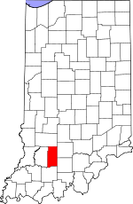
Adjacent counties:
Daviess  Dubois  Greene  Lawrence  Orange  

Find in Indiana

Map of the Martin County area


Our detail map of Martin County shows the Martin County, Indiana boundary lines and other interesting items.

Places in Martin County, Indiana

  Bends     show all on map

Devils Elbow, Heathen Bend, Henshaw Bend, Norman Rock Bend

  Bridges     show all on map

Brooks Bridge, Butler Bridge, Houghton Bridge

  Buildings     show all on map

Loogootee Fire Department, Loogootee Volunteer Fire Department, Lost River Volunteer Fire Department, Martin County Civil Defense and Fire Department, Naval Surface Warfare Center Crane Division Fire Department, Shoals Volunteer Fire Department

  Cemeteries     show all on map

Acre Cemetery, Anderson Cemetery, Baxter Cemetery, Blankenship Cemetery, Boggs Creek Cemetery, Bridges Cemetery, Bridges Cemetery, Brock Cemetery, Brook Cemetery, Carr Cemetery, Chandler Cemetery, Clarke Cemetery, Cornel Cemetery, Dogtrot Cemetery, Elliott Cemetery, Emmons Ridge Cemetery, Goodwill Cemetery, Green Cemetery, Hall Cemetery, Hawkins Cemetery, Henry Cemetery, Holt Cemetery, Holtsglaw Cemetery, Houghton Cemetery, Jackson Cemetery, Jones Cemetery, Ledgerwood Cemetery, Little Hickory Ridge Cemetery, Love Cemetery, McBrides Cemetery, Mountain Spring Cemetery, Pleasant Grove Cemetery, Rector Cemetery, Roberts Cemetery, Saint Johns Cemetery, Saint Joseph Cemetery, Salem Cemetery, Sholts Cemetery, Simmons Cemetery, Union Cemetery, Uno-Paton Cemetery, Waggoner Cemetery, Wagner Cemetery, Walker Cemetery, Wards Cemetery, West Union Cemetery, Williams Cemetery, Woods Cemetery

  Census     show all on map

Burns City Census Designated Place, Dover Hill Census Designated Place

  Churches     show all on map

Fairview Church, Friendship Church, Hindostan Church, Inman Church, Mount Calvary Church, Mount Union Church, Mount Zion Church, Poplar Grove Church, Powell Valley Church, Saint Josephs Church, South Martin Church, Truelove Church, Waggoner Chapel, Weisbach Church

  Cliffs     show all on map

Cedar Bluff, McBrides Bluff, Old Mans Nose

  Dams     show all on map

Baver Lake Dam, Greenwood Lake Dam, Soil and Water Conservancy District Dam, West Boggs Creek Dam

  Falls     show all on map

Hindostan Falls

  Forests     show all on map

Martin County State Forest, Martin State Forest

  Gaps     show all on map

Peek Cut

  Military     show all on map

Naval Surface Warfare Center Crane

  Mines     show all on map

Shoals Mine

  Parks     show all on map

Hindostan Falls Public Fishing Area, West Boggs Park

  Pillars     show all on map

Pinnacle Rock

  Populated Places     show all on map

Bramble, Burns City, Cale, Crane, Dover Hill, Hindostan Falls, Indian Springs, Ironton, Lacy, Loogootee, Mount Olive, Mount Pleasant, Natchez, Pleasant Valley, Rusk, Scenic Hill, Shoals, Shoals Overlook, South Martin, Whitfield, Willow Valley, Windom, Yenne

  Post Offices     show all on map

Dye Post Office (historical), Mountain Spring Post Office (historical)

  Reservoirs     show all on map

Baver Lake, Deep Cut Lake, Greenwood Lake, Oberlin Lake, Seed Tick Lake

  Ridges     show all on map

Emmons Ridge, Hickory Ridge, Narrows, Pigeon Ridge

  Schools     show all on map

Bateman School, Loogootee High School, Saint John Lutheran School, Shoals Community Elementary School, Shoals Community High School, Shoals Community Middle School

  Springs     show all on map

Chalybeate Springs, LaSalle Springs, Qualkenbush Spring, Spout Spring, Sulphur Spring, Sulphur Springs, Tank Spring, Trinity Springs, Trinity Springs

  Streams     show all on map

American Run, Barn Run, Beech Creek, Blue Creek, Boggs Creek, Branch Run, Buck Creek, Buck Knob Creek, Buzzard Run, Cedar Brook, Church Brook, Crooked Creek, Culpepper Brook, Dover Run, Elm Creek, First Creek, First Creek, Flood Run, Free Run, Freemans Spring Branch, French Run, Friends Creek, Grassy Creek, Grove Brook, Gushing Creek, Haw Creek, Hickory Run, Hill Branch, Hoffman Run, Houghton Run, House Rock Branch, Indian Creek, Indian Run, Iron Creek, Jackman Branch, Jet Run, Knob Branch, Lacy Drain, Leaf Branch, Lemon Run, Limb Run, Lime Run, Little Sulphur Creek, Mountain Stream, Nest Brook, Nubbin Ridge Branch, Nut Brook, Opo Run, Opossum Creek, Overlook Drain, Peek Run, Plaster Creek, Poplar Creek, Poss Creek, River Drain, Root Brook, Seed Tick Creek, Sherfick Stream, Shurn Creek, Silverville Branch, Simmons Creek, Slate Creek, Sod Run, Speel Creek, Spurt Run, Squirt Run, Sulphur Creek, Sum Creek, Turkey Branch, Turkey Creek, Union Creek, Virginia Rill, West Boggs Creek, Willow Creek, Windy Run

  Summits     show all on map

Bear Hill, Buck Knob, Gobbler Knob, Hopper Hill, House Rock, Sampson Hill, Schoolhouse Hill, Shell Mound

  Tunnels     show all on map

Willow Tunnel

  Valleys     show all on map

Boone Hollow, Coal Hollow, Coon Hollow, Goldsberry Hollow, Happy Hollow, Harner Hollow, Johnson Hollow, Opossum Hollow, Qualkenbush Hollow, Rattlesnake Hollow,

Martin County, Indiana Population By Race (2012 estimate)

RacePopulation
WhiteMartin County White population 10,08710,086  
MixedMartin County Mixed population 8282
American IndianMartin County American Indian population 3130
BlackMartin County Black population 2120
Hawaiian & Pacific IslanderMartin County Hawaiian & Pacific Islander population 00

Additional population tables :
State population table
Indiana population by county