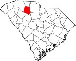
Union County, South Carolina Basics:


Union County South Carolina - Government Site

Population: 28,273
Area: 514 square miles
County seat: Union
Area code(s) in use: 864 803
Time zone: EST
High school graduate or higher: 76.8%
Bachelor's degree or higher: 12.3%
Median household income: $32,459
Persons in poverty: 21.5%
Home ownership rate: 72.6%
Mean travel time to work: 26.5 minutes


Adjacent counties:
Cherokee  Chester  Fairfield  Laurens  Newberry  Spartanburg  York  

Find in South Carolina

Map of the Union County area


Our detail map of Union County shows the Union County, South Carolina boundary lines and other interesting items.

Places in Union County, South Carolina

  Airports     show all on map

E M M D Plant Heliport, Union County Airport, Troy Shelton Field

  Areas     show all on map

Meadow Woods

  Bars     show all on map

Grindall Shoals, Lockhart Lower Shoals, Lockharts Upper Shoals

  Bridges     show all on map

Beaty Bridge (historical), Cedar Bluff Bridge, Gist Bridge, Gist Bridge, Gordons Bridge, Harris Bridge, Johns Creek Bridge, Jones Bridge, Minter Bridge (historical), Mud Bridge, Murphy Bridge, Thompson Bridge, Tinsley Bridge, Upper Rice Bridge, Vernon Bridge

  Buildings     show all on map

Bonham Fire Department, Buffalo Fire Department, Buffalo Mill Fire Department, Carlisle Fire Department, Cross Keys Fire Department, Jonesville Fire Department, Jonesville Police Department, Kelly - Kelton Fire Department, Lockhart Fire Department, Metro Care, Monarch Fire Department, Philippi Fire Department, Pinckneyville Courthouse (historical), Santuc Fire Department, Southside Fire Department, Union Carnegie Library, Union City Fire Department, Union City Hall, Union County Courthouse, Union County Emergency Medical Services, Union County Home, Union County Jail, Union Public Safety Department - Police

  Canals     show all on map

Lockharts Canala

  Cemeteries     show all on map

Askew Cemetery, Belmont Cemetery, Bethlehem Cemetery, Beulah Cemetery, Blackstock Road Cemetery, Bobo Cemetery, Bogansville Cemetery, Briggs Cemetery, Browns Creek Cemetery, Buffalo Cemetery, Cane Creek Cemetery, Cane Creek Cemetery, Cane Creek Cemetery, Cold Well Cemetery, Fairforest Cemetery, Fairview Cemetery, Fant Cemetery, Fawcett Cemetery, Fernandez Cemetery, Fish Dam Cemetery, Flat Rock Cemetery, Forest Lawn Cemetery, Foster Chapel Cemetery, Foster-Woolbright Cemetery, Free Cemetery, Gallman Cemetery, Garner Cemetery, Gibbs Cemetery, Gilead Cemetery, Gilliams Cemetery, Gist Cemetery, Gist-Giles-Pinckneyville Cemetery, Glenn Cemetery, Going Cemetery, Grace Cemetery, Gregory Cemetery, Hames-Gault Cemetery, Hancock Cemetery, Haney Cemetery, Harris Cemetery, Hebron Cemetery, Hill Cemetery, Hodge Cemetery, Holcombe Cemetery, Humphries Cemetery, Jeter Cemetery, Johnson Cemetery, Kelly Cemetery, Kellys Cemetery, Lawson Cemetery, Lee Cemetery, Littlejohn Cemetery, Lower Fairforest Cemetery, Macedonia Cemetery, Mayhew Cemetery, McBride Cemetery, McDaniel Cemetery, McKissick Cemetery, Mitchell Cemetery, Mount Joy Cemetery, Mount Lebanon Cemetery, Mount Tabor Cemetery, Murphy-Duncan Cemetery, New Hope Cemetery, New Prospects Cemetery, Old Fairforest Cemetery, Old Lower Fairforest Cemetery, Old Quaker Cemetery, Otterson Fort Cemetery, Padgetts Creek Cemetery, Palmer Cemetery, Parks Cemetery, Philippi Cemetery, Pinckney Cemetery, Porter Cemetery, Putnam Cemetery, Reidsville Cemetery, Rice Cemetery, Rice Cemetery, Rogers Cemetery, Rogers Cemetery, Rosemont Cemetery, Salem Cemetery, Sanders Cemetery, Sardis Cemetery, Scales Cemetery, Shiloh Cemetery, Sims Cemetery, Sims Cemetery, Smith Cemetery, Spears Cemetery, Spring Hill Cemetery, Steen Cemetery, Sulphur Springs Cemetery, Sunset Memorial Gardens, Swink-Little Cemetery, Thomas Cemetery, Union Memorial Gardens, Upper Fairforest Cemetery, Wallace Cemetery, Ward Cemetery, Weber-Haile Cemetery, Wesley Chapel Cemetery, West Springs Cemetery, Wood Cemetery

  Census     show all on map

Buffalo Census Designated Place, Monarch Mill Census Designated Place

  Churches     show all on map

Antioch Church, Antioch Church (historical), Augsburg Evangelical Lutheran Church, Beattys Chapel, Belmont Church (historical), Bethel African Methodist Episcopal Church, Bethel Baptist Church, Bethel United Methodist Church, Bethesda Baptist Church, Bethesda Church, Bethlehem United Methodist Church, Bethseda Church, Beulah Baptist Church, Bishops Church (historical), Black Rock Church (historical), Bogansville Church (historical), Bogansville Methodist Church, Browns Creek Baptist Church, Buffalo Baptist Church, Buffalo United Methodist Church, Calvary Church, Canaan Church (historical), Cane Creek Presbyterian Church, Cedar Grove Church, Church of Christ, Church of God, Church of God, Church of God, Clinton Chapel Methodist Church (historical), Cold Well Church, Corinth Baptist Church (historical), Duncan Acres United Methodist Church, Enoree Presbyterian Church (historical), Episcopal Church of the Nativity, Evergreen Church (historical), Fairforest Baptist Church (historical), Fairforest Presbyterian Church (historical), Fairview Baptist Church, First Baptist Church of Union, First Presbyterian Church, Flat Rock Methodist Episcopal Church South (historical), Flint Hill Church (historical), Fosters Chapel, Fosters Chapel United Methodist Church, Galilee Baptist Church, Gilead Baptist Church, Gilliam Chapel Methodist Church, Grace United Methodist Church, Healing Spring Church, Hebron Baptist Church, Jacobs Chapel, Jerusalem Church, Jeter Chapel African Methodist Episcopal Church, Jonesville Baptist Church, Kelly Chapel (historical), Lockhart Chapel, Longs Chapel, Lower Fairforest Baptist Church, Macbeth Church (historical), Macedonia Church, Macedonia Church (historical), Maple Ridge Baptist Church, McCutchen Memorial Presbyterian Church, Mitchell Chapel, Mon Aetna Baptist Church, Morningside Baptist Church, Mount Calvary Baptist Church, Mount Joy Baptist Church, Mount Lebanon Baptist Church, Mount Olive Baptist Church, Mount Rouell Church, Mount Tabor Church, Mount Vernon Church, New Chapel, New Chapel Church (historical), New Emanuel Chapel, New Hope Church, New Hope United Methodist Church, Padgetts Creek Baptist Church, Paradise African Methodist Episcopal Church, Philippi Baptist Church, Pine Ridge Baptist Church, Putman Baptist Church, Quaker Church, Red Hill Church, Rices Chapel, Rodgers Church (historical), Saint Augustine Catholic CHurch, Saint Lukes Church, Saint Lukes Church, Saint Mathews African Methodist Episcopal Church, Saint Paul Baptist Church, Salem Baptist Church, Sardis United Methodist Church, Spring Hill Christian Methodist Episcopal Church, Sulphur Springs Baptist Church, Tabernacle Baptist Church, Thomas Chapel African Methodist Episcopal Church, Thompson Church, Tinker Creek Church (historical), Union Church, Union Seventh Day Adventist Church, Unity Methodist Church, Upper Fairforest Baptist Church, Weleyan Methodist Episcopal Church (historical), Wesley Chapel, West Springs Baptist Church, West Springs Church (historical), Westside Baptist Church, Woodson Baptist Church

  Crossings     show all on map

Adams Ford, Avery Ford, Blackstocks Ford, Bobos Ford, Browns Ferry (historical), David Sims Ferry (historical), Greenshaws Ford, Hamiltons Ford, Joens Ford, Jones Ferry (historical), Kennedys Ford, Odels Ford, Rogers Ferry (historical), Smiths Ferry (historical)

  Dams     show all on map

Adams Lake Dam D-2153, Bogan Pond Dam D-2304, Browns Creek Watershed Number Two D-2163 Dam, Cudds Pond Dam D-2158, Foster Park Lake Dam D-2155, Gallmans Pond Dam D-2148, Gus Jeter Lake Dam D-2159, Jeters Pond Dam D-2157, Jonesville Town Pond Dam D-2161, Lake John D Long Dam D-2162, Lockhart Dam, McDaniels Pond Dam Number Two, Neal Shoals Dam, Ophelias Dam, Poplar Lake Dam D-2152, Renumber Lake Dam D-2156, Salinas Pond Dam D-2610, Turners Pond Dam D-2150, Union County Pond D-2151 Dam, Union Water Works Pond Dam D-2154, White Pines Lake Dam D-2149

  Falls     show all on map

Hendricks Falls

  Hospitals     show all on map

Union Community Hospital (historical), Wallace Thomson Hospital

  Lakes     show all on map

Maple Pond, Rock Spring Pond

  Locales     show all on map

Bald Rock, Beattys Bridge Hunt Camp, Black Buck Hunt Camp, Broad River Campground, Collins Creek Hunt Camp, Fair Forest Hunt Camp, Fair Forest Rifle Range, Fosters Mill (historical), Garretts Mill (historical), Gist Bridge Boat Ramp, Gist Mill (historical), Herbert, Herbert Hunt Camp, Hickory Nut Hunt Camp, Linams Mills (historical), Murphys Mill (historical), Rose Hill Plantation (historical), Sedalia Hunt Camp, Sedalia Tower Hunt Camp, Tyger Work Center, Union Country Club, Union County Fairgrounds, Union Plaza Shopping Center, Union Square Shopping Center, White Oak Hunt Camp, Whitmire Lookout, Wrights Mill (historical)

  Parks     show all on map

Buffalo Mill Historic District, Calhoun Experimental Forest, Calhoun Experimental Forest, East Main Street-Douglass Heights Historic District, Rose Hill State Park, South Street-South Church Street Historic District, Union Downtown Historic District, Veterans Memorial park

  Populated Places     show all on map

Ada (historical), Adamsburg, Bailey Town (historical), Beaver Dam, Bishop Town (historical), Black Jack Valley (historical), Bonham, Buffalo, Carem, Carlisle, Colerain, Cross Keys, Delta, Flat Rock (historical), Goat Alley, Goshen Hill, Gregory (historical), Herbert, Humphriesville (historical), Jonesville, Kelly, Kelton, Kennedy Mill, Lockhart, Lockhart Junction, Meador (historical), Mean Crossroads, Meansville (historical), Monarch, Neal Shoals, New Hill, No Mans Land (historical), Pinckney, Pinckneyville, Pine Tree (historical), Pride (historical), Red Hill, Red Point (historical), Red Town (historical), Robat, Rogansville (historical), Santuc, Sardis, Sartor Town, Sedalia, Shady Grove (historical), Simmon Tree (historical), South Hills, Tempie Hill, Tuckertown, Union, West Springs, Wildcat (historical)

  Post Offices     show all on map

Buffalo Post Office

  Rapidss     show all on map

Fairforest Shoal, Hawkins Shoals, Neal Shoals

  Reservoirs     show all on map

Adams Lake, Bogan Pond, Cudds Pond, Foster Park Lake, Gallmans Pond, Gus Jeter Lake, Jeters Pond, Jonesville Town Pond, Lake John D Long, Lockhart Reservoir, McDaniels Pond, Morres Lake, Neal Shoals Reservoir, Poplar Lake, Reno Lake, Salinas Pond, Turners Pond, Union Water Works Pond, White Pines Lake, White Pines Lake, Whitlock Lakes

  Schools     show all on map

Adamsburg School (historical), Barkham School (historical), Beaty Bridge School (historical), Bishop School (historical), Black School (historical), Brannon School (historical), Buffalo Elementary School, Canaan School (historical), Carem School (historical), Carem School (historical), Carlisle-Santuc School, Carlsan Elementary School, Cedar Grove School (historical), Cedar Grove School (historical), Cedar Hill School (historical), Cedar Hill School (historical), Central Junior High School, Clifford Female Seminary (historical), Cohen Street School, Cold Well School (historical), Colerain School (historical), Cowen School (historical), Cross Keys School (historical), Douglas School (historical), Ebenezer School (historical), Elford Grove School (historical), Emmanuel School (historical), Evergreen School (historical), Excelsior Elementary School, Farr School (historical), Foster Park Elementary School, Fosters School, Gage School (historical), Gage School (historical), Gault School (historical), Greenbrier School (historical), Hainey School (historical), Hamilton School (historical), Harris School (historical), Howell School (historical), James Hope School (historical), Jerusalem School (historical), Jeters Chapel School (historical), Johnson School (historical), Jonesville Elementary School, Jonesville High School, Kelly Pinckney High School, Kelly School (historical), Knott Hill School (historical), Lindsey School (historical), Lockhart Elementary School, Lockhart High School, Macedonia School (historical), Main Street Grammar School (historical), Maple Ridge School (historical), McBeth Grammar School (historical), McGowan School (historical), Meador School (historical), Monarch Elementary School, Mount Calvary School (historical), Mount Joy School (historical), Mount Rouell School (historical), New Hope School (historical), New Primary School, Oattaray School (historical), Paradise School (historical), Poplar Grove School (historical), Putnam School (historical), Rock Hill School (historical), Rocky Creek School (historical), Saint Lukes School (historical), Santuck School (historical), Sardis School (historical), Sedalia School (historical), Sims Chapel School (historical), Sims High School, Thompson School, Tinker Creek School (historical), Tinker Creek School (historical), Union Academy, Union Academy (historical), Union Branch School (historical), Union High School, Unionville Female Academy (historical), Unionville Male Academy (historical), University of South Carolina Regional Campus, West End School, West Springs Elementary School (historical), West Springs School (historical), Wilburns School (historical), Woodson School (historical), Wyatts School (historical)

  Streams     show all on map

Addis Branch, Beaverdam Creek, Bethlehem Creek, Big Browns Creek, Bishop Branch, Brocks Creek, Brownings Creek, Browns Creek, Brushy Creek, Buffalo Creek, Cane Creek, Colemans Creek, Coxs Creek, Cunningham Creek, Dining Creek, Dodds Branch, Doil Creek, Duffs Branch, Eison Branch, Elishas Creek, Evans Branch, Fairforest Creek, Fanning Creek, Frenchman Creek, Gregorys Creek, Harris Creek, Hawkins Creek, Henry Creek, Hills Creek, Hobsons Creek, Holcombe Branch, Hughes Creek, Isaacs Creek, Johns Creek, Johnsons Creek, Judas Branch, Jumping Run Creek, Knox Creek, Little Browns Creek, McClure Creek, Meng Creek, Mill Creek, Mitchell Creek, Morris Branch, Neals Creek, Pacolet River, Padgetts Creek, Peter Hawk Creek, Reedy Branch, Rennicks Branch, Rocky Creek, Salters Creek, Sand Creek, Sandy Run Creek, Sharps Creek, Shoal Creek, Sparks Creek, Spear Creek, Sugar Creek, Sulphur Spring Branch, Swift Run, Swink Creek, Tinker Creek, Tyger River, Vanderford Branch, West Springs Branch, Wildcat Branch, Wilsons Creek

  Summits     show all on map

Beddington Mountain

  Towers     show all on map

Kelly Lookout Tower, Sedalia Lookout Tower, WBCU-AM (Union), Whitmire Lookout Tower,

Union County, South Carolina Population By Race (2012 estimate)

RacePopulation
WhiteUnion County White population 18,85818,858  
BlackUnion County Black population 8,8788,877
MixedUnion County Mixed population 368367
AsianUnion County Asian population 8584
American IndianUnion County American Indian population 5756
Hawaiian & Pacific IslanderUnion County Hawaiian & Pacific Islander population 00

Additional population tables :
State population table
South Carolina population by county