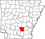
Cleveland County, Arkansas Basics:


Cleveland County Arkansas - Government Site

Population: 8,639
Area: 598 square miles
County seat: Rison
Area code(s) in use: 870
Time zone: CST
High school graduate or higher: 85.1%
Bachelor's degree or higher: 14.3%
Median household income: $38,060
Persons in poverty: 18.3%
Home ownership rate: 78.5%
Mean travel time to work: 27.4 minutes


Adjacent counties:
Bradley  Calhoun  Dallas  Drew  Grant  Jefferson  Lincoln  
Find in Arkansas

Map of the Cleveland County area


Our detail map of Cleveland County shows the Cleveland County, Arkansas boundary lines and other interesting items.

Places in Cleveland County, Arkansas

  Buildings     show all on map

Cleveland County Ambulance, Cleveland County Courthouse, Cleveland County Sheriff's Office, County Line Volunteer Fire Department, Highway 35 Volunteer Fire Department, Kingsland Police Department, Kingsland Volunteer Fire Department, New Edinburg Volunteer Fire Station, Pansy Volunteer Fire Department, Rison Police Department, Rison Volunteer Fire Department, Rye Volunteer Fire Department, Woodlawn Fire Station 1, Y Fire Department, Y Fire Department Substation

  Cemeteries     show all on map

Bethel Cemetery, Black Cemetery, Blankenship Cemetery, Broach Cemetery, Camp Springs Cemetery, Canada Cemetery, Carter Cemetery, Cherry Cemetery, Crain Cemetery, Friendship Cemetery, Garner Cemetery, Grace Cemetery, Greenwood Cemetery, Gum Grove Cemetery, Harlow Cemetery, Humble Hope Cemetery, Johnson Cemetery, Kingsland Cemetery, Kingsland Cemetery, Liberty Hill Cemetery, Lindsey Cemetery, Little Family Cemetery, Macedonia Cemetery, Macedonia Cemetery, Marks Cemetery, McCoy Cemetery, Moores Cemetery, Morgan Cemetery, Moseley Cemetery, New Cemetery, Pleasant Ridge Cemetery, Prosperity Cemetery, Randolph Cemetery, Reaves Cemetery, Rowell Cemetery, Saint John Cemetery, Searcy Cemetery, Seymore Cemetery, Shady Grove Cemetery, Tolson Cemetery, Union Cemetery, Union Cemetery Number 2, Varnell Cemetery, Wesley Chapel Cemetery, Wilson Cemetery, Wright Cemetery, Zachary Cemetery

  Census     show all on map

New Edinburg Census Designated Place, Rye Census Designated Place, Staves Census Designated Place, Woodlawn Census Designated Place

  Churches     show all on map

Amy Church, Assembly of God Church, Bethel Church, Bethel Church, Camp Springs Church, Center Church, Chapel Hill Church, Church of Christ, Como Church, Crossroads Church, Emmaus Church, Enon Missionary Church, Free Hill Church, Greenland Church, Harmony Church, Hebron Church, Kedron Church, Liberty Hill Church, Macedonia Church, Macedonia Church, Mount Carnel Church, Mount Elba Church, Mount Gilead Church, Mount Lebanon Church, Mount Zion Church, New Friendship Church, New Home Church, New Hope Church, Piney Grove Church, Pleasant Ridge Church, Rainbow Tabernacle, Saint Francis Church, Sanctified Church, Shady Grove Church, Smith Church, Union Grove Church, Union Hill Church, Union Methodist Church, Wesley Chapel, Zion Hill Church

  Cliffs     show all on map

Bridges Bluff, Vince Bluff

  Crossings     show all on map

Charnnings Ferry

  Dams     show all on map

Clements Pond Dam, Kesterson Lake Dam, Lake Dunkeffie Dam, Lake Elrod Dam, Larson Lake Dam, Schultz Lake Dam, Studdard Lake Dam, Van Sadler Lake Dam

  Guts     show all on map

Mink Slough

  Lakes     show all on map

Crane Lake, Grays Lake, Lower Canada Lake, Upper Canada Lake, Wilson Lake

  Locales     show all on map

Pinchbacks Mills (historical)

  Parks     show all on map

Marks Mill Battleground

  Populated Places     show all on map

Annover (historical), Bleaker (historical), Cabool (historical), Calmer, Canoe Landing, Como (historical), Croak (historical), Dialton (historical), Draughon (historical), Dwight (historical), Eunice, Friendship, Gum Springs, Hebron, Herbine, Kedron, Kingsland, Lehigh (historical), Mansville (historical), Mason (historical), McKinney (historical), Meek (historical), Mount Elba, Mount Zion, New Edinburg, Oak Grove, Oak Grove, Orlando, Pansy, Peace (historical), Pool (historical), Radway (historical), Randall, Ripley (historical), Rison, Rowell, Rye, Saline, Scoby (historical), Sneed (historical), Staves, Tipton, Toledo, Trigg (historical), Unionville (historical), White Oak Bluff

  Reservoirs     show all on map

Clements Pond, Dunkeffie Lake, Kesterson Lake, Lake Elrod, Larson Lake, Schultz Lake, Studdard Lake, Van Sadler Lake

  Schools     show all on map

Kingsland Elementary School, Kingsland High School, New Home School (historical), Rison Elementary School, Rison High School, Woodlawn Elementary School, Woodlawn High School, Woodlawn School

  Streams     show all on map

Atwood Creek, Barn Hill Creek, Big Creek, Blakey Creek, Bridge Creek, Browning Creek, Brushy Creek, Camp Creek, Canada Creek, Caney Creek, Caney Creek, Caney Creek, Cold Branch, Cooks Creek, Cottonmouth Creek, Derrieusseaux Creek, Double Creek, Finley Creek, Fite Creek, Fools Head Creek, Frazier Creek, Fritz Creek, Gooley Creek, Grisly Creek, Hall Creek, Harrison Creek, Hurricane Creek, Kissee Creek, Lagle Creek, Lawrence Moro Creek, Little Blakey Creek, Little Brushy Creek, Mile Creek, Mill Branch, Mill Creek, Panther Creek, Panther Creek, Pickett Creek, Pine Bridge Creek, Sanders Creek, Schoolhouse Branch, Sixteenth Creek, Smith Creek, Spring Branch, Tanyard Creek, Thompson Creek, Toad Creek, Varnell Creek, Walker Branch, White Oak Creek

  Towers     show all on map

Moro Lookout Tower,

Cleveland County, Arkansas Population By Race (2012 estimate)

RacePopulation
WhiteCleveland County White population 7,4737,472  
BlackCleveland County Black population 1,0281,028
MixedCleveland County Mixed population 9595
American IndianCleveland County American Indian population 2625
AsianCleveland County Asian population 98
Hawaiian & Pacific IslanderCleveland County Hawaiian & Pacific Islander population 00

Additional population tables :
State population table
Arkansas population by county