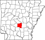
Grant County, Arkansas Basics:


Grant County Arkansas - Government Site

Population: 18,013
Area: 632 square miles
County seat: Sheridan
Area code(s) in use: 870
Time zone: CST
High school graduate or higher: 84.2%
Bachelor's degree or higher: 17.0%
Median household income: $49,063
Persons in poverty: 8.4%
Home ownership rate: 80.0%
Mean travel time to work: 28.9 minutes


Adjacent counties:
Cleveland  Dallas  Hot Spring  Jefferson  Pulaski  Saline  

Find in Arkansas

Map of the Grant County area


Our detail map of Grant County shows the Grant County, Arkansas boundary lines and other interesting items.

Places in Grant County, Arkansas

  Airports     show all on map

Katheryn's Landing Airport, Sheridan Municipal Airport

  Buildings     show all on map

Calvert Township Volunteer Fire Department, Calvert Township Volunteer Fire Station 2, Cane Creek Volunteer Fire Department, Center Grove Volunteer Fire Station, Grant County Sheriff's Office, Grapevine Volunteer Fire Department, Leola Volunteer Fire Department, Metropolitan Emergency Medical Service Sheridan, Palestine Community Volunteer Fire Department, Poyen Volunteer Fire Station, Prattsville Volunteer Fire Department, Sheridan Police Department, Sheridan Volunteer Fire Station, Tull Volunteer Fire Department

  Cemeteries     show all on map

Ashcraft Cemetery, Bethel Cemetery, Camp Creek Cemetery, Center Campground Cemetery, Clement Cemetery, Corinth Cemetery, Crossroads Cemetery, Davis Cemetery, Gum Springs Cemetery, Hardin Cemetery, Jackson Cemetery, Jacob Cemetery, Jones Cemetery, Jones Cemetery, Jones Cemetery, Lost Creek Cemetery, Moores Cemetery, Morris Cemetery, Mount Zion Cemetery, Newhope Cemetery, Oak Grove Cemetery, Orion Cemetery, Poe Cemetery, Poyen Cemetery, Raymick Cemetery, Rhodes Cemetery, Saint John Cemetery, Saint Paul Cemetery, Shell Cemetery, Shiloh Cemetery, South Marlow Cemetery, Taylor Cemetery, White Cemetery

  Churches     show all on map

Ain Church, Bethany Church, Bethel Church, Calvary Church, Cedar Branch Church, Church of Jesus Christ, Corinth Church, Ephesus Church, Forest Tower Church, Grapevine Church, Heddon Chapel, Little Creek Church, Marlow Church, Moores Chapel, Mount Zion Church, Orion Church, Palestine Church, Philadelphia Church, Pine Ridge Church, Providence Church, Saint Paul Church, Sardis Church, Shady Grove Church, Shiloh Church, Sweet Home Church

  Crossings     show all on map

Nance Ford, Summerville Ford

  Dams     show all on map

Clear Lake Dam, Cox Creek Lake Dam, Fiser Lake Dam, Horne Lake Dam, Lake Brown Dam, Lake Kay Dam, Stephens Lake Dam, Whitworth Lake Dam

  Lakes     show all on map

Moores Lake, Nall Lake, Tolar Lake, Tull Lake

  Parks     show all on map

Jenkins Ferry State Park

  Populated Places     show all on map

Ain, Amber (historical), Arthur (historical), Belfast, Brush Creek, Buie, Cane Creek, Carver, Center Grove, Cherry Grove (historical), Clear Lake, Cross Roads, Darysaw (historical), Deer Creek, Dogwood, Ebb, Fenter, Fikes (historical), Grapevine, Ico (historical), Junet, Lamont, Lamont (historical), Lenham, Leola, Lucian (historical), McLean (historical), Millerville, Obin (historical), Orion, Poyen, Prague, Prattsville, Saline River (historical), Sheridan, Slabtown, Studemeir (historical), Thiel, Tull, Turin (historical), Walnut Ridge

  Reservoirs     show all on map

Clear Lake, Cox Creek Lake, Fiser Lake, Horne Lake, Lake Brown, Lake Kay, Stephens Lake, Whitworth Lake

  Ridges     show all on map

Counterfeit Ridge

  Schools     show all on map

Cooper School, Ellis School (historical), Grapevine Elementary School, Poyen Elementary School, Poyen High School, Prattsville Elementary School, Prattsville High School, Saint Paul School, Sheridan Elementary School, Sheridan High School, Sheridan Intermediate School, Sheridan Junior High School

  Streams     show all on map

Bear Creek, Beard Branch, Beech Creek, Big Branch, Big Brushy Creek, Big Creek, Big Creek, Boxley Creek, Bradley Branch, Brush Creek, Brush Creek, Brushy Creek, Camp Creek, Cane Creek, Caney Creek, Caple Creek, Chapel Creek, Clegg Creek, Cox Creek, Davis Branch, Deer Creek, Dukes Branch, East Branch Flat Creek, Flat Creek, Fletcher Slough, Francois Creek, Gamble Creek, Gee Branch, George Creek, Graves Creek, Guesses Creek, Harrington Spring Branch, Herbert Creek, Holly Branch, Horn Branch, Horn Branch, Hubbard Creek, Hurricane Creek, Huskey Creek, Hyde Branch, Irrington Spring Branch, Jack Creek, Jerning Branch, Johnson Creek, Jordan Creek, Kelly Branch, Kelt Creek, Little Creek, Little Derrieusseaux Creek, Little Lost Creek, Little Mud Creek, Logan Creek, Lost Creek, Lou Creek, Marlow Creek, McGhee Branch, McKiney Branch, Mill Creek, Moores Slough, Mud Creek, Mud Creek, Mud Creek, Patterson Branch, Polk Creek, Poly Branch, Preacher Berry Creek, Price Branch, Pumpkinvine Creek, Railroad Branch, Ray Creek, Red Fork, Rhinehart Branch, Rosin Branch, Simon Branch, Simpson Creek, Skullbone Creek, Steep Creek, Thunder Branch, Tollman Branch, Town Branch, Turkey Creek, Twomile Branch, Ward Branch, Watson Branch, Weaver Creek, West Branch Flat Creek, West Fork Big Creek, White Oak Creek, White Oak Creek, White Oak Creek, Wildcat Creek, Wilson Branch

  Towers     show all on map

KASN-TV (Pine Bluff), KGHT-AM (Sheridan), KGHT-AM (Sheridan), KOLL-FM (Pine Bluff), KXIX-FM (Sheridan),

Grant County, Arkansas Population By Race (2012 estimate)

RacePopulation
WhiteGrant County White population 17,18417,184  
BlackGrant County Black population 468468
MixedGrant County Mixed population 216216
American IndianGrant County American Indian population 9090
AsianGrant County Asian population 5454
Hawaiian & Pacific IslanderGrant County Hawaiian & Pacific Islander population 00

Additional population tables :
State population table
Arkansas population by county